


<< Our Photo Pages >> Corriedoo - Cairn in Scotland in Dumfries and Galloway
Submitted by markj99 on Thursday, 15 February 2001 Page Views: 8973
Neolithic and Bronze AgeSite Name: Corriedoo Alternative Name: Knockman Hill; White CairnCountry: Scotland County: Dumfries and Galloway Type: Cairn
Nearest Town: St John's Town of Da
Map Ref: NX6814083327 Landranger Map Number: 77
Latitude: 55.126716N Longitude: 4.069481W
Condition:
| 5 | Perfect |
| 4 | Almost Perfect |
| 3 | Reasonable but with some damage |
| 2 | Ruined but still recognisable as an ancient site |
| 1 | Pretty much destroyed, possibly visible as crop marks |
| 0 | No data. |
| -1 | Completely destroyed |
| 5 | Superb |
| 4 | Good |
| 3 | Ordinary |
| 2 | Not Good |
| 1 | Awful |
| 0 | No data. |
| 5 | Can be driven to, probably with disabled access |
| 4 | Short walk on a footpath |
| 3 | Requiring a bit more of a walk |
| 2 | A long walk |
| 1 | In the middle of nowhere, a nightmare to find |
| 0 | No data. |
| 5 | co-ordinates taken by GPS or official recorded co-ordinates |
| 4 | co-ordinates scaled from a detailed map |
| 3 | co-ordinates scaled from a bad map |
| 2 | co-ordinates of the nearest village |
| 1 | co-ordinates of the nearest town |
| 0 | no data |
Be the first person to rate this site - see the 'Contribute!' box in the right hand menu.
Internal Links:
External Links:
")
There are two cairns recorded at this grid reference. The first is Canmore ID 64282 which includes a record from 1845 which reads: "There is a cairn, smaller than, and close to, White Cairn (NX68SE 2: at NX 681 833). It is supposed to commemorate the killing of a wild boar by the first Knight of Lochinvar." A later entry, dated 1979, records that no cairn could be found.
The second, White Cairn is recorded as Canmore ID 64279 at grid reference NX 68140 83327. This was surveyed in 1978, the report reading: "White Cairn (name not verified) is an extant and impressive round cairn situated on the end of a low promontory. Measuring 31.0m in diameter and 3.5m high it has been robbed almost to ground level in the south quadrant. It has no special features."
Update October 2018: markj99 has visited this site and adds: "Corriedoo cairn is visible on the left side of the A702 travelling from St John's Town of Dalry to Moniaive. Turn into the A702 in St John's Town of Dalry, after around 2.5 miles you will enter Corriedoo forest. There is a convenient layby at NX 683 833. Corriedoo cairn is around 200 yards W of the layby. Corriedoo Cairn is a substantial round cairn with some exposed stones. It's a short walk over rough ground for a relatively well preserved cairn."
You may be viewing yesterday's version of this page. To see the most up to date information please register for a free account.
")
Do not use the above information on other web sites or publications without permission of the contributor.
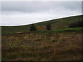
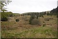
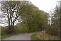
Nearby Images from Geograph Britain and Ireland:

©2024(licence)

©2025(licence)
©2007(licence)
©2019(licence)
©2019(licence)
The above images may not be of the site on this page, they are loaded from Geograph.
Please Submit an Image of this site or go out and take one for us!
Click here to see more info for this site
Nearby sites
Key: Red: member's photo, Blue: 3rd party photo, Yellow: other image, Green: no photo - please go there and take one, Grey: site destroyed
Download sites to:
KML (Google Earth)
GPX (GPS waypoints)
CSV (Garmin/Navman)
CSV (Excel)
To unlock full downloads you need to sign up as a Contributory Member. Otherwise downloads are limited to 50 sites.
Turn off the page maps and other distractions
Nearby sites listing. In the following links * = Image available
2.6km NE 46° Spa Well (Dalry) Holy Well or Sacred Spring (NX7009385098)
5.7km NE 49° Hole Stone (Blackmark)* Standing Stone (Menhir) (NX72568698)
5.9km SW 224° Dalarran Holm* Standing Stone (Menhir) (NX6388179164)
6.3km SW 215° Lady's Well (Balmaclellan) Holy Well or Sacred Spring (NX6435678263)
7.1km WNW 298° Mackilston S* Cairn (NX61968678)
7.1km WNW 298° Mackilston N* Cairn (NX61968682)
7.1km ENE 62° Physic Well (Balmaclellan) Holy Well or Sacred Spring (NX7452586502)
7.7km SW 223° Physic Well (Kells) Holy Well or Sacred Spring (NX6270677877)
9.1km NNW 331° Stroanfreggan Cairn* Cairn (NX64019142)
9.7km NNW 346° Stellhead S* Cairn (NX66059285)
9.8km NNW 329° Smittons Bridge* Cairn (NX63409188)
9.8km NNW 331° Stroanfreggan Craig* Hillfort (NX63709206)
9.8km NNW 346° Stellhead N* Cairn (NX66089297)
9.9km WNW 289° Stroangassel Stone Circle (NX589869)
10.0km NNW 339° Chalybeate Well (Dalry)* Holy Well or Sacred Spring (NX6488792815)
10.7km SSW 208° Milldown Well (Kells) Holy Well or Sacred Spring (NX6287273982)
10.8km NNW 339° Round Craigs* Cairn (NX64519355)
11.0km SSW 204° Cairn Edward Well (Kells) Holy Well or Sacred Spring (NX6343073408)
12.4km NNW 332° Craigengillan* Cairn (NX62699448)
12.6km WNW 288° Physic Well (Kells) Holy Well or Sacred Spring (NX5622587525)
13.1km SSW 197° Loch Stroan Stone Circle (NX640709)
13.3km WNW 302° Braidenoch Cross Slabs* Early Christian Sculptured Stone (NX57099081)
13.7km WNW 303° Bardennoch* Cairn (NX56859120)
13.8km SSE 167° St Ninian's Well (Parton) Holy Well or Sacred Spring (NX7079369806)
13.8km NNE 30° St. Conal's Well* Holy Well or Sacred Spring (NX75399508)
View more nearby sites and additional images


 We would like to know more about this location. Please feel free to add a brief description and any relevant information in your own language.
 Wir möchten mehr über diese Stätte erfahren. Bitte zögern Sie nicht, eine kurze Beschreibung und relevante Informationen in Deutsch hinzuzufügen.
 Nous aimerions en savoir encore un peu sur les lieux. S'il vous plaît n'hesitez pas à ajouter une courte description et tous les renseignements pertinents dans votre propre langue.
 Quisieramos informarnos un poco más de las lugares. No dude en añadir una breve descripción y otros datos relevantes en su propio idioma.