<< Our Photo Pages >> Craig Twrch - Cairn in Wales in Carmarthenshire
Submitted by coldrum on Tuesday, 12 October 2010 Page Views: 4870
Neolithic and Bronze AgeSite Name: Craig TwrchCountry: Wales
NOTE: This site is 0.9 km away from the location you searched for.
County: Carmarthenshire Type: Cairn
Map Ref: SN66104910
Latitude: 52.123945N Longitude: 3.957315W
Condition:
| 5 | Perfect |
| 4 | Almost Perfect |
| 3 | Reasonable but with some damage |
| 2 | Ruined but still recognisable as an ancient site |
| 1 | Pretty much destroyed, possibly visible as crop marks |
| 0 | No data. |
| -1 | Completely destroyed |
| 5 | Superb |
| 4 | Good |
| 3 | Ordinary |
| 2 | Not Good |
| 1 | Awful |
| 0 | No data. |
| 5 | Can be driven to, probably with disabled access |
| 4 | Short walk on a footpath |
| 3 | Requiring a bit more of a walk |
| 2 | A long walk |
| 1 | In the middle of nowhere, a nightmare to find |
| 0 | No data. |
| 5 | co-ordinates taken by GPS or official recorded co-ordinates |
| 4 | co-ordinates scaled from a detailed map |
| 3 | co-ordinates scaled from a bad map |
| 2 | co-ordinates of the nearest village |
| 1 | co-ordinates of the nearest town |
| 0 | no data |
Be the first person to rate this site - see the 'Contribute!' box in the right hand menu.
Internal Links:
External Links:
I have visited· I would like to visit
Penbron has visited here
")
Source: Extract from Cadw Scheduling description."
Source: Coflein
You may be viewing yesterday's version of this page. To see the most up to date information please register for a free account.
")
Do not use the above information on other web sites or publications without permission of the contributor.
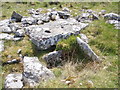
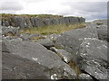
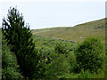
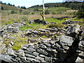
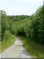
Nearby Images from Geograph Britain and Ireland:
©2011(licence)
©2007(licence)
©2017(licence)
©2015(licence)
©2017(licence)
The above images may not be of the site on this page, they are loaded from Geograph.
Please Submit an Image of this site or go out and take one for us!
Click here to see more info for this site
Nearby sites
Key: Red: member's photo, Blue: 3rd party photo, Yellow: other image, Green: no photo - please go there and take one, Grey: site destroyed
Download sites to:
KML (Google Earth)
GPX (GPS waypoints)
CSV (Garmin/Navman)
CSV (Excel)
To unlock full downloads you need to sign up as a Contributory Member. Otherwise downloads are limited to 50 sites.
Turn off the page maps and other distractions
Nearby sites listing. In the following links * = Image available
1.9km SW 230° Carreg Y Bwci* Cairn (SN646479)
3.0km W 273° Tir Ifan (Cellan)* Misc. Earthwork (SN63134931)
3.9km E 100° Crug Siarls* Stone Circle (SN69954830)
4.0km WSW 252° Caer Cadwgan Hillfort (SN62234796)
4.1km N 9° Crug cairn* Cairn (SN66855311)
4.2km WSW 240° Bryn Goleu* Cairn (SN62434712)
4.5km SW 232° Hirfaen Gwyddog* Standing Stone (Menhir) (SN62454645)
5.0km NNE 16° Careg Samson* Standing Stone (Menhir) (SN67575384)
6.1km WNW 286° Castell Goetre* Hillfort (SN60325095)
6.2km N 1° St David (Llandewi Brefi)* Ancient Cross (SN66385531)
6.4km W 262° Bryn Maen Caerau* Ancient Village or Settlement (SN59704836)
6.5km E 98° Esgair Nant-y-Maen cairn* Ring Cairn (SN72544798)
6.7km WNW 302° Ffynnon-Wen* Holy Well or Sacred Spring (SN60535283)
6.8km W 277° Castell Allt-Goch* Hillfort (SN59335012)
7.0km SSE 149° Maes-yr-haidd Round Barrow I* Cairn (SN6960042991)
7.1km ESE 119° Crugiau Merched, Cairn 1* Cairn (SN72214553)
7.1km SSE 150° Maes-yr-haidd Round Barrow II* Cairn (SN6954242882)
7.1km ESE 118° Crugiau Merched* Cairn (SN72274555)
7.1km ESE 118° Crugiau Merched Cairn 2 Cairn (SN72324557)
7.5km SE 135° Rhiwgaregog Standing Stone (recumbent)* Standing Stone (Menhir) (SN71274364)
7.5km SE 136° Rhiw Gwaregog Standing Stone Standing Stone (Menhir) (SN71184354)
7.5km SE 136° Rhiw Garegog Ditch* Misc. Earthwork (SN71184352)
7.6km E 87° Cefn Gwernffrwd Row* Stone Row / Alignment (SN7370049328)
7.6km E 87° Cefn Gwernffrwd stone circle* Stone Circle (SN7370049328)
7.6km SE 136° Rhiw Garegog Round barrows* Round Barrow(s) (SN71214346)
View more nearby sites and additional images


 We would like to know more about this location. Please feel free to add a brief description and any relevant information in your own language.
 Wir möchten mehr über diese Stätte erfahren. Bitte zögern Sie nicht, eine kurze Beschreibung und relevante Informationen in Deutsch hinzuzufügen.
 Nous aimerions en savoir encore un peu sur les lieux. S'il vous plaît n'hesitez pas à ajouter une courte description et tous les renseignements pertinents dans votre propre langue.
 Quisieramos informarnos un poco más de las lugares. No dude en añadir una breve descripción y otros datos relevantes en su propio idioma.