


<< Our Photo Pages >> Caerberllan Farm - Standing Stone (Menhir) in Wales in Gwynedd
Submitted by Postman on Saturday, 13 October 2012 Page Views: 5339
Neolithic and Bronze AgeSite Name: Caerberllan Farm Alternative Name: Caer BerllanCountry: Wales
NOTE: This site is 3.1 km away from the location you searched for.
County: Gwynedd Type: Standing Stone (Menhir)
Nearest Town: Barmouth Nearest Village: Abergynolwyn
Map Ref: SH6622507979
Latitude: 52.652991N Longitude: 3.97902W
Condition:
| 5 | Perfect |
| 4 | Almost Perfect |
| 3 | Reasonable but with some damage |
| 2 | Ruined but still recognisable as an ancient site |
| 1 | Pretty much destroyed, possibly visible as crop marks |
| 0 | No data. |
| -1 | Completely destroyed |
| 5 | Superb |
| 4 | Good |
| 3 | Ordinary |
| 2 | Not Good |
| 1 | Awful |
| 0 | No data. |
| 5 | Can be driven to, probably with disabled access |
| 4 | Short walk on a footpath |
| 3 | Requiring a bit more of a walk |
| 2 | A long walk |
| 1 | In the middle of nowhere, a nightmare to find |
| 0 | No data. |
| 5 | co-ordinates taken by GPS or official recorded co-ordinates |
| 4 | co-ordinates scaled from a detailed map |
| 3 | co-ordinates scaled from a bad map |
| 2 | co-ordinates of the nearest village |
| 1 | co-ordinates of the nearest town |
| 0 | no data |
Internal Links:
External Links:
I have visited· I would like to visit
Mountainharry visited on 31st Mar 2024 - their rating: Cond: 3 Amb: 4 Access: 5 Used as a gatepost. Would be lovely if the hedge was trimmed back so it was easily distinguishable. If you hadn't an OS map or previous knowledge, you'd walk right by it.
Orcinus visited on 2nd May 2021 - their rating: Cond: 4 Amb: 3 Access: 5 Just at the crossroads, behind a 5-bar gate
Average ratings for this site from all visit loggers: Condition: 3.5 Ambience: 3.5 Access: 5
")
In the corner of a field right next to the gate, but not used as gate post or anything. About six feet tall. Felt sorry for this stone, hidden behind the hedge, hidden from the view towards the mountains.
You may be viewing yesterday's version of this page. To see the most up to date information please register for a free account.
")
")
Do not use the above information on other web sites or publications without permission of the contributor.
davidmorgan has found this location on Google Street View:
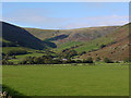
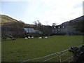
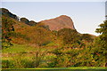
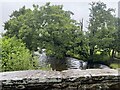
Nearby Images from Geograph Britain and Ireland:

©2025(licence)
©2010(licence)
©2010(licence)
©2014(licence)
©2023(licence)
The above images may not be of the site on this page, they are loaded from Geograph.
Please Submit an Image of this site or go out and take one for us!
Click here to see more info for this site
Nearby sites
Key: Red: member's photo, Blue: 3rd party photo, Yellow: other image, Green: no photo - please go there and take one, Grey: site destroyed
Download sites to:
KML (Google Earth)
GPX (GPS waypoints)
CSV (Garmin/Navman)
CSV (Excel)
To unlock full downloads you need to sign up as a Contributory Member. Otherwise downloads are limited to 50 sites.
Turn off the page maps and other distractions
Nearby sites listing. In the following links * = Image available
2.1km SW 230° Flat topped hill enclosure near Craig-Yr-Aderyn* Ancient Village or Settlement (SH646067)
2.1km SW 226° Bryncrug Cairn* Cairn (SH64690658)
2.1km SW 217° Maen Cairns 1,2,3* Cairn (SH6488206297)
2.2km SW 235° Craig Yr Aderyn* Hillfort (SH644068)
2.4km SSE 165° Mynydd Pentre* Polissoir (SH6677705648)
3.4km N 354° Twll yr Ogof* Cairn (SH65961140)
3.9km W 278° Twll Y Darren Round Barrow(s) (SH624086)
4.1km WSW 247° Tyrgawen* Standing Stone (Menhir) (SH6238106444)
4.5km NW 320° Bedd-y-brenin* Cairn (SH6343811484)
4.6km NW 311° Pen y Garn Cairn and Cist* Cairn (SH6284911112)
4.7km NW 318° Cyfannedd Fawr erratic* Natural Stone / Erratic / Other Natural Feature (SH63221155)
4.7km W 266° Allt Lwyd Cairn and Ritual Complex* Cairn (SH615078)
4.7km W 265° Cairn and enclosure south of Allt Lwyd* Cairn (SH615077)
4.7km NW 321° Settlement and Cairn South of Cyfannedd Fawr* Ancient Village or Settlement (SH6331011730)
4.7km NW 318° Hut Circle Settlement SE of Cyfannedd Fawr* Ancient Village or Settlement (SH6313011590)
4.8km NW 326° Braich Ddu Cairn Cemetery* Barrow Cemetery (SH6362012020)
4.9km W 272° Cairn South of Afon Gwril* Cairn (SH613083)
4.9km W 274° Afon Gwril Hut Circle Settlement* Ancient Village or Settlement (SH613085)
4.9km NW 325° Braich Ddu Round Hut* Ancient Village or Settlement (SH6352512130)
4.9km NW 325° Braich Ddu Cairns* Cairn (SH6350512120)
5.1km NW 312° Bryn Seward Round House and Field System* Ancient Village or Settlement (SH6254111493)
5.1km NW 325° Cyfannedd Fawr Settlement* Ancient Village or Settlement (SH6342012260)
5.1km W 273° Afon Gwril Cairn* Cairn (SH611084)
5.2km NW 314° Bryn Seward Hut Circle* Ancient Village or Settlement (SH6256411688)
5.2km NW 314° Bryn Seward Cairn 1* Cairn (SH6259711729)
View more nearby sites and additional images


 We would like to know more about this location. Please feel free to add a brief description and any relevant information in your own language.
 Wir möchten mehr über diese Stätte erfahren. Bitte zögern Sie nicht, eine kurze Beschreibung und relevante Informationen in Deutsch hinzuzufügen.
 Nous aimerions en savoir encore un peu sur les lieux. S'il vous plaît n'hesitez pas à ajouter une courte description et tous les renseignements pertinents dans votre propre langue.
 Quisieramos informarnos un poco más de las lugares. No dude en añadir una breve descripción y otros datos relevantes en su propio idioma.