<< Text Pages >> Tir Artair Standing Stone (Killin) - Standing Stone (Menhir) in Scotland in Perth and Kinross
Submitted by BigSweetie on Thursday, 25 March 2004 Page Views: 7370
Neolithic and Bronze AgeSite Name: Tir Artair Standing Stone (Killin)Country: Scotland County: Perth and Kinross Type: Standing Stone (Menhir)
Nearest Town: Killin
Map Ref: NN5887034720 Landranger Map Number: 51
Latitude: 56.483370N Longitude: 4.293322W
Condition:
| 5 | Perfect |
| 4 | Almost Perfect |
| 3 | Reasonable but with some damage |
| 2 | Ruined but still recognisable as an ancient site |
| 1 | Pretty much destroyed, possibly visible as crop marks |
| 0 | No data. |
| -1 | Completely destroyed |
| 5 | Superb |
| 4 | Good |
| 3 | Ordinary |
| 2 | Not Good |
| 1 | Awful |
| 0 | No data. |
| 5 | Can be driven to, probably with disabled access |
| 4 | Short walk on a footpath |
| 3 | Requiring a bit more of a walk |
| 2 | A long walk |
| 1 | In the middle of nowhere, a nightmare to find |
| 0 | No data. |
| 5 | co-ordinates taken by GPS or official recorded co-ordinates |
| 4 | co-ordinates scaled from a detailed map |
| 3 | co-ordinates scaled from a bad map |
| 2 | co-ordinates of the nearest village |
| 1 | co-ordinates of the nearest town |
| 0 | no data |
Be the first person to rate this site - see the 'Contribute!' box in the right hand menu.
Internal Links:
External Links:
Standing Stone in Perthshire
This stone is recorded as Canmore site no. 24205, which tells us: "This standing stone is situated in a clearing within birch woodland, to the N of a knoll. It measures 1.15m in breadth from N to S by 0.7m in thickness and 1.5m in height. It leans slightly towards the N."
The Northern Antiquarian (TNA) also features a page for this standing stone - see their entry for Tir Artair, Killin, Perthshire which gives directions for finding this standing stone (described as difficult, due to the excess of deer fences), and photographs. TNA tempts us to visit with this description: "In this “land of Arthur”—as the place-name means—we find this beautiful moss and lichen-encrusted standing stone, living alone in remains of mainly birch woodland. It stands less than 5 feet tall, just in front of some old walling encircling one of the many rounded knolls in this area. The stone may have had some megalithic partners in bygone days, as we find, about 25 yards away sleeping amidst overgrown vegetation beside an old oak, a couple of other old stones laid on the ground that seem to have been placed here by human hands. Their antiquarian nature is unknown."
You may be viewing yesterday's version of this page. To see the most up to date information please register for a free account.
Do not use the above information on other web sites or publications without permission of the contributor.
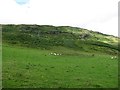
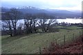
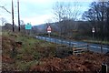
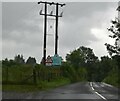
Nearby Images from Geograph Britain and Ireland:
©2011(licence)
©2014(licence)
©2014(licence)
©2021(licence)
©2023(licence)
The above images may not be of the site on this page, they are loaded from Geograph.
Please Submit an Image of this site or go out and take one for us!
Click here to see more info for this site
Nearby sites
Key: Red: member's photo, Blue: 3rd party photo, Yellow: other image, Green: no photo - please go there and take one, Grey: site destroyed
Download sites to:
KML (Google Earth)
GPX (GPS waypoints)
CSV (Garmin/Navman)
CSV (Excel)
To unlock full downloads you need to sign up as a Contributory Member. Otherwise downloads are limited to 50 sites.
Turn off the page maps and other distractions
Nearby sites listing. In the following links * = Image available
211m ENE 64° Tir Artair 1 (Killin) Rock Art (NN5906334807)
1.7km SE 126° Firbush Point (Killin) Hillfort (NN602337)
2.2km SSW 209° Kinnell* Stone Circle (NN5770032803)
2.4km SW 224° Fingal's Stone* Standing Stone (Menhir) (NN5712933021)
2.7km SW 215° Innis Bhuidhe* Stone Fort or Dun (NN57223255)
3.0km WNW 302° Allt na Ceardaich Knoll Rock Art (NN564364)
3.5km NW 313° Creag na Cailleach (Killin) Ancient Mine, Quarry or other Industry (NN56403715)
3.7km E 100° Creag Ard* Rock Art (NN6250433969)
4.1km SW 219° Acharn Standing Stone* Standing Stone (Menhir) (NN56143160)
4.5km W 269° Murlaganmore Footprint (Killin) Sculptured Stone (NN54323483)
4.8km W 266° Murlaganmore (Killin) Rock Art (NN54023455)
4.9km W 266° Murlaganmore 2 (Killin) Rock Art (NN53953455)
5.7km W 279° Duncroisk* Rock Art (NN53223582)
5.8km W 279° Duncroisk 2 (Glen Lochay) Rock Art (NN53133584)
5.9km WNW 285° Duncroisk Crosses Ancient Cross (NN53253641)
5.9km W 279° Corrycharmaig East 4 (Glen Lochay) Rock Art (NN53103582)
5.9km W 279° Corrycharmaig East 3 (Glen Lochay) Rock Art (NN5305635877)
6.0km WNW 284° Duncroisk 1 (Glen Lochay) Rock Art (NN53113640)
6.0km W 279° Corrycharmaig East 2 (Glen Lochay) Rock Art (NN52943588)
6.1km WNW 287° Tirai* Standing Stone (Menhir) (NN53083670)
6.1km SW 216° Mid Lix (Killin) Rock Art (NN55132987)
6.1km W 275° Corrycharmaig 3 (Glen Lochay) Rock Art (NN52783549)
6.3km WNW 283° Tullich Rock Art Rock Art (NN52813634)
6.3km NW 306° Duncroisk (Glen Lochay) Hillfort (NN539386)
6.7km ENE 59° Carie (Kenmore) Sculptured Stone (NN6477238018)
View more nearby sites and additional images


 We would like to know more about this location. Please feel free to add a brief description and any relevant information in your own language.
 Wir möchten mehr über diese Stätte erfahren. Bitte zögern Sie nicht, eine kurze Beschreibung und relevante Informationen in Deutsch hinzuzufügen.
 Nous aimerions en savoir encore un peu sur les lieux. S'il vous plaît n'hesitez pas à ajouter une courte description et tous les renseignements pertinents dans votre propre langue.
 Quisieramos informarnos un poco más de las lugares. No dude en añadir una breve descripción y otros datos relevantes en su propio idioma.