<< Text Pages >> Crawley Rocks - Promontory Fort / Cliff Castle in Wales in South Glamorgan
Submitted by coldrum on Thursday, 07 January 2010 Page Views: 3511
Iron Age and Later PrehistorySite Name: Crawley RocksCountry: Wales County: South Glamorgan Type: Promontory Fort / Cliff Castle
Map Ref: SS51878796
Latitude: 51.570995N Longitude: 4.138813W
Condition:
| 5 | Perfect |
| 4 | Almost Perfect |
| 3 | Reasonable but with some damage |
| 2 | Ruined but still recognisable as an ancient site |
| 1 | Pretty much destroyed, possibly visible as crop marks |
| 0 | No data. |
| -1 | Completely destroyed |
| 5 | Superb |
| 4 | Good |
| 3 | Ordinary |
| 2 | Not Good |
| 1 | Awful |
| 0 | No data. |
| 5 | Can be driven to, probably with disabled access |
| 4 | Short walk on a footpath |
| 3 | Requiring a bit more of a walk |
| 2 | A long walk |
| 1 | In the middle of nowhere, a nightmare to find |
| 0 | No data. |
| 5 | co-ordinates taken by GPS or official recorded co-ordinates |
| 4 | co-ordinates scaled from a detailed map |
| 3 | co-ordinates scaled from a bad map |
| 2 | co-ordinates of the nearest village |
| 1 | co-ordinates of the nearest town |
| 0 | no data |
Be the first person to rate this site - see the 'Contribute!' box in the right hand menu.
Internal Links:
External Links:
Promontory Fort / Cliff Castle in South Glamorgan
From Coflein:
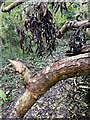
"A promontory fort visited for the purposes of archival updating. The earthwork is densely overgrown with trees and undergrowth but the remains appear to be substantially as recorded in 1967 and 1969. Locally, there has been some change in the N boundary. The outer scarp which projects into an arable field to the N has probably been pared down a little."
Source: Coflein
You may be viewing yesterday's version of this page. To see the most up to date information please register for a free account.
Do not use the above information on other web sites or publications without permission of the contributor.
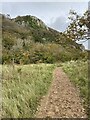
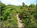
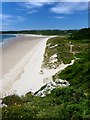
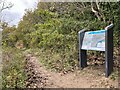
Nearby Images from Geograph Britain and Ireland:
©2023(licence)
©2011(licence)
©2008(licence)
©2023(licence)
©2023(licence)
The above images may not be of the site on this page, they are loaded from Geograph.
Please Submit an Image of this site or go out and take one for us!
Click here to see more info for this site
Nearby sites
Key: Red: member's photo, Blue: 3rd party photo, Yellow: other image, Green: no photo - please go there and take one, Grey: site destroyed
Download sites to:
KML (Google Earth)
GPX (GPS waypoints)
CSV (Garmin/Navman)
CSV (Excel)
To unlock full downloads you need to sign up as a Contributory Member. Otherwise downloads are limited to 50 sites.
Turn off the page maps and other distractions
Nearby sites listing. In the following links * = Image available
949m N 10° Cefn Bryn Cairn 1* Cairn (SS52068889)
955m NNE 18° Cefn Bryn Beacon 1 Cairn (SS52198886)
969m NNE 20° Cefn Bryn Beacon 2 Cairn (SS52238886)
1.2km ESE 101° Leather's Hole Cave or Rock Shelter (SS530877)
1.3km N 359° Cefn Bryn Burnt Mound 2 Misc. Earthwork (SS51888922)
1.3km N 359° Cefn Bryn Burnt Mound Misc. Earthwork (SS51898922)
1.3km N 0° Cefn Bryn Ring Cairn Ring Cairn (SS51918922)
1.3km E 81° Penmaen Burrows* Chambered Tomb (SS53168812)
1.3km NW 315° Nicholaston Hall Cairn Cairn (SS50948894)
1.4km NW 305° Nicholaston Long Cairn* Chambered Tomb (SS50768879)
1.5km ENE 62° North Hills Lane Barrow Cemetary Barrow Cemetery (SS53248863)
1.7km NW 316° Talbot Road Cairn 1* Ring Cairn (SS50758920)
1.7km NW 317° Talbot Road Cairn 2 Ring Cairn (SS50758921)
2.0km ENE 73° Pennard Pill Promontory Fort / Cliff Castle (SS53828851)
2.6km NE 41° Church Hill Earthwork* Misc. Earthwork (SS53628987)
2.6km NE 43° Parc le Breos* Chambered Tomb (SS53738984)
2.7km ENE 61° Gower Heritage centre* Museum (SS543892)
2.8km NE 41° Cat Hole Cave* Cave or Rock Shelter (SS53779002)
2.9km ESE 101° Ravencliffe Cave* Cave or Rock Shelter (SS547873)
3.0km NW 313° Holy Well (Cefn Bryn)* Holy Well or Sacred Spring (SS49769003)
3.0km WSW 244° Norton Camp (Swansea) Misc. Earthwork (SS4915486734)
3.2km NNE 21° Tooth Cave* Cave or Rock Shelter (SS531909)
3.4km NW 309° Cefn Bryn Cairn 2* Ring Cairn (SS49269021)
3.5km NW 311° Cefn Bryn Cairn 3* Ring Cairn (SS493903)
3.5km NNW 345° Pen-y-Crug Barrow* Round Barrow(s) (SS51099137)
View more nearby sites and additional images


 We would like to know more about this location. Please feel free to add a brief description and any relevant information in your own language.
 Wir möchten mehr über diese Stätte erfahren. Bitte zögern Sie nicht, eine kurze Beschreibung und relevante Informationen in Deutsch hinzuzufügen.
 Nous aimerions en savoir encore un peu sur les lieux. S'il vous plaît n'hesitez pas à ajouter une courte description et tous les renseignements pertinents dans votre propre langue.
 Quisieramos informarnos un poco más de las lugares. No dude en añadir una breve descripción y otros datos relevantes en su propio idioma.