<< Our Photo Pages >> Bagbie Wall Stone - Standing Stone (Menhir) in Scotland in Dumfries and Galloway
Submitted by markj99 on Monday, 26 April 2021 Page Views: 964
Neolithic and Bronze AgeSite Name: Bagbie Wall StoneCountry: Scotland County: Dumfries and Galloway Type: Standing Stone (Menhir)
Nearest Town: Creetown
Map Ref: NX49795635
Latitude: 54.879276N Longitude: 4.34284W
Condition:
| 5 | Perfect |
| 4 | Almost Perfect |
| 3 | Reasonable but with some damage |
| 2 | Ruined but still recognisable as an ancient site |
| 1 | Pretty much destroyed, possibly visible as crop marks |
| 0 | No data. |
| -1 | Completely destroyed |
| 5 | Superb |
| 4 | Good |
| 3 | Ordinary |
| 2 | Not Good |
| 1 | Awful |
| 0 | No data. |
| 5 | Can be driven to, probably with disabled access |
| 4 | Short walk on a footpath |
| 3 | Requiring a bit more of a walk |
| 2 | A long walk |
| 1 | In the middle of nowhere, a nightmare to find |
| 0 | No data. |
| 5 | co-ordinates taken by GPS or official recorded co-ordinates |
| 4 | co-ordinates scaled from a detailed map |
| 3 | co-ordinates scaled from a bad map |
| 2 | co-ordinates of the nearest village |
| 1 | co-ordinates of the nearest town |
| 0 | no data |
Internal Links:
External Links:
I have visited· I would like to visit
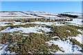
markj99 visited on 27th Apr 2021 - their rating: Cond: 4 Amb: 4 Access: 4 I have made multiple visits to Bagbie Cairn and its surroundings. There are many sites to visit in a small area. There is a view of the sea from Bagbie Cairn which may have influenced its location.
")
Canmore ID 281565 notes that the stone is "on a direct sight-line between Bagbie standing stone and the two upright stones on the ESE edge on Bagbie cairn." (J Pickin 2005)
You may be viewing yesterday's version of this page. To see the most up to date information please register for a free account.
")
")
")
")
Do not use the above information on other web sites or publications without permission of the contributor.
Nearby Images from Geograph Britain and Ireland:
©2015(licence)
©2015(licence)
©2016(licence)
©2016(licence)
©2015(licence)
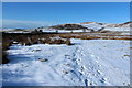
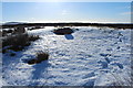
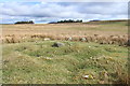
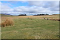
The above images may not be of the site on this page, they are loaded from Geograph.
Please Submit an Image of this site or go out and take one for us!
Click here to see more info for this site
Nearby sites
Key: Red: member's photo, Blue: 3rd party photo, Yellow: other image, Green: no photo - please go there and take one, Grey: site destroyed
Download sites to:
KML (Google Earth)
GPX (GPS waypoints)
CSV (Garmin/Navman)
CSV (Excel)
To unlock full downloads you need to sign up as a Contributory Member. Otherwise downloads are limited to 50 sites.
Turn off the page maps and other distractions
Nearby sites listing. In the following links * = Image available
36m NNE 32° Bagbie Four Poster* Stone Circle (NX49815638)
40m N 358° Bagbie cairn* Cairn (NX49795639)
52m N 8° Bagbie stones* Standing Stones (NX4979956401)
151m S 184° Standing Stone of Bagbie* Standing Stone (Menhir) (NX4977456200)
744m SE 127° Knock Gray Standing Stone* Standing Stone (Menhir) (NX5037055881)
1.2km W 261° Kirkmabreck* Rock Art (NX48625620)
2.0km E 98° Claughreid* Stone Circle (NX5177356005)
2.1km NNE 27° Glenquicken Cist* Cairn (NX50785815)
2.2km NNE 25° Glenquickan N Stone Circle (NX50795830)
2.2km NNE 30° Glenquicken Circle* Stone Circle (NX50965821)
2.4km SE 129° Cairnholy 5* Rock Art (NX51615480)
2.5km SE 132° Cairnholy 4* Rock Art (NX51555463)
2.5km SE 132° Cairnholy 12* Rock Art (NX5155054630)
2.5km SE 132° Cairnholy 11* Rock Art (NX5155154631)
2.5km SE 132° Cairnholy 14* Rock Art (NX5155554633)
2.5km SE 126° Cairnholy 7* Rock Art (NX51765484)
2.5km ESE 122° Cairnholy 6* Rock Art (NX51855496)
2.6km SE 134° Cairnholy 9* Rock Art (NX51615445)
2.8km SSE 149° Clash Wood Cairn* Round Cairn (NX5117853862)
2.8km NE 37° Glenquicken Stone* Standing Stone (Menhir) (NX51575858)
3.0km SE 131° Cairnholy 3* Rock Art (NX52005428)
3.1km SE 137° Cairnholy 2* Chambered Cairn (NX5182054045)
3.1km SE 133° Kirkdale Burn* Cairn (NX5198354134)
3.1km SE 139° Cairnholy 1* Chambered Cairn (NX5176053890)
3.2km SE 139° Cairnholy 2 (Rock Art)* Rock Art (NX5177453889)
View more nearby sites and additional images


 We would like to know more about this location. Please feel free to add a brief description and any relevant information in your own language.
 Wir möchten mehr über diese Stätte erfahren. Bitte zögern Sie nicht, eine kurze Beschreibung und relevante Informationen in Deutsch hinzuzufügen.
 Nous aimerions en savoir encore un peu sur les lieux. S'il vous plaît n'hesitez pas à ajouter une courte description et tous les renseignements pertinents dans votre propre langue.
 Quisieramos informarnos un poco más de las lugares. No dude en añadir una breve descripción y otros datos relevantes en su propio idioma.