


<< Our Photo Pages >> Hirdre-faig - Standing Stone (Menhir) in Wales in Anglesey (Sir Ynys Mon)
Submitted by vicky on Monday, 24 March 2003 Page Views: 12455
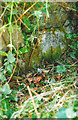
Neolithic and Bronze AgeSite Name: Hirdre-faigCountry: Wales County: Anglesey (Sir Ynys Mon) Type: Standing Stone (Menhir)
Nearest Town: Llangefni Nearest Village: Talwrn
Map Ref: SH484745 Landranger Map Number: 114
Latitude: 53.245808N Longitude: 4.27345W
Condition:
| 5 | Perfect |
| 4 | Almost Perfect |
| 3 | Reasonable but with some damage |
| 2 | Ruined but still recognisable as an ancient site |
| 1 | Pretty much destroyed, possibly visible as crop marks |
| 0 | No data. |
| -1 | Completely destroyed |
| 5 | Superb |
| 4 | Good |
| 3 | Ordinary |
| 2 | Not Good |
| 1 | Awful |
| 0 | No data. |
| 5 | Can be driven to, probably with disabled access |
| 4 | Short walk on a footpath |
| 3 | Requiring a bit more of a walk |
| 2 | A long walk |
| 1 | In the middle of nowhere, a nightmare to find |
| 0 | No data. |
| 5 | co-ordinates taken by GPS or official recorded co-ordinates |
| 4 | co-ordinates scaled from a detailed map |
| 3 | co-ordinates scaled from a bad map |
| 2 | co-ordinates of the nearest village |
| 1 | co-ordinates of the nearest town |
| 0 | no data |
Internal Links:
External Links:
I have visited· I would like to visit
PAB has visited here
")
Have you visited this site? Please add a comment below.
You may be viewing yesterday's version of this page. To see the most up to date information please register for a free account.
")
")
")
")
Do not use the above information on other web sites or publications without permission of the contributor.
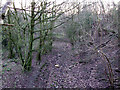
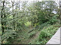
Nearby Images from Geograph Britain and Ireland:
©2006(licence)
©2023(licence)
©2019(licence)

©2007(licence)

©2008(licence)
The above images may not be of the site on this page, they are loaded from Geograph.
Please Submit an Image of this site or go out and take one for us!
Click here to see more info for this site
Nearby sites
Key: Red: member's photo, Blue: 3rd party photo, Yellow: other image, Green: no photo - please go there and take one, Grey: site destroyed
Download sites to:
KML (Google Earth)
GPX (GPS waypoints)
CSV (Garmin/Navman)
CSV (Excel)
To unlock full downloads you need to sign up as a Contributory Member. Otherwise downloads are limited to 50 sites.
Turn off the page maps and other distractions
Nearby sites listing. In the following links * = Image available
2.3km WNW 299° Llangefni Gorsedd Circle* Modern Stone Circle etc (SH4636875687)
2.8km WSW 258° Lledwigan* Standing Stone (Menhir) (SH456740)
3.0km WNW 296° Ffynnon Cyngar Sant / St Cyngars Well* Holy Well or Sacred Spring (SH4572875881)
3.3km E 86° St Gredifael's Holy Well (Penmynydd) Holy Well or Sacred Spring (SH51677465)
3.3km NW 307° Oriel Ynys Mon* Museum (SH458766)
4.3km NNE 20° Stone Science Museum (SH49997851)
4.4km NNE 21° Llanddfynan Standing Stone* Standing Stone (Menhir) (SH5014978592)
4.6km SSE 153° Tyddyn-bach* Standing Stone (Menhir) (SH5031770341)
4.7km NNE 30° Llanddyfynan Barrows* Chambered Tomb (SH5088278462)
4.8km SSE 151° Bryn Celli Ddu Gorsedd* Rock Art (SH50627024)
4.9km SSE 150° Bryn Celli Ddu* Passage Grave (SH50757017)
4.9km SSE 151° Bryn Celli Ddu Standing Stone* Standing Stone (Menhir) (SH50637010)
4.9km SSE 150° Bryn Celli Ddu Cairn* Cairn (SH50727012)
5.1km SSE 154° Bryn Celli Ddu Car Park Mound* Modern Stone Circle etc (SH50506990)
5.8km ESE 119° Modern Stone Circle near Marquis of Anglesey's Column* Modern Stone Circle etc (SH53437156)
5.9km NE 47° The Three Leaps* Stone Row / Alignment (SH5283878407)
6.0km ESE 111° Ty Mawr Tomb* Passage Grave (SH5388672144)
6.0km SE 141° Plas Newydd Burial Chamber* Chambered Tomb (SH5199069722)
6.1km W 261° St Ceinwen Holy Well* Holy Well or Sacred Spring (SH423737)
6.3km WSW 245° Hen Blas* Burial Chamber or Dolmen (SH42577197)
6.5km SE 146° Bryn yr Hen Bobl* Chambered Cairn (SH5188869005)
6.7km SSW 197° Bodowyr* Passage Grave (SH46276816)
6.7km NE 51° Mynydd Llwydiarth Hillfort (SH5378978520)
6.7km S 189° Pont Sarn Las Ancient Village or Settlement (SH471679)
6.7km S 186° Ty Mawr 2* Standing Stone (Menhir) (SH4743667830)
View more nearby sites and additional images


 We would like to know more about this location. Please feel free to add a brief description and any relevant information in your own language.
 Wir möchten mehr über diese Stätte erfahren. Bitte zögern Sie nicht, eine kurze Beschreibung und relevante Informationen in Deutsch hinzuzufügen.
 Nous aimerions en savoir encore un peu sur les lieux. S'il vous plaît n'hesitez pas à ajouter une courte description et tous les renseignements pertinents dans votre propre langue.
 Quisieramos informarnos un poco más de las lugares. No dude en añadir una breve descripción y otros datos relevantes en su propio idioma.