


<< Our Photo Pages >> Eirth dant - Standing Stone (Menhir) in Wales in Carmarthenshire (Sir Caerfyrddin)
Submitted by pjk7009 on Wednesday, 03 December 2014 Page Views: 2673
Neolithic and Bronze AgeSite Name: Eirth dant Alternative Name: Bears toothCountry: Wales
NOTE: This site is 0.4 km away from the location you searched for.
County: Carmarthenshire (Sir Caerfyrddin) Type: Standing Stone (Menhir)
Map Ref: SN469324
Latitude: 51.968929N Longitude: 4.230072W
Condition:
| 5 | Perfect |
| 4 | Almost Perfect |
| 3 | Reasonable but with some damage |
| 2 | Ruined but still recognisable as an ancient site |
| 1 | Pretty much destroyed, possibly visible as crop marks |
| 0 | No data. |
| -1 | Completely destroyed |
| 5 | Superb |
| 4 | Good |
| 3 | Ordinary |
| 2 | Not Good |
| 1 | Awful |
| 0 | No data. |
| 5 | Can be driven to, probably with disabled access |
| 4 | Short walk on a footpath |
| 3 | Requiring a bit more of a walk |
| 2 | A long walk |
| 1 | In the middle of nowhere, a nightmare to find |
| 0 | No data. |
| 5 | co-ordinates taken by GPS or official recorded co-ordinates |
| 4 | co-ordinates scaled from a detailed map |
| 3 | co-ordinates scaled from a bad map |
| 2 | co-ordinates of the nearest village |
| 1 | co-ordinates of the nearest town |
| 0 | no data |
Internal Links:
External Links:
")
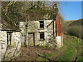
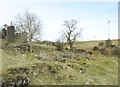
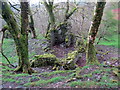
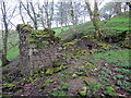
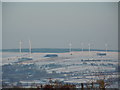
A meter high stone sits by a stream in a gully. Forestry to one side, fields to the other. Access is unknown since the turbines went up. The stone is out of sight of anything and does not serve any practical purpose such as acting as part of a dam or fence post. It is just a seemingly random upright stone.
You may be viewing yesterday's version of this page. To see the most up to date information please register for a free account.
Do not use the above information on other web sites or publications without permission of the contributor.
Nearby Images from Geograph Britain and Ireland:
©2010(licence)
©2010(licence)
©2020(licence)
©2020(licence)
©2020(licence)
The above images may not be of the site on this page, they are loaded from Geograph.
Please Submit an Image of this site or go out and take one for us!
Click here to see more info for this site
Nearby sites
Key: Red: member's photo, Blue: 3rd party photo, Yellow: other image, Green: no photo - please go there and take one, Grey: site destroyed
Download sites to:
KML (Google Earth)
GPX (GPS waypoints)
CSV (Garmin/Navman)
CSV (Excel)
To unlock full downloads you need to sign up as a Contributory Member. Otherwise downloads are limited to 50 sites.
Turn off the page maps and other distractions
Nearby sites listing. In the following links * = Image available
1.5km NE 40° Cruigau Ros-Wen 1* Round Barrow(s) (SN47883348)
1.6km NE 55° Crugiau Rhos-Wen 2* Round Barrow(s) (SN48213326)
2.6km NE 40° Crugyn Amlwg* Round Barrow(s) (SN48613432)
4.0km NE 39° Crug-Y-Bedw* Cairn (SN49523543)
4.5km NE 45° Crug Penheol* Cairn (SN50233547)
4.6km SE 142° Crug Bach Cairn (SN49632863)
4.8km SE 140° Crugiau Round Barrow* Cairn (SN49882864)
4.8km ENE 60° Hafod Tridrws* Round Barrow(s) (SN51153466)
4.9km SE 139° Crug Canol* Cairn (SN50012855)
5.2km SE 137° Crug Melyn* Cairn (SN50282850)
5.3km S 173° Crug-y-Rhyd-Hir* Cairn (SN47422714)
5.4km NW 312° Crug Sgethlin* Cairn (SN43033616)
5.6km SE 138° Crug i'r de* Cairn (SN5054228147)
5.6km NNE 34° Crugiau Giar, South Cairn* Round Cairn (SN50193700)
6.1km S 183° Pant-y-llyn Cairn Cairn (SN46352635)
6.1km SE 130° Llech Ciste* Stone Row / Alignment (SN51422832)
6.1km S 184° Bull Hall Crug Cairn (SN46272631)
6.1km W 274° Crug Gilfach Fach Round Barrow(s) (SN40783299)
6.3km W 271° Crugiau Fach* Barrow Cemetery (SN40543270)
6.4km S 187° Meini-Gwyn* Stone Row / Alignment (SN4598126102)
6.4km W 280° Gareg Hir* Standing Stone (Menhir) (SN40603367)
6.6km S 181° Croes Arthur Hillfort* Hillfort (SN46602585)
6.6km WNW 301° Yr Hen Llech Chambered Tomb (SN413360)
6.8km WNW 300° Blaennantrhys Cairn 3* Cairn (SN41123592)
6.8km W 265° Crug Gwyn* Cairn (SN40063204)
View more nearby sites and additional images


 We would like to know more about this location. Please feel free to add a brief description and any relevant information in your own language.
 Wir möchten mehr über diese Stätte erfahren. Bitte zögern Sie nicht, eine kurze Beschreibung und relevante Informationen in Deutsch hinzuzufügen.
 Nous aimerions en savoir encore un peu sur les lieux. S'il vous plaît n'hesitez pas à ajouter une courte description et tous les renseignements pertinents dans votre propre langue.
 Quisieramos informarnos un poco más de las lugares. No dude en añadir una breve descripción y otros datos relevantes en su propio idioma.