


<< Our Photo Pages >> Kumayama Iseki - Pyramid / Mastaba in Japan in Honshū
Submitted by Aska on Tuesday, 02 December 2014 Page Views: 6960
Early Medieval (Dark Age)Site Name: Kumayama Iseki Alternative Name: 熊山遺跡Country: Japan Region: Honshū Type: Pyramid / Mastaba
Nearest Town: Akaiwa (Okayama pref.) Nearest Village: Seiriki 勢力
Latitude: 34.753831N Longitude: 134.120965E
Condition:
| 5 | Perfect |
| 4 | Almost Perfect |
| 3 | Reasonable but with some damage |
| 2 | Ruined but still recognisable as an ancient site |
| 1 | Pretty much destroyed, possibly visible as crop marks |
| 0 | No data. |
| -1 | Completely destroyed |
| 5 | Superb |
| 4 | Good |
| 3 | Ordinary |
| 2 | Not Good |
| 1 | Awful |
| 0 | No data. |
| 5 | Can be driven to, probably with disabled access |
| 4 | Short walk on a footpath |
| 3 | Requiring a bit more of a walk |
| 2 | A long walk |
| 1 | In the middle of nowhere, a nightmare to find |
| 0 | No data. |
| 5 | co-ordinates taken by GPS or official recorded co-ordinates |
| 4 | co-ordinates scaled from a detailed map |
| 3 | co-ordinates scaled from a bad map |
| 2 | co-ordinates of the nearest village |
| 1 | co-ordinates of the nearest town |
| 0 | no data |
Internal Links:
External Links:
")
You may be viewing yesterday's version of this page. To see the most up to date information please register for a free account.
")
Do not use the above information on other web sites or publications without permission of the contributor.
Nearby Images from Flickr
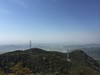
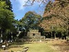
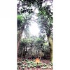
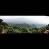
The above images may not be of the site on this page, but were taken nearby. They are loaded from Flickr so please click on them for image credits.
Click here to see more info for this site
Nearby sites
Click here to view sites on an interactive map of the areaKey: Red: member's photo, Blue: 3rd party photo, Yellow: other image, Green: no photo - please go there and take one, Grey: site destroyed
Download sites to:
KML (Google Earth)
GPX (GPS waypoints)
CSV (Garmin/Navman)
CSV (Excel)
To unlock full downloads you need to sign up as a Contributory Member. Otherwise downloads are limited to 50 sites.
Turn off the page maps and other distractions
Nearby sites listing. In the following links * = Image available
9.2km NNW 334° Taichi-baka* Not Known (by us)
10.1km WSW 249° Ōmeguri-Komeguriyama* Hillfort
12.4km SSW 206° Jōkō-in temple* Modern Stone Circle etc
12.4km SSW 207° Eryō-in temple* Modern Stone Circle etc
13.1km W 265° Takakura Jinja shrine* Cairn
14.5km WSW 246° Bizen KurumaZuka Kofun* Long Barrow
15.2km SSE 166° Kongōchō-ji temple* Modern Stone Circle etc
17.1km SW 232° Sōgen-ji temple* Modern Stone Circle etc
19.5km WSW 251° Okuike Kofungun* Passage Grave
21.3km NNE 21° Ameno-Iwatowake Jinja shrine* Cairn
23.7km ENE 68° Yoi-Taniguchi Kofungun* Chambered Cairn
24.9km WSW 250° Kibitsuhiko Jinja shrine* Stone Circle
25.7km WSW 250° Kibi-no-Nakayama* Misc. Earthwork
26.3km E 95° Tabuchi garden* Modern Stone Circle etc
27.9km N 6° An’yō-ji temple* Modern Stone Circle etc
28.8km WSW 250° Tatetsuki* Barrow Cemetery
28.9km WSW 248° Mamiya Jinja shrine* Stone Circle
29.9km NE 41° Kuzaki Kyōzuka* Pyramid / Mastaba
31.0km WSW 248° Futago Kofun (in Okayama)* Passage Grave
31.3km E 88° Tsubone Kofungun* Chambered Cairn
32.0km SE 146° Hoshigajō* Hillfort
32.1km W 265° Kinojō* Hillfort
33.4km WSW 249° Tanukiiwayama Kofun* Chambered Cairn
33.6km NNE 31° Fukuyoshi Kyōzuka* Pyramid / Mastaba
34.5km WNW 282° Tenrai-an tea room* Modern Stone Circle etc
View more nearby sites and additional images


 We would like to know more about this location. Please feel free to add a brief description and any relevant information in your own language.
 Wir möchten mehr über diese Stätte erfahren. Bitte zögern Sie nicht, eine kurze Beschreibung und relevante Informationen in Deutsch hinzuzufügen.
 Nous aimerions en savoir encore un peu sur les lieux. S'il vous plaît n'hesitez pas à ajouter une courte description et tous les renseignements pertinents dans votre propre langue.
 Quisieramos informarnos un poco más de las lugares. No dude en añadir una breve descripción y otros datos relevantes en su propio idioma.