<< Our Photo Pages >> Maen Chwyf - Natural Stone / Erratic / Other Natural Feature in Wales in Anglesey
Submitted by guile on Wednesday, 01 August 2012 Page Views: 4845
Natural PlacesSite Name: Maen Chwyf Alternative Name: The stone that rocksCountry: Wales
NOTE: This site is 0.2 km away from the location you searched for.
County: Anglesey Type: Natural Stone / Erratic / Other Natural Feature
Nearest Town: Lllanerch y Medd Nearest Village: Rhosybol
Map Ref: SH43268574
Latitude: 53.345262N Longitude: 4.355963W
Condition:
| 5 | Perfect |
| 4 | Almost Perfect |
| 3 | Reasonable but with some damage |
| 2 | Ruined but still recognisable as an ancient site |
| 1 | Pretty much destroyed, possibly visible as crop marks |
| 0 | No data. |
| -1 | Completely destroyed |
| 5 | Superb |
| 4 | Good |
| 3 | Ordinary |
| 2 | Not Good |
| 1 | Awful |
| 0 | No data. |
| 5 | Can be driven to, probably with disabled access |
| 4 | Short walk on a footpath |
| 3 | Requiring a bit more of a walk |
| 2 | A long walk |
| 1 | In the middle of nowhere, a nightmare to find |
| 0 | No data. |
| 5 | co-ordinates taken by GPS or official recorded co-ordinates |
| 4 | co-ordinates scaled from a detailed map |
| 3 | co-ordinates scaled from a bad map |
| 2 | co-ordinates of the nearest village |
| 1 | co-ordinates of the nearest town |
| 0 | no data |
Internal Links:
External Links:
I have visited· I would like to visit
cactus_chris visited on 1st Oct 2020 - their rating: Cond: 2 Access: 1 In a farmers field - to which I couldn't see any access.
guile have visited here
")
Text taken from J.E. Griffiths, F.L.S., F.R.A.S., "Portfolio of Photographs of the Cromlechs of Anglesey and Carnarvonshire 1900"
"Maen Chwyf: It is marked on the Ordinance Map under the name “Maen Chwyt,” it ought to be “Maen Chwyf” viz., a rocking-stone.
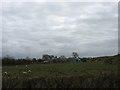
This enormous block of stone lies on rising ground, in a field east of Gaerwen farm and about one mile and a half from Llanerchymedd, and has all the appearance of having been a very large Cromlech in former times. There are one or two of its supports to be seen projecting from underneath it. The capstone is eleven feet long and eight feet wide at the north end, and five feet ten inches at the south end, and averaging about three feet in thickness.
There is a tradition in the neighbourhood that it formerly used to rock, but now the space underneath is filled up with earth and debris, and the whole block is so overgrown with briars, thorns, and bracken, that it is difficult to obtain a good photograph of it. [Not recorded in Arch. Camb.]"
I had to keep returning to this site in an attempt to get a picture, not because of gorse like my more illustrious predecessor but rather because Maen Chwyf is located in a complex of four or five interconnecting fields that are home to a large herd of curious heifers [ I hope that's what they were] that kept charging after me. Not noted for my love of bovines I was forced to turn tail and run on many occasions as they thundered after me.
I know my pictures look very different from the stone in the multi coloured site, but it does look exactly like the one photographed by John Griffiths.
The stones around here are indeed magnificent, Maen Chwyf itself is some 12 foot by 9 foot with many lesser stones underneath and around it. It is possible to see from its shape how it might have rocked in the past. Although I have described the ambience as good, I had to run for my life [again] straight after taking these pictures as I was spotted by the local herd!
It is interesting to see how interpretations change over the years, despite being listed as an Ancient Monument [SAM AN07] current thinking seems now to incline towards this being a natural feature.
Maen Chwyf is located some 310 yards from the Llys Einion stone and is part of what in Neolithic times must have been a ritually significant area with Llys Einion a.k.a. Bryn Dyfrydog, The Altar Stone, Carreg Lleidir, Llech Golman, Maenaddwyn and Llwydiarth Esgob all close by.
Only excavation could really settle the matter.
You may be viewing yesterday's version of this page. To see the most up to date information please register for a free account.
")
")
")
Do not use the above information on other web sites or publications without permission of the contributor.
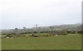
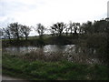
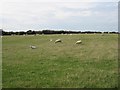
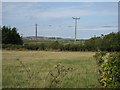
Nearby Images from Geograph Britain and Ireland:
©2009(licence)
©2009(licence)
©2006(licence)
©2006(licence)
©2009(licence)
The above images may not be of the site on this page, they are loaded from Geograph.
Please Submit an Image of this site or go out and take one for us!
Click here to see more info for this site
Nearby sites
Key: Red: member's photo, Blue: 3rd party photo, Yellow: other image, Green: no photo - please go there and take one, Grey: site destroyed
Download sites to:
KML (Google Earth)
GPX (GPS waypoints)
CSV (Garmin/Navman)
CSV (Excel)
To unlock full downloads you need to sign up as a Contributory Member. Otherwise downloads are limited to 50 sites.
Turn off the page maps and other distractions
Nearby sites listing. In the following links * = Image available
226m NW 313° Bryn Dyfrydog* Standing Stone (Menhir) (SH431859)
1.4km SSE 164° Llwydiarth Esgob Stone* Rock Art (SH436844)
1.4km SSW 202° Bedd y Foel* Burial Chamber or Dolmen (SH42698444)
2.0km SE 135° Carreg Leidr* Standing Stone (Menhir) (SH446843)
2.2km SE 132° Clorach Wells* Not Known (by us) (SH4487584177)
2.3km SE 132° Ffynnon Deiniol* Holy Well or Sacred Spring (SH44908416)
2.3km SE 132° Ffynnon Gybi* Holy Well or Sacred Spring (SH44908414)
3.3km SE 142° Llech Golman* Standing Stone (Menhir) (SH452831)
3.3km SE 126° Llanfihangel Tre'r Beirdd Cross* Ancient Cross (SH4588783693)
3.7km SE 128° Maen Addwyn* Standing Stone (Menhir) (SH461834)
3.9km SSW 213° Mynydd Mwyn Mawr standing stones* Standing Stones (SH41058256)
4.4km SW 230° Carmel Standing Stone* Standing Stone (Menhir) (SH39798304)
4.4km E 91° Ponc y Garreg Hir* Standing Stone (Menhir) (SH47668549)
4.9km NNE 13° Parys Mountain* Ancient Mine, Quarry or other Industry (SH445905)
5.2km NNW 327° Bodewryd* Standing Stone (Menhir) (SH406902)
5.3km NW 313° Maen y Goges* Natural Stone / Erratic / Other Natural Feature (SH39518948)
5.5km E 95° Tyddyn Isaf Burnt Mound Misc. Earthwork (SH4873185067)
5.6km E 88° Rhos Lligwy Burnt Mound Misc. Earthwork (SH4888185780)
5.6km WNW 282° St Pabo's Church Memorial Stone* Early Christian Sculptured Stone (SH378871)
5.7km ENE 64° Ogof Arian Cave or Rock Shelter (SH485881)
5.8km E 94° Bwlch-Y-Dafarn Enclosed Settlement Ancient Village or Settlement (SH4900085103)
5.8km E 86° Coed Newydd Burnt Mounds Misc. Earthwork (SH4904885932)
5.8km E 93° Bwlch-Y-Dafarn Settlement Enclosure Ancient Village or Settlement (SH4910585235)
5.9km ESE 108° Frigan Field System Misc. Earthwork (SH488837)
6.0km E 89° Bwlch-Y-Dafarn Ancient Village or Settlement (SH4929285663)
View more nearby sites and additional images


 We would like to know more about this location. Please feel free to add a brief description and any relevant information in your own language.
 Wir möchten mehr über diese Stätte erfahren. Bitte zögern Sie nicht, eine kurze Beschreibung und relevante Informationen in Deutsch hinzuzufügen.
 Nous aimerions en savoir encore un peu sur les lieux. S'il vous plaît n'hesitez pas à ajouter une courte description et tous les renseignements pertinents dans votre propre langue.
 Quisieramos informarnos un poco más de las lugares. No dude en añadir una breve descripción y otros datos relevantes en su propio idioma.