<< Our Photo Pages >> Torhousekie Stones East - Standing Stones in Scotland in Dumfries and Galloway
Submitted by vicky on Tuesday, 29 October 2002 Page Views: 4841
Neolithic and Bronze AgeSite Name: Torhousekie Stones East Alternative Name: Torhouse EastCountry: Scotland County: Dumfries and Galloway Type: Standing Stones
Map Ref: NX3827156468 Landranger Map Number: 83
Latitude: 54.876741N Longitude: 4.522265W
Condition:
| 5 | Perfect |
| 4 | Almost Perfect |
| 3 | Reasonable but with some damage |
| 2 | Ruined but still recognisable as an ancient site |
| 1 | Pretty much destroyed, possibly visible as crop marks |
| 0 | No data. |
| -1 | Completely destroyed |
| 5 | Superb |
| 4 | Good |
| 3 | Ordinary |
| 2 | Not Good |
| 1 | Awful |
| 0 | No data. |
| 5 | Can be driven to, probably with disabled access |
| 4 | Short walk on a footpath |
| 3 | Requiring a bit more of a walk |
| 2 | A long walk |
| 1 | In the middle of nowhere, a nightmare to find |
| 0 | No data. |
| 5 | co-ordinates taken by GPS or official recorded co-ordinates |
| 4 | co-ordinates scaled from a detailed map |
| 3 | co-ordinates scaled from a bad map |
| 2 | co-ordinates of the nearest village |
| 1 | co-ordinates of the nearest town |
| 0 | no data |
Internal Links:
External Links:
I have visited· I would like to visit
Couplands saw from a distance on 20th Apr 2025 - their rating: Cond: 4 Amb: 3 Access: 3
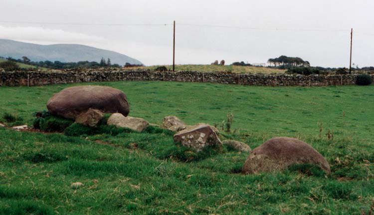
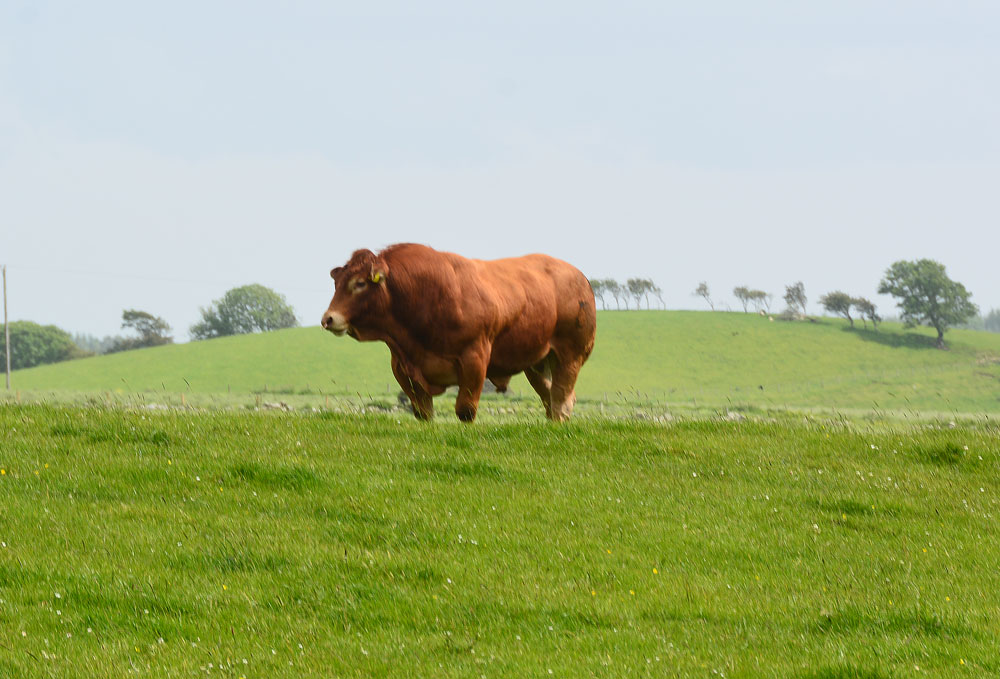
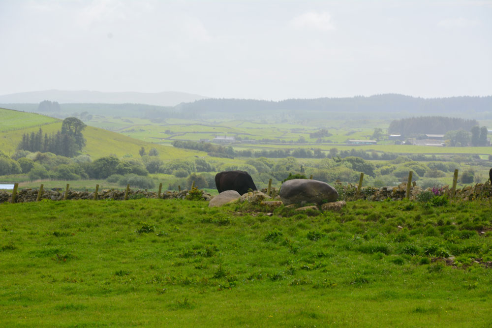
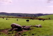
Anne T visited on 17th Jun 2019 - their rating: Cond: 2 Amb: 3 Access: 4 Torhouseskie Stones East: To be found in the field immediately to the east of the Torhousekie Stone Circles, one of these stones was most certainly the size of the boulders used in the stone circle, although because of the sheer number of cattle (and The Huge Bull) around these stones (and the deep puddles around them and in the adjacent field) we didn't go and investigate further. I then got chatting to another gentleman with his camera who was also keen to investigate the stones, but taking one look at the cattle and The Huge Bull, we looked at each other and said 'No'.
I confess that even having printed off all the Canmore and Stone Rows of Great Britain records for this immediate area, I'd misread the grid reference and thought these stones were the ones to the south west of the circle (see Torhousekie South West Stones) and only realised my mistake when looking at the photographs and Canmore site together at home later. Although there appears to be a stone marked just to the east of the stone circle on Sandy G's plan of alignments at Torhousekie, which still confuses me - I need to check with Sandy.
Even to my untrained eye, it looked like large field clearance boulders had been dumped next to the large boulder. I have since read Sandy G's visit report, which confirms his thinking that these are field clearance stones, but their proximity to the stone circle has influenced thinking as to what they are interpreted as.
SandyG visited on 5th Sep 2017 - their rating: Cond: 1 Amb: 4 Access: 3 This line of stones is probably entirely the result of field clearance. The largest stone at the northern end clearly sits on top of stones similar in size to those which lie in a line parallel to the field wall. The proximity of the stone circle has probably influenced the interpretation of this site as prehistoric. Whilst a prehistoric date cannot be wholly discounted the feature as a whole has the appearance of being the result of field clearance.
graemefield visited on 27th Jun 2011 - their rating: Cond: 3 Amb: 4 Access: 3
markj99 visited on 7th Feb 2009 - their rating: Cond: 1 Amb: 3 Access: 3 I am incline to agree with Sandy G's interpretation of this dubious stone row. The scale and random nature of the stones make me interpret this as field clearance stones.
Average ratings for this site from all visit loggers: Condition: 2.2 Ambience: 3.4 Access: 3.2
Not to be confused with another pair of standing stones recorded as Canmore ID 62844, which lie to the SSW of the stone circle, outside the stone circle enclosure.
See Sandy G's 2017 visit report, which reads: "This line of stones is probably entirely the result of field clearance. The largest stone at the northern end clearly sits on top of stones similar in size to those which lie in a line parallel to the field wall. The proximity of the stone circle has probably influenced the interpretation of this site as prehistoric. Whilst a prehistoric date cannot be wholly discounted the feature as a whole has the appearance of being the result of field clearance".
You may be viewing yesterday's version of this page. To see the most up to date information please register for a free account.


Do not use the above information on other web sites or publications without permission of the contributor.
Click here to see more info for this site
Nearby sites
Key: Red: member's photo, Blue: 3rd party photo, Yellow: other image, Green: no photo - please go there and take one, Grey: site destroyed
Download sites to:
KML (Google Earth)
GPX (GPS waypoints)
CSV (Garmin/Navman)
CSV (Excel)
To unlock full downloads you need to sign up as a Contributory Member. Otherwise downloads are limited to 50 sites.
Turn off the page maps and other distractions
Nearby sites listing. In the following links * = Image available
30m NW 325° Torhousekie stone circle* Stone Circle (NX3825556493)
76m WSW 246° Torhouseskie South West Standing Stones* Standing Stones (NX38205644)
116m ENE 67° Torhousekie East* Stone Row / Alignment (NX38385651)
155m NNW 326° Torhousekie N* Cairn (NX38195660)
211m N 1° Torhouse North Cairn* Cairn (NX3828156679)
219m NNW 332° Torhouse North Side Cairn* Cairn (NX3817456665)
405m SSE 154° Torhousekie Standing Stone* Standing Stone (Menhir) (NX3843456097)
479m NW 305° Torhousekie Farm Cairn* Cairn (NX37895676)
1.8km WSW 245° White Cairn (Crouse)* Cairn (NX36585577)
1.8km WSW 244° Crow Stone (Wigtown)* Standing Stone (Menhir) (NX3658555732)
3.0km WNW 298° Spittal Croft cairn* Cairn (NX35645800)
3.3km ENE 61° Cairnhouse W* Cairn (NX41205798)
3.4km WNW 296° Knocknocher stone pair* Standing Stones (NX35225808)
3.4km WNW 298° Whitecairn (Boreland)* Cairn (NX35285819)
3.8km SSW 191° Culmalzie (Whauphill) Holy Well or Sacred Spring (NX37405281)
3.8km ESE 111° Neilson's Hill* Rock Art (NX4176655018)
3.9km ENE 62° Cairnhouse E* Cairn (NX41765813)
4.0km SSE 168° Barvernochan Standing Stone* Standing Stone (Menhir) (NX38975255)
4.6km ESE 117° Bladnoch* Standing Stone (Menhir) (NX4229254238)
5.0km N 357° Cairn Hill (Barraer)* Cairn (NX38226149)
6.0km NNE 28° High Baltersan* Cairn (NX41346168)
6.3km SE 140° St. Kennera's Cross* Ancient Cross (NX42195150)
7.5km NW 321° Barhoise* Cairn (NX33776245)
7.5km SE 135° North Balfern Cup and Rings* Rock Art (NX43375098)
7.7km NNE 31° St Ninian's Well (Upper Barr) Holy Well or Sacred Spring (NX42506286)
View more nearby sites and additional images


 We would like to know more about this location. Please feel free to add a brief description and any relevant information in your own language.
 Wir möchten mehr über diese Stätte erfahren. Bitte zögern Sie nicht, eine kurze Beschreibung und relevante Informationen in Deutsch hinzuzufügen.
 Nous aimerions en savoir encore un peu sur les lieux. S'il vous plaît n'hesitez pas à ajouter une courte description et tous les renseignements pertinents dans votre propre langue.
 Quisieramos informarnos un poco más de las lugares. No dude en añadir una breve descripción y otros datos relevantes en su propio idioma.