<< Our Photo Pages >> St Medana's Well - Holy Well or Sacred Spring in Scotland in Dumfries and Galloway
Submitted by markj99 on Sunday, 14 November 2021 Page Views: 675
Springs and Holy WellsSite Name: St Medana's Well Alternative Name: Chincough WellCountry: Scotland County: Dumfries and Galloway Type: Holy Well or Sacred Spring
Nearest Town: Port William Nearest Village: Monreith
Map Ref: NX36454005
Latitude: 54.728755N Longitude: 4.541345W
Condition:
| 5 | Perfect |
| 4 | Almost Perfect |
| 3 | Reasonable but with some damage |
| 2 | Ruined but still recognisable as an ancient site |
| 1 | Pretty much destroyed, possibly visible as crop marks |
| 0 | No data. |
| -1 | Completely destroyed |
| 5 | Superb |
| 4 | Good |
| 3 | Ordinary |
| 2 | Not Good |
| 1 | Awful |
| 0 | No data. |
| 5 | Can be driven to, probably with disabled access |
| 4 | Short walk on a footpath |
| 3 | Requiring a bit more of a walk |
| 2 | A long walk |
| 1 | In the middle of nowhere, a nightmare to find |
| 0 | No data. |
| 5 | co-ordinates taken by GPS or official recorded co-ordinates |
| 4 | co-ordinates scaled from a detailed map |
| 3 | co-ordinates scaled from a bad map |
| 2 | co-ordinates of the nearest village |
| 1 | co-ordinates of the nearest town |
| 0 | no data |
Internal Links:
External Links:
")
According to Canmore ID 62764 , Medana, a beautiful Irish lady, plucked out her eyes to spurn an unwelcome suitor. The saints caused a spring to appear, the water having the property of restoring her sight. Canmore gives the OS Grid Reference for St Medana's Well as NX 3642 4006, approximately 30 yards west of the natural spring.
You may be viewing yesterday's version of this page. To see the most up to date information please register for a free account.
")
")
Do not use the above information on other web sites or publications without permission of the contributor.
Nearby Images from Geograph Britain and Ireland:
©2023(licence)
©2015(licence)
©2017(licence)
©2008(licence)
©2008(licence)
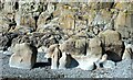
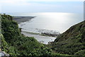
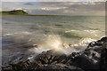
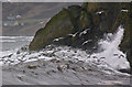
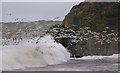
The above images may not be of the site on this page, they are loaded from Geograph.
Please Submit an Image of this site or go out and take one for us!
Click here to see more info for this site
Nearby sites
Key: Red: member's photo, Blue: 3rd party photo, Yellow: other image, Green: no photo - please go there and take one, Grey: site destroyed
Download sites to:
KML (Google Earth)
GPX (GPS waypoints)
CSV (Garmin/Navman)
CSV (Excel)
To unlock full downloads you need to sign up as a Contributory Member. Otherwise downloads are limited to 50 sites.
Turn off the page maps and other distractions
Nearby sites listing. In the following links * = Image available
70m N 358° Knock Rock Art (1)* Rock Art (NX36454012)
134m SE 125° Kirkmaiden Old Church* Ancient Cross (NX3655739968)
452m N 4° Knock Rock Art (4)* Rock Art (NX365405)
460m E 100° Knock 5* Carving (NX36903995)
661m SSE 149° Boden Walls Well Holy Well or Sacred Spring (NX36773947)
1.4km NE 34° Blairbuy 2* Rock Art (NX37284117)
1.4km NNE 25° Blairbuy 1* Rock Art (NX371413)
1.6km NNW 348° Milton Hill* Standing Stones (NX36174159)
2.0km NNW 348° Wren's Egg* Standing Stones (NX36104199)
2.0km N 8° Blairbuy 4 Rock Art (NX368420)
2.0km NNE 32° Blairbuy 5* Rock Art (NX37594175)
2.1km WNW 302° Barsalloch* Promontory Fort / Cliff Castle (NX3472041210)
2.1km NNE 27° Fell of Barhullion* Hillfort (NX37454188)
2.4km N 4° Blairbuy 6* Rock Art (NX36714243)
2.5km NNE 22° Blairbuy 3* Rock Art (NX37464233)
2.8km N 351° Black Loch of Myrton Settlement* Crannog (NX3610442835)
3.1km N 355° Lady Well (Monreith Mains) Holy Well or Sacred Spring (NX36314315)
3.3km NNW 347° White Loch of Myrton* Crannog (NX35854328)
4.2km N 358° Drumtroddan Stone Row* Stone Row / Alignment (NX36454430)
4.3km SE 128° Laggan Camp* Hillfort (NX3976437252)
4.7km N 356° Drumtroddan Cup and Ring Markings* Rock Art (NX36264474)
4.9km ESE 121° Glasserton Mains* Rock Art (NX40613737)
5.4km NE 41° White Loch. Crannog (NX40174404)
6.5km E 89° Rispain Camp* Ancient Village or Settlement (NX4293039930)
7.1km ESE 123° St Ninian's Cave (Isle of Whithorn)* Early Christian Sculptured Stone (NX42243595)
View more nearby sites and additional images


 We would like to know more about this location. Please feel free to add a brief description and any relevant information in your own language.
 Wir möchten mehr über diese Stätte erfahren. Bitte zögern Sie nicht, eine kurze Beschreibung und relevante Informationen in Deutsch hinzuzufügen.
 Nous aimerions en savoir encore un peu sur les lieux. S'il vous plaît n'hesitez pas à ajouter une courte description et tous les renseignements pertinents dans votre propre langue.
 Quisieramos informarnos un poco más de las lugares. No dude en añadir una breve descripción y otros datos relevantes en su propio idioma.