<< Our Photo Pages >> Presaddfed - Chambered Tomb in Wales in Anglesey
Submitted by TimPrevett on Monday, 09 December 2013 Page Views: 16974
Neolithic and Bronze AgeSite Name: PresaddfedCountry: Wales County: Anglesey Type: Chambered Tomb
Nearest Town: Holyhead Nearest Village: Bodedern
Map Ref: SH34768089 Landranger Map Number: 114
Latitude: 53.299120N Longitude: 4.480991W
Condition:
| 5 | Perfect |
| 4 | Almost Perfect |
| 3 | Reasonable but with some damage |
| 2 | Ruined but still recognisable as an ancient site |
| 1 | Pretty much destroyed, possibly visible as crop marks |
| 0 | No data. |
| -1 | Completely destroyed |
| 5 | Superb |
| 4 | Good |
| 3 | Ordinary |
| 2 | Not Good |
| 1 | Awful |
| 0 | No data. |
| 5 | Can be driven to, probably with disabled access |
| 4 | Short walk on a footpath |
| 3 | Requiring a bit more of a walk |
| 2 | A long walk |
| 1 | In the middle of nowhere, a nightmare to find |
| 0 | No data. |
| 5 | co-ordinates taken by GPS or official recorded co-ordinates |
| 4 | co-ordinates scaled from a detailed map |
| 3 | co-ordinates scaled from a bad map |
| 2 | co-ordinates of the nearest village |
| 1 | co-ordinates of the nearest town |
| 0 | no data |
Internal Links:
External Links:
I have visited· I would like to visit
stellajnr KieKa elad13 Couplands would like to visit
Alexlowtherharris visited on 13th Aug 2020 - their rating: Cond: 4 Amb: 3 Access: 4 maybe part of a complex of stones on the other side of the lake.
bishop_pam visited on 28th May 2019 - their rating: Cond: 5 Amb: 5 Access: 4
cactus_chris visited on 17th Jun 2018 - their rating: Cond: 5 Amb: 4 Access: 4
pickle1984 visited on 29th Mar 2012 - their rating: Cond: 3 Amb: 4 Access: 4 Awesome place to visit and the lambs are cute too
jeffrep visited on 7th May 2009 - their rating: Cond: 3 Amb: 3 Access: 4
Twistytwirly visited - their rating: Cond: 3 Amb: 4 Access: 4
coin visited - their rating: Cond: 4 Amb: 4 Access: 4
PAB DrewParsons guile TimPrevett have visited here
Average ratings for this site from all visit loggers: Condition: 3.86 Ambience: 3.86 Access: 4

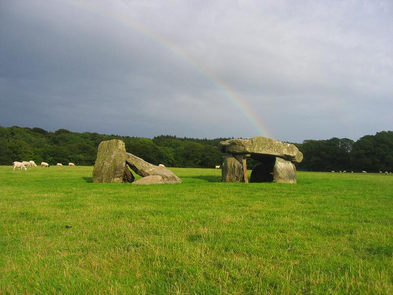
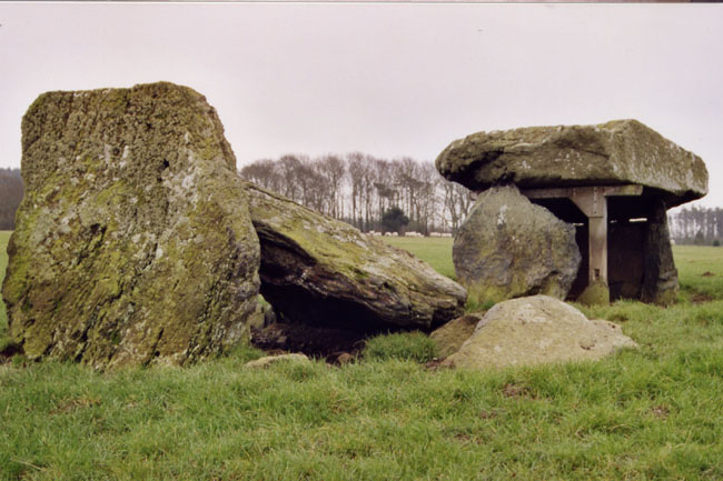
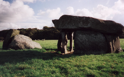
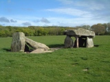
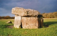
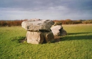
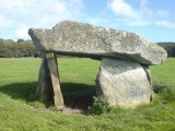
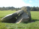
The southern chamber is still standing, but supported by a large wooden frame; it is obviously used as a sheep shelter, and we couldn't help speculating that one day the site could make some sheep puree!
Access: A short distance off the B5109, NEE of Bodedern. Good parking, with signposting for the location, good access, and entry to field through a kissing gate.
Note: Recent excavations led by Vicki Cummings and Colin Richards find a standing stone socket in the collapsed dolmen, meaning a stone probably stood there before the dolmen was built, see latest comment for more. See also news on their work at Garn Turne
You may be viewing yesterday's version of this page. To see the most up to date information please register for a free account.








These are just the first 25 photos of Presaddfed. If you log in with a free user account you will be able to see our entire collection.
Do not use the above information on other web sites or publications without permission of the contributor.
Click here to see more info for this site
Nearby sites
Key: Red: member's photo, Blue: 3rd party photo, Yellow: other image, Green: no photo - please go there and take one, Grey: site destroyed
Download sites to:
KML (Google Earth)
GPX (GPS waypoints)
CSV (Garmin/Navman)
CSV (Excel)
To unlock full downloads you need to sign up as a Contributory Member. Otherwise downloads are limited to 50 sites.
Turn off the page maps and other distractions
Nearby sites listing. In the following links * = Image available
2.4km NNW 341° Tre-Gwehelydd* Standing Stone (Menhir) (SH34068318)
3.0km W 274° Shop Farm* Standing Stone (Menhir) (SH3180581223)
3.2km NNE 27° New Church* Standing Stone (Menhir) (SH363837)
3.3km E 83° Maen Llechgynfarwy* Standing Stone (Menhir) (SH38108116)
4.3km NNE 16° Bedd Branwen* Ring Cairn (SH3611184978)
4.4km NNW 348° Llynnon Mill and Iron Age Settlement* Museum (SH340852)
5.3km NNE 21° Bod Deiniol* Standing Stone (Menhir) (SH3683285739)
5.5km ENE 65° Carmel Standing Stone* Standing Stone (Menhir) (SH39798304)
5.8km SSE 147° A55 Erratic* Natural Stone / Erratic / Other Natural Feature (SH3774475886)
6.0km SW 221° Llyn Cerrig Bach* Natural Stone / Erratic / Other Natural Feature (SH30607650)
6.1km NNW 331° Soar Stone* Standing Stone (Menhir) (SH3192286327)
6.4km S 171° Bodfeddan Inscribed Stone* Standing Stone (Menhir) (SH356745)
6.5km ENE 73° Mynydd Mwyn Mawr standing stones* Standing Stones (SH41058256)
6.9km NNE 24° St Pabo's Church Memorial Stone* Early Christian Sculptured Stone (SH378871)
7.0km S 181° Ty Newydd (Llanfaelog)* Chambered Tomb (SH34437387)
7.4km WSW 252° Ynys Leurad* Ancient Village or Settlement (SH2764978895)
8.0km W 275° Penrhos (Holyhead)* Standing Stone (Menhir) (SH26828183)
8.0km WSW 239° Bodior Standing Stone* Standing Stone (Menhir) (SH277770)
8.3km WSW 253° Trearddur standing stone* Standing Stone (Menhir) (SH267788)
8.4km W 263° Trearddur Dolmen* Burial Chamber or Dolmen (SH264802)
8.7km ENE 64° Bedd y Foel* Burial Chamber or Dolmen (SH42698444)
8.9km W 266° Trefignath* Chambered Tomb (SH25858056)
8.9km SE 128° Druid Farm* Standing Stones (SH416751)
9.0km SE 130° Graiglas* Round Barrow(s) (SH415749)
9.3km W 268° Ty Mawr (Nr Holyhead)* Standing Stone (Menhir) (SH2539480951)
View more nearby sites and additional images


 We would like to know more about this location. Please feel free to add a brief description and any relevant information in your own language.
 Wir möchten mehr über diese Stätte erfahren. Bitte zögern Sie nicht, eine kurze Beschreibung und relevante Informationen in Deutsch hinzuzufügen.
 Nous aimerions en savoir encore un peu sur les lieux. S'il vous plaît n'hesitez pas à ajouter une courte description et tous les renseignements pertinents dans votre propre langue.
 Quisieramos informarnos un poco más de las lugares. No dude en añadir una breve descripción y otros datos relevantes en su propio idioma.