<< Our Photo Pages >> Capel Tan-Y-Foel - Standing Stone (Menhir) in Wales in Gwynedd
Submitted by PhilipBurton on Monday, 01 February 2010 Page Views: 5265
Neolithic and Bronze AgeSite Name: Capel Tan-Y-FoelCountry: Wales County: Gwynedd Type: Standing Stone (Menhir)
Nearest Village: Rhiw
Map Ref: SH22612767
Latitude: 52.817303N Longitude: 4.633774W
Condition:
| 5 | Perfect |
| 4 | Almost Perfect |
| 3 | Reasonable but with some damage |
| 2 | Ruined but still recognisable as an ancient site |
| 1 | Pretty much destroyed, possibly visible as crop marks |
| 0 | No data. |
| -1 | Completely destroyed |
| 5 | Superb |
| 4 | Good |
| 3 | Ordinary |
| 2 | Not Good |
| 1 | Awful |
| 0 | No data. |
| 5 | Can be driven to, probably with disabled access |
| 4 | Short walk on a footpath |
| 3 | Requiring a bit more of a walk |
| 2 | A long walk |
| 1 | In the middle of nowhere, a nightmare to find |
| 0 | No data. |
| 5 | co-ordinates taken by GPS or official recorded co-ordinates |
| 4 | co-ordinates scaled from a detailed map |
| 3 | co-ordinates scaled from a bad map |
| 2 | co-ordinates of the nearest village |
| 1 | co-ordinates of the nearest town |
| 0 | no data |
Internal Links:
External Links:
I have visited· I would like to visit
bishop_pam visited on 7th Sep 2022 - their rating: Cond: 4 Amb: 3 Access: 4
PhilipBurton visited on 1st Sep 2011 - their rating: Cond: 4 Amb: 4 Access: 4 This 7ft high column of basalt stands on the parish boundary between Rhiw and Llanfaelrhys and is considered to be one of a pair of stones, the second of which can be seen lying in the bank below to the North. Sometimes called Lladron Maelrhys – Maelrhys’s Thieves – tradition says that the rogues stole money from the church and were turned to stone when they crossed the parish boundary. (Margaret Griffiths in Transactions of Caernarvon Hist. Soc. 1983). Locals will still tell you that the stones should be spoken to as you pass them.
Average ratings for this site from all visit loggers: Condition: 4 Ambience: 3.5 Access: 4
")
Sometimes called Lladron Maelrhys – Maelrhys’s Thieves – tradition says that the rogues stole money from the church and were turned to stone when they crossed the parish boundary. (Margaret Griffiths in Transactions of Caernarvon Hist. Soc. 1983). Locals will still tell you that the stones should be spoken to as you pass them.
Coflein says: "Standing stone upright in a field wall, a basalt monolith, 2.1m high and 0.45m in width."
You may be viewing yesterday's version of this page. To see the most up to date information please register for a free account.
")
")
Do not use the above information on other web sites or publications without permission of the contributor.
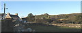
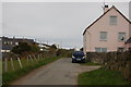
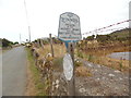
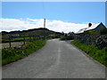
Nearby Images from Geograph Britain and Ireland:
©2007(licence)
©2012(licence)
©2018(licence)
©2009(licence)
©2007(licence)
The above images may not be of the site on this page, they are loaded from Geograph.
Please Submit an Image of this site or go out and take one for us!
Click here to see more info for this site
Nearby sites
Key: Red: member's photo, Blue: 3rd party photo, Yellow: other image, Green: no photo - please go there and take one, Grey: site destroyed
Download sites to:
KML (Google Earth)
GPX (GPS waypoints)
CSV (Garmin/Navman)
CSV (Excel)
To unlock full downloads you need to sign up as a Contributory Member. Otherwise downloads are limited to 50 sites.
Turn off the page maps and other distractions
Nearby sites listing. In the following links * = Image available
330m SE 143° Mynydd y Graig* Hillfort (SH228274)
575m SE 127° Tuhwnt-I'r-Mynyd Cairn (SH23062731)
732m NE 50° Bronheulog* Burial Chamber or Dolmen (SH23192812)
748m NNE 29° Rhiw fort* Ancient Village or Settlement (SH23002831)
1.1km NE 42° Ffynnon Aelrhiw* Holy Well or Sacred Spring (SH23382847)
1.6km NE 44° Tan-Y-Muriau* Chambered Cairn (SH23772877)
1.8km WSW 240° St Maelrhys’ Holy Well* Holy Well or Sacred Spring (SH21052683)
1.8km WSW 240° St Maelrhys’ Church, Llanfaelrhys* Holy Well or Sacred Spring (SH21002683)
1.8km NNW 328° Meillionydd double ringwork* Hillfort (SH21692924)
1.9km NNE 17° Mynydd Rhiw South* Cairn (SH23242949)
2.0km NNE 16° Mynydd Rhiw Cairn 1* Cairn (SH23262960)
2.1km NNE 16° Mynydd Rhiw Cairn 2* Cairn (SH23262962)
2.2km NNE 16° Mynydd Rhiw Cairn 3* Cairn (SH23302972)
2.4km NNE 17° Mynydd Rhiw Neolithic axe factory* Ancient Mine, Quarry or other Industry (SH23392991)
2.4km NE 39° Ffynnon Saint (Rhiw)* Holy Well or Sacred Spring (SH24202947)
2.4km NE 39° Tyn-y-parc Holy Well* Holy Well or Sacred Spring (SH242295)
2.7km N 11° Castell Caeron Hillfort (SH232303)
3.4km NE 47° Gelliwig Ancient Palace (SH252299)
3.4km WNW 289° Ffynnon Ffol Holy Well or Sacred Spring (SH19402891)
3.5km NNW 332° Maenhir Penygroeslon Standing Stone (Menhir) (SH21093079)
3.7km N 359° Ffynnon Fair (Gwynedd)* Holy Well or Sacred Spring (SH22663139)
4.0km W 278° Castell Odo* Hillfort (SH187284)
4.1km N 358° Cae Newydd Mynachdy Hillfort (SH22593178)
4.4km WSW 237° Carreg Gybi Standing Stones (SH18852540)
5.2km NNW 338° Llangwnnadl* Standing Stone (Menhir) (SH20843253)
View more nearby sites and additional images


 We would like to know more about this location. Please feel free to add a brief description and any relevant information in your own language.
 Wir möchten mehr über diese Stätte erfahren. Bitte zögern Sie nicht, eine kurze Beschreibung und relevante Informationen in Deutsch hinzuzufügen.
 Nous aimerions en savoir encore un peu sur les lieux. S'il vous plaît n'hesitez pas à ajouter une courte description et tous les renseignements pertinents dans votre propre langue.
 Quisieramos informarnos un poco más de las lugares. No dude en añadir una breve descripción y otros datos relevantes en su propio idioma.