


<< Our Photo Pages >> Meillionydd double ringwork - Hillfort in Wales in Gwynedd
Submitted by coldrum on Thursday, 13 July 2017 Page Views: 7992
Iron Age and Later PrehistorySite Name: Meillionydd double ringworkCountry: Wales County: Gwynedd Type: Hillfort
Nearest Town: Aberdaron Nearest Village: Rhoshirwaun
Map Ref: SH21692924
Latitude: 52.831098N Longitude: 4.648268W
Condition:
| 5 | Perfect |
| 4 | Almost Perfect |
| 3 | Reasonable but with some damage |
| 2 | Ruined but still recognisable as an ancient site |
| 1 | Pretty much destroyed, possibly visible as crop marks |
| 0 | No data. |
| -1 | Completely destroyed |
| 5 | Superb |
| 4 | Good |
| 3 | Ordinary |
| 2 | Not Good |
| 1 | Awful |
| 0 | No data. |
| 5 | Can be driven to, probably with disabled access |
| 4 | Short walk on a footpath |
| 3 | Requiring a bit more of a walk |
| 2 | A long walk |
| 1 | In the middle of nowhere, a nightmare to find |
| 0 | No data. |
| 5 | co-ordinates taken by GPS or official recorded co-ordinates |
| 4 | co-ordinates scaled from a detailed map |
| 3 | co-ordinates scaled from a bad map |
| 2 | co-ordinates of the nearest village |
| 1 | co-ordinates of the nearest town |
| 0 | no data |
Be the first person to rate this site - see the 'Contribute!' box in the right hand menu.
Internal Links:
External Links:
I have visited· I would like to visit
Andy B has visited here
")
The sites were occupied by several family groups but are likely to have been places where larger communities gathered seasonally, when specialised activities or events were carried out, such as artefact production, ceremony and feasting.
Despite their regional significance, very little is known about the chronology of these sites or the nature of their occupation.
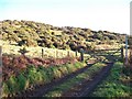
The preliminary excavations undertaken at Meillionydd in 2010 and 2011 (by K Waddington and R Karl, Bangor University) confirmed the presence of double concentric earth and stone banks which are accompanied by quarry hollows.
Within the enclosure there is evidence of a lengthy sequence of occupation which possibly spans most of the first millennium BC, indicated by multiple sequences of timber and stone roundhouses that were built on the same locations.
The successive overlapping roundhouses reveal that people developed strong attachments to certain places.
The complex processes which surrounded the abandonment of the final phase roundhouses suggests that closing the site was an important event, and one that was marked in specific ways by the occupants.
Official Web Site: meillionydd.bangor.ac.uk
You may be viewing yesterday's version of this page. To see the most up to date information please register for a free account.
")
Do not use the above information on other web sites or publications without permission of the contributor.
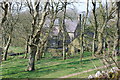
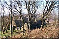
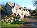
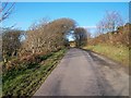
Nearby Images from Geograph Britain and Ireland:
©2007(licence)
©2010(licence)
©2010(licence)
©2010(licence)
©2010(licence)
The above images may not be of the site on this page, they are loaded from Geograph.
Please Submit an Image of this site or go out and take one for us!
Click here to see more info for this site
Nearby sites
Key: Red: member's photo, Blue: 3rd party photo, Yellow: other image, Green: no photo - please go there and take one, Grey: site destroyed
Download sites to:
KML (Google Earth)
GPX (GPS waypoints)
CSV (Garmin/Navman)
CSV (Excel)
To unlock full downloads you need to sign up as a Contributory Member. Otherwise downloads are limited to 50 sites.
Turn off the page maps and other distractions
Nearby sites listing. In the following links * = Image available
1.6km ENE 79° Mynydd Rhiw South* Cairn (SH23242949)
1.6km ESE 123° Rhiw fort* Ancient Village or Settlement (SH23002831)
1.6km ENE 75° Mynydd Rhiw Cairn 1* Cairn (SH23262960)
1.6km ENE 74° Mynydd Rhiw Cairn 2* Cairn (SH23262962)
1.7km NNW 337° Maenhir Penygroeslon Standing Stone (Menhir) (SH21093079)
1.7km ENE 71° Mynydd Rhiw Cairn 3* Cairn (SH23302972)
1.8km SSE 148° Capel Tan-Y-Foel* Standing Stone (Menhir) (SH22612767)
1.8km ENE 66° Mynydd Rhiw Neolithic axe factory* Ancient Mine, Quarry or other Industry (SH23392991)
1.8km NE 53° Castell Caeron Hillfort (SH232303)
1.9km ESE 112° Ffynnon Aelrhiw* Holy Well or Sacred Spring (SH23382847)
1.9km SE 125° Bronheulog* Burial Chamber or Dolmen (SH23192812)
2.1km E 101° Tan-Y-Muriau* Chambered Cairn (SH23772877)
2.1km SSE 147° Mynydd y Graig* Hillfort (SH228274)
2.3km W 260° Ffynnon Ffol Holy Well or Sacred Spring (SH19402891)
2.4km NNE 22° Ffynnon Fair (Gwynedd)* Holy Well or Sacred Spring (SH22663139)
2.4km SE 143° Tuhwnt-I'r-Mynyd Cairn (SH23062731)
2.5km SSW 193° St Maelrhys’ Holy Well* Holy Well or Sacred Spring (SH21052683)
2.5km SSW 194° St Maelrhys’ Church, Llanfaelrhys* Holy Well or Sacred Spring (SH21002683)
2.5km E 83° Ffynnon Saint (Rhiw)* Holy Well or Sacred Spring (SH24202947)
2.5km E 82° Tyn-y-parc Holy Well* Holy Well or Sacred Spring (SH242295)
2.7km NNE 17° Cae Newydd Mynachdy Hillfort (SH22593178)
3.1km WSW 252° Castell Odo* Hillfort (SH187284)
3.4km NNW 343° Llangwnnadl* Standing Stone (Menhir) (SH20843253)
3.6km ENE 77° Gelliwig Ancient Palace (SH252299)
4.1km NNW 346° St Gwynhoedl’s Church and Grave* Ancient Cross (SH20883323)
View more nearby sites and additional images


 We would like to know more about this location. Please feel free to add a brief description and any relevant information in your own language.
 Wir möchten mehr über diese Stätte erfahren. Bitte zögern Sie nicht, eine kurze Beschreibung und relevante Informationen in Deutsch hinzuzufügen.
 Nous aimerions en savoir encore un peu sur les lieux. S'il vous plaît n'hesitez pas à ajouter une courte description et tous les renseignements pertinents dans votre propre langue.
 Quisieramos informarnos un poco más de las lugares. No dude en añadir una breve descripción y otros datos relevantes en su propio idioma.