


<< Our Photo Pages >> Watergate Stone - Standing Stone (Menhir) in England in Cornwall
Submitted by markj99 on Thursday, 25 March 2021 Page Views: 619
Date UncertainSite Name: Watergate StoneCountry: England
NOTE: This site is 1.4 km away from the location you searched for.
County: Cornwall Type: Standing Stone (Menhir)
Nearest Town: Looe
Map Ref: SX23455436
Latitude: 50.362598N Longitude: 4.483617W
Condition:
| 5 | Perfect |
| 4 | Almost Perfect |
| 3 | Reasonable but with some damage |
| 2 | Ruined but still recognisable as an ancient site |
| 1 | Pretty much destroyed, possibly visible as crop marks |
| 0 | No data. |
| -1 | Completely destroyed |
| 5 | Superb |
| 4 | Good |
| 3 | Ordinary |
| 2 | Not Good |
| 1 | Awful |
| 0 | No data. |
| 5 | Can be driven to, probably with disabled access |
| 4 | Short walk on a footpath |
| 3 | Requiring a bit more of a walk |
| 2 | A long walk |
| 1 | In the middle of nowhere, a nightmare to find |
| 0 | No data. |
| 5 | co-ordinates taken by GPS or official recorded co-ordinates |
| 4 | co-ordinates scaled from a detailed map |
| 3 | co-ordinates scaled from a bad map |
| 2 | co-ordinates of the nearest village |
| 1 | co-ordinates of the nearest town |
| 0 | no data |
Internal Links:
External Links:
")
Watergate Stone is a recumbent stone which lies 1 mile WNW of Looe. It measures c. 6 feet long, tapering from c. 2.5 feet wide at the base to 1.5 feet wide at the top. There is a 30 degree angle on the base indicating a possible fracture plane. There are no other large stones close to Watergate Stone and no field clearance stones nearby. It would appear to be a broken Standing Stone or Boundary Marker.
You may be viewing yesterday's version of this page. To see the most up to date information please register for a free account.
")
")
Do not use the above information on other web sites or publications without permission of the contributor.
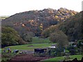
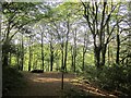
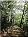
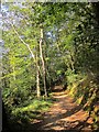
Nearby Images from Geograph Britain and Ireland:
©2007(licence)
©2014(licence)
©2014(licence)

©2014(licence)
©2014(licence)
The above images may not be of the site on this page, they are loaded from Geograph.
Please Submit an Image of this site or go out and take one for us!
Click here to see more info for this site
Nearby sites
Key: Red: member's photo, Blue: 3rd party photo, Yellow: other image, Green: no photo - please go there and take one, Grey: site destroyed
Download sites to:
KML (Google Earth)
GPX (GPS waypoints)
CSV (Garmin/Navman)
CSV (Excel)
To unlock full downloads you need to sign up as a Contributory Member. Otherwise downloads are limited to 50 sites.
Turn off the page maps and other distractions
Nearby sites listing. In the following links * = Image available
1.9km NNW 326° Yearle’s Fort Hillfort (SX2246555953)
1.9km SE 140° Portlooe Cross* Ancient Cross (SX24625289)
2.3km NNW 331° St Non's Well (Cornwall)* Holy Well or Sacred Spring (SX224564)
2.3km WNW 297° Hall Rings Hillfort (SX214555)
2.3km ESE 112° St Mary's Well (Cornwall)* Holy Well or Sacred Spring (SX256534)
2.5km SSE 166° Hendersick Barrow* Round Barrow(s) (SX23965196)
2.7km E 88° Barrow near Looe Barrow Cemetery (SX2611054356)
3.1km SE 128° St Martin's Well (Shutta) Holy Well or Sacred Spring (SX258524)
3.1km W 280° Holy Well in Pelynt Holy Well or Sacred Spring (SX204550)
3.4km W 269° Pelynt Barrow Cemetery* Barrow Cemetery (SX200544)
3.7km N 8° St Cuby's Well (Duloe)* Holy Well or Sacred Spring (SX24085796)
3.7km N 359° St Cuby's Church Iron Age Fort* Hillfort (SX23485809)
3.9km SW 233° Polperro (Kellow) Standing Stone* Standing Stone (Menhir) (SX20275216)
4.0km N 360° Duloe* Stone Circle (SX23585831)
4.5km SW 221° St Peter's Holy Well (Cornwall)* Holy Well or Sacred Spring (SX20395105)
4.8km W 275° Bake rings* Ancient Village or Settlement (SX187549)
5.4km NE 48° Bin Down (East Looe)* Ancient Village or Settlement (SX2764957830)
6.1km N 11° St Keyne's Well* Holy Well or Sacred Spring (SX248603)
6.8km NW 315° Bury Camp (Cornwall)* Hillfort (SX188594)
10.0km NW 322° Middle Taphouse Round Barrow (B)* Round Barrow(s) (SX175624)
10.2km N 8° Pipe Well* Holy Well or Sacred Spring (SX252644)
10.3km WSW 249° Polruan Standing Stones* Standing Stones (SX137510)
10.4km NE 48° Padderbury Top Ancient Village or Settlement (SX3139661023)
10.7km NW 323° Middle Taphouse Round Barrow (A)* Round Barrow(s) (SX172631)
11.3km WSW 249° Lanteglos-by-Fowey Church Crosses Ancient Cross (SX12755074)
View more nearby sites and additional images


 We would like to know more about this location. Please feel free to add a brief description and any relevant information in your own language.
 Wir möchten mehr über diese Stätte erfahren. Bitte zögern Sie nicht, eine kurze Beschreibung und relevante Informationen in Deutsch hinzuzufügen.
 Nous aimerions en savoir encore un peu sur les lieux. S'il vous plaît n'hesitez pas à ajouter une courte description et tous les renseignements pertinents dans votre propre langue.
 Quisieramos informarnos un poco más de las lugares. No dude en añadir una breve descripción y otros datos relevantes en su propio idioma.