

<< Our Photo Pages >> Miltonise North Cairn - Cairn in Scotland in Dumfries and Galloway
Submitted by markj99 on Sunday, 15 March 2020 Page Views: 775
Neolithic and Bronze AgeSite Name: Miltonise North CairnCountry: Scotland County: Dumfries and Galloway Type: Cairn
Nearest Town: Stranraer Nearest Village: New Luce
Map Ref: NX19257405
Latitude: 55.028031N Longitude: 4.829424W
Condition:
| 5 | Perfect |
| 4 | Almost Perfect |
| 3 | Reasonable but with some damage |
| 2 | Ruined but still recognisable as an ancient site |
| 1 | Pretty much destroyed, possibly visible as crop marks |
| 0 | No data. |
| -1 | Completely destroyed |
| 5 | Superb |
| 4 | Good |
| 3 | Ordinary |
| 2 | Not Good |
| 1 | Awful |
| 0 | No data. |
| 5 | Can be driven to, probably with disabled access |
| 4 | Short walk on a footpath |
| 3 | Requiring a bit more of a walk |
| 2 | A long walk |
| 1 | In the middle of nowhere, a nightmare to find |
| 0 | No data. |
| 5 | co-ordinates taken by GPS or official recorded co-ordinates |
| 4 | co-ordinates scaled from a detailed map |
| 3 | co-ordinates scaled from a bad map |
| 2 | co-ordinates of the nearest village |
| 1 | co-ordinates of the nearest town |
| 0 | no data |
Internal Links:
External Links:
")
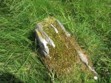
Miltonise North cairn lies 30m E of the Stranraer to Girvan railway line 650m NNE of Miltonise farm (as noted in Canmore ID 61803).
It is a robbed out cairn, approximately 10m across with an off-centre kist exposed. The kist is a 0.5m square, approximately 0.5m deep with two stone slabs remaining in situ. A third potential stone slab lies within 1m of the kist.
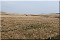
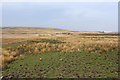
A small scattering of buried stones remain on the grass covered cairn, which stands out as a green spot surrounded by brown moorland.
In this rough moorland the cairn is almost invisible until one is standing over it.
Canmore ID 61803 also notes that a second cairn 5m in diameter, covered in peat lies 10m S of this cairn however I was unable to locate this feature.
Canmore ID 61853 describes Miltonise South cairn, which is positioned approximately 400m S. Again, it is a turfed over cairn, around 6m in diameter. I was unable to investigate this due to the proximity of beef cattle in the area.
You may be viewing yesterday's version of this page. To see the most up to date information please register for a free account.
")
")
Do not use the above information on other web sites or publications without permission of the contributor.
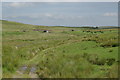
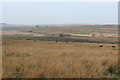
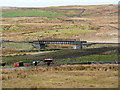
Nearby Images from Geograph Britain and Ireland:
©2008(licence)
©2014(licence)
©2013(licence)
©2014(licence)
©2014(licence)
The above images may not be of the site on this page, they are loaded from Geograph.
Please Submit an Image of this site or go out and take one for us!
Click here to see more info for this site
Nearby sites
Key: Red: member's photo, Blue: 3rd party photo, Yellow: other image, Green: no photo - please go there and take one, Grey: site destroyed
Download sites to:
KML (Google Earth)
GPX (GPS waypoints)
CSV (Garmin/Navman)
CSV (Excel)
To unlock full downloads you need to sign up as a Contributory Member. Otherwise downloads are limited to 50 sites.
Turn off the page maps and other distractions
Nearby sites listing. In the following links * = Image available
71m SW 223° Miltonish Stone Circle (NX192740)
1.7km WNW 297° Markdhu White Cairn* Cairn (NX17807486)
2.1km WNW 302° Cairn Kenny* Passage Grave (NX17467525)
3.8km SE 126° Laggangarn* Standing Stones (NX22237166)
4.1km ESE 113° Wells of the Rees* Holy Well or Sacred Spring (NX22977232)
4.6km NNW 335° Arecleoch Chambered Cairn Chambered Cairn (NX175783)
4.8km SSW 194° Craigbirnoch NW Cairn* Cairn (NX17946944)
4.8km SSW 192° Craigbirnoch NE Cairn* Cairn (NX18026940)
5.1km SSW 196° Craigbirnoch Central NW Cairn* Cairn (NX17656925)
5.1km SSW 195° Craigbirnoch Central SE Cairn* Cairn (NX17706920)
5.3km NNW 347° Cave Cairn (Chirmorrie)* Chambered Cairn (NX18317924)
5.4km SSW 193° Craigbirnoch S Cairn* Cairn (NX17806884)
5.9km NE 37° Laggish White Cairn* Cairn (NX22987860)
6.3km WSW 248° Grey Hill (Shennas)* Cairn (NX13307198)
6.3km WSW 255° Laganbeastie East* Cairn (NX13057271)
6.4km WSW 256° Laganabeastie West* Cairn (NX13007271)
6.6km SSW 205° Altigoukie Burn Cairn* Cairn (NX16266817)
6.6km SSW 211° Kilfeddar Farm* Cairn (NX15626852)
6.6km SSW 204° Altigoukie Burn Burnt Mound* Misc. Earthwork (NX16336811)
6.9km SSE 161° Cairn na Gath* Cairn (NX21266741)
7.4km SSW 195° Barlure* Cairn (NX17036693)
7.6km W 269° Drummanmoan Loan* Cairn (NX11667427)
7.8km SSW 211° Cairnerzean Farm NE* Cairn (NX14996748)
7.8km SSW 211° Cairnerzean Farm SW* Cairn (NX14986747)
8.3km NNW 348° Arecleoch Standing Stone* Standing Stone (Menhir) (NX178822)
View more nearby sites and additional images


 We would like to know more about this location. Please feel free to add a brief description and any relevant information in your own language.
 Wir möchten mehr über diese Stätte erfahren. Bitte zögern Sie nicht, eine kurze Beschreibung und relevante Informationen in Deutsch hinzuzufügen.
 Nous aimerions en savoir encore un peu sur les lieux. S'il vous plaît n'hesitez pas à ajouter une courte description et tous les renseignements pertinents dans votre propre langue.
 Quisieramos informarnos un poco más de las lugares. No dude en añadir una breve descripción y otros datos relevantes en su propio idioma.