<< Text Pages >> Carn Ingli Settlement South - Ancient Village or Settlement in Wales in Pembrokeshire
Submitted by coldrum on Friday, 17 July 2009 Page Views: 3302
Multi-periodSite Name: Carn Ingli Settlement SouthCountry: Wales County: Pembrokeshire Type: Ancient Village or Settlement
Map Ref: SN0621237014
Latitude: 51.997663N Longitude: 4.824274W
Condition:
| 5 | Perfect |
| 4 | Almost Perfect |
| 3 | Reasonable but with some damage |
| 2 | Ruined but still recognisable as an ancient site |
| 1 | Pretty much destroyed, possibly visible as crop marks |
| 0 | No data. |
| -1 | Completely destroyed |
| 5 | Superb |
| 4 | Good |
| 3 | Ordinary |
| 2 | Not Good |
| 1 | Awful |
| 0 | No data. |
| 5 | Can be driven to, probably with disabled access |
| 4 | Short walk on a footpath |
| 3 | Requiring a bit more of a walk |
| 2 | A long walk |
| 1 | In the middle of nowhere, a nightmare to find |
| 0 | No data. |
| 5 | co-ordinates taken by GPS or official recorded co-ordinates |
| 4 | co-ordinates scaled from a detailed map |
| 3 | co-ordinates scaled from a bad map |
| 2 | co-ordinates of the nearest village |
| 1 | co-ordinates of the nearest town |
| 0 | no data |
Be the first person to rate this site - see the 'Contribute!' box in the right hand menu.
Internal Links:
External Links:
Ancient Village or Settlement in Pembrokeshire (Sir Benfro)
This is a 6.0m diameter stone-walled structure, possibly a roundhouse, adjoined by a rectangular structure, 4.0m by 2.0m.
https://www.coflein.gov.uk/en/site/304319
You may be viewing yesterday's version of this page. To see the most up to date information please register for a free account.
Do not use the above information on other web sites or publications without permission of the contributor.
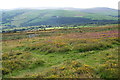
Nearby Images from Geograph Britain and Ireland:
©2007(licence)
©2021(licence)
©2011(licence)
©2011(licence)
©2011(licence)
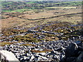
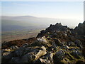
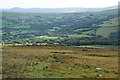
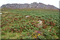
The above images may not be of the site on this page, they are loaded from Geograph.
Please Submit an Image of this site or go out and take one for us!
Click here to see more info for this site
Nearby sites
Key: Red: member's photo, Blue: 3rd party photo, Yellow: other image, Green: no photo - please go there and take one, Grey: site destroyed
Download sites to:
KML (Google Earth)
GPX (GPS waypoints)
CSV (Garmin/Navman)
CSV (Excel)
To unlock full downloads you need to sign up as a Contributory Member. Otherwise downloads are limited to 50 sites.
Turn off the page maps and other distractions
Nearby sites listing. In the following links * = Image available
254m NNE 13° Carn Ingli Mountain Fort* Hillfort (SN0627737260)
539m SW 231° Dol-Rhang-Isaf Cairn Cairn (SN05783669)
578m W 273° Carn Briw* Cairn (SN0563537067)
592m N 6° Mynydd Carn Ingli* Standing Stone (Menhir) (SN063376)
592m N 6° Carn Ingli Barrows Round Barrow(s) (SN063376)
741m WSW 251° Carn Edward Ancient Village or Settlement (SN055368)
790m N 4° Carn Ingli Mountain Neolithic Settlement Ancient Village or Settlement (SN063378)
790m N 4° Carn Ingli Settlement Hillfort (SN063378)
817m N 352° Crn Llwyd Stone* Standing Stone (Menhir) (SN0613537828)
817m W 260° Carn Llwyd* Ancient Village or Settlement (SN054369)
928m W 279° Carn Ingli Mountain IA Settlement Ancient Village or Settlement (SN053372)
962m WSW 249° Carn Ingli Kerb Cairn Cairn (SN053367)
1.2km N 359° Carn Llwyd Open Settlement Ancient Village or Settlement (SN0623038205)
1.3km NE 43° Brithdir Mawr stone circle* Modern Stone Circle etc (SN071379)
1.4km WNW 288° Waun Fawr Ancient Village or Settlement (SN049375)
1.6km NE 52° Brithdir Mawr Barrow* Modern Stone Circle etc (SN0753137967)
1.6km SSE 152° Trefach Enclosure Hillfort (SN06923555)
1.7km WNW 300° Carn Ffoi* Hillfort (SN048379)
1.7km WSW 242° Gochel Sythi Standing Stone (Menhir) (SN047363)
1.9km S 172° Trefach* Standing Stone (Menhir) (SN064351)
1.9km NNW 345° Inscribed cross stones St. Mary's church* Early Christian Sculptured Stone (SN058389)
2.1km WSW 253° Mynydd Caregog Ancient Village or Settlement (SN042365)
2.1km NNW 347° Golden Lion stone* Standing Stone (Menhir) (SN058391)
2.3km N 353° Carreg Coetan Arthur* Burial Chamber or Dolmen (SN06033935)
2.4km SSE 166° Carn Wrach Cairn (SN067347)
View more nearby sites and additional images


 We would like to know more about this location. Please feel free to add a brief description and any relevant information in your own language.
 Wir möchten mehr über diese Stätte erfahren. Bitte zögern Sie nicht, eine kurze Beschreibung und relevante Informationen in Deutsch hinzuzufügen.
 Nous aimerions en savoir encore un peu sur les lieux. S'il vous plaît n'hesitez pas à ajouter une courte description et tous les renseignements pertinents dans votre propre langue.
 Quisieramos informarnos un poco más de las lugares. No dude en añadir una breve descripción y otros datos relevantes en su propio idioma.