

<< Text Pages >> Carn Wrach - Cairn in Wales in Pembrokeshire
Submitted by coldrum on Wednesday, 08 July 2009 Page Views: 2652
Neolithic and Bronze AgeSite Name: Carn WrachCountry: Wales County: Pembrokeshire Type: Cairn
Map Ref: SN067347
Latitude: 51.977053N Longitude: 4.81587W
Condition:
| 5 | Perfect |
| 4 | Almost Perfect |
| 3 | Reasonable but with some damage |
| 2 | Ruined but still recognisable as an ancient site |
| 1 | Pretty much destroyed, possibly visible as crop marks |
| 0 | No data. |
| -1 | Completely destroyed |
| 5 | Superb |
| 4 | Good |
| 3 | Ordinary |
| 2 | Not Good |
| 1 | Awful |
| 0 | No data. |
| 5 | Can be driven to, probably with disabled access |
| 4 | Short walk on a footpath |
| 3 | Requiring a bit more of a walk |
| 2 | A long walk |
| 1 | In the middle of nowhere, a nightmare to find |
| 0 | No data. |
| 5 | co-ordinates taken by GPS or official recorded co-ordinates |
| 4 | co-ordinates scaled from a detailed map |
| 3 | co-ordinates scaled from a bad map |
| 2 | co-ordinates of the nearest village |
| 1 | co-ordinates of the nearest town |
| 0 | no data |
Be the first person to rate this site - see the 'Contribute!' box in the right hand menu.
Internal Links:
External Links:
Cairn in Pembrokeshire (Sir Benfro)
Bronze Age cairn.
Coflein record:
https://www.coflein.gov.uk/en/site/401673
You may be viewing yesterday's version of this page. To see the most up to date information please register for a free account.
Do not use the above information on other web sites or publications without permission of the contributor.
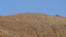
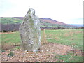
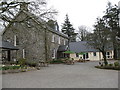
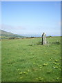
Nearby Images from Geograph Britain and Ireland:
©2006(licence)
©2007(licence)
©2011(licence)
©2008(licence)
©2008(licence)
The above images may not be of the site on this page, they are loaded from Geograph.
Please Submit an Image of this site or go out and take one for us!
Click here to see more info for this site
Nearby sites
Key: Red: member's photo, Blue: 3rd party photo, Yellow: other image, Green: no photo - please go there and take one, Grey: site destroyed
Download sites to:
KML (Google Earth)
GPX (GPS waypoints)
CSV (Garmin/Navman)
CSV (Excel)
To unlock full downloads you need to sign up as a Contributory Member. Otherwise downloads are limited to 50 sites.
Turn off the page maps and other distractions
Nearby sites listing. In the following links * = Image available
499m NW 321° Trefach* Standing Stone (Menhir) (SN064351)
582m WSW 237° Banc Du (Pembs)* Standing Stone (Menhir) (SN062344)
877m NNE 12° Trefach Enclosure Hillfort (SN06923555)
1.4km W 260° Tregynon Ancient Village or Settlement (SN053345)
1.5km ESE 118° Waun Mawn W* Standing Stone (Menhir) (SN08033394)
1.7km ESE 123° Tafarn-y-Bwlch* Standing Stones (SN08133370)
1.8km ESE 109° Waun Mawn NE* Standing Stones (SN08353405)
2.2km NNW 333° Dol-Rhang-Isaf Cairn Cairn (SN05783669)
2.3km ENE 61° Troed y rhiw Stone Row / Alignment (SN0879235756)
2.4km NNW 346° Carn Ingli Settlement South Ancient Village or Settlement (SN0621237014)
2.4km S 178° Cerrig Lladron Stones* Stone Row / Alignment (SN067323)
2.4km NNW 328° Carn Edward Ancient Village or Settlement (SN055368)
2.4km S 174° Foel Eryr rock outcrop Rock Outcrop (SN06883227)
2.4km NW 323° Carn Ingli Kerb Cairn Cairn (SN053367)
2.5km ENE 70° The Penlan Stone* Standing Stone (Menhir) (SN09053545)
2.5km ENE 63° Penlan Stone Pair* Standing Stones (SN09033575)
2.6km NNW 327° Carn Llwyd* Ancient Village or Settlement (SN054369)
2.6km NW 307° Gochel Sythi Standing Stone (Menhir) (SN047363)
2.6km NNW 334° Carn Briw* Cairn (SN0563537067)
2.6km NNW 348° Carn Ingli Mountain Fort* Hillfort (SN0627737260)
2.6km S 180° Foel Eryr Cairn* Cairn (SN06583208)
2.6km ENE 66° St Brynach's Well Holy Well or Sacred Spring (SN09173568)
2.8km S 174° Foel Eryr enclosure* Ancient Village or Settlement (SN069319)
2.8km W 262° Castell Pengegin Hillfort (SN039344)
2.9km NNW 329° Carn Ingli Mountain IA Settlement Ancient Village or Settlement (SN053372)
View more nearby sites and additional images


 We would like to know more about this location. Please feel free to add a brief description and any relevant information in your own language.
 Wir möchten mehr über diese Stätte erfahren. Bitte zögern Sie nicht, eine kurze Beschreibung und relevante Informationen in Deutsch hinzuzufügen.
 Nous aimerions en savoir encore un peu sur les lieux. S'il vous plaît n'hesitez pas à ajouter une courte description et tous les renseignements pertinents dans votre propre langue.
 Quisieramos informarnos un poco más de las lugares. No dude en añadir una breve descripción y otros datos relevantes en su propio idioma.