


<< Our Photo Pages >> Achnagoul 1 - Chambered Cairn in Scotland in Argyll
Submitted by vicky on Sunday, 21 July 2002 Page Views: 5812
Neolithic and Bronze AgeSite Name: Achnagoul 1Country: Scotland County: Argyll Type: Chambered Cairn
Nearest Town: Inverary
Map Ref: NN061056 Landranger Map Number: 56
Latitude: 56.203377N Longitude: 5.127496W
Condition:
| 5 | Perfect |
| 4 | Almost Perfect |
| 3 | Reasonable but with some damage |
| 2 | Ruined but still recognisable as an ancient site |
| 1 | Pretty much destroyed, possibly visible as crop marks |
| 0 | No data. |
| -1 | Completely destroyed |
| 5 | Superb |
| 4 | Good |
| 3 | Ordinary |
| 2 | Not Good |
| 1 | Awful |
| 0 | No data. |
| 5 | Can be driven to, probably with disabled access |
| 4 | Short walk on a footpath |
| 3 | Requiring a bit more of a walk |
| 2 | A long walk |
| 1 | In the middle of nowhere, a nightmare to find |
| 0 | No data. |
| 5 | co-ordinates taken by GPS or official recorded co-ordinates |
| 4 | co-ordinates scaled from a detailed map |
| 3 | co-ordinates scaled from a bad map |
| 2 | co-ordinates of the nearest village |
| 1 | co-ordinates of the nearest town |
| 0 | no data |
Internal Links:
External Links:
")
The remains of this Clyde type chambered cairn are about 45metres long by 11metres wide but it has been truncated around the edges by ploughing. It is situated on farmland at about 120 metres above sea level.
Access is along the track to Achagoul farm from the A831 (ask permission), then up the hill towards the woods.
Achnagoul 2 is in the woods & can be reached (with difficulty) from the track behind the gate.
You may be viewing yesterday's version of this page. To see the most up to date information please register for a free account.
")
")
")
Do not use the above information on other web sites or publications without permission of the contributor.
Nearby Images from Geograph Britain and Ireland:
©2022(licence)
©2009(licence)
©2007(licence)

©2025(licence)
©2010(licence)
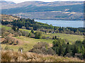
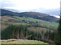
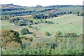
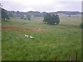
The above images may not be of the site on this page, they are loaded from Geograph.
Please Submit an Image of this site or go out and take one for us!
Click here to see more info for this site
Nearby sites
Key: Red: member's photo, Blue: 3rd party photo, Yellow: other image, Green: no photo - please go there and take one, Grey: site destroyed
Download sites to:
KML (Google Earth)
GPX (GPS waypoints)
CSV (Garmin/Navman)
CSV (Excel)
To unlock full downloads you need to sign up as a Contributory Member. Otherwise downloads are limited to 50 sites.
Turn off the page maps and other distractions
Nearby sites listing. In the following links * = Image available
223m NNE 24° Achnagoul 2* Chambered Cairn (NN062058)
697m SSW 201° Barmore Wood Chambered Cairn (NN05820496)
3.1km SW 235° Creag Mhor Chambered Cairn (NN03450395)
3.2km SW 223° Auchindrain Cairn (NN03790337)
4.8km NE 42° Inveraray Castle* Standing Stone (Menhir) (NN0946809048)
9.4km NNE 13° Drimfern Chambered Cairn (NN086147)
9.8km NW 314° Ardchonnell* Chambered Cairn (NM99321275)
9.9km ENE 73° Ardno* Cairn (NN15680808)
10.5km NW 306° Innis Chonnel Crannog* Crannog (NM97841220)
10.6km S 173° Kilmartin Timber Circle Timber Circle (NS070950)
11.0km SW 219° Fairy Knowe Argyll Cairn (NR98749736)
11.2km SW 219° Crarae* Chambered Cairn (NR9859097283)
11.4km NE 39° Dron Rocking Stone* Rock Art (NN137141)
11.6km SSW 203° Kilmorie Cross* Ancient Cross (NS0108595167)
11.7km SSW 203° Tobar Cill Moire* Holy Well or Sacred Spring (NS0106295054)
12.4km SSW 204° Cnoc Mor (Garbhallt) Standing Stone (Menhir) (NS005945)
12.5km W 277° Rubna na Fidhle* Class III Pictish Cross Slab (NM9377607789)
13.5km SW 216° Brainport Bay Standing stones and Alignment* Standing Stone (Menhir) (NR9759595075)
13.5km NNW 331° Carn Dubh, Crannog (Loch Awe)* Crannog (NN00131775)
13.7km SW 219° Barr (Minard) Rock Art (NR96899535)
15.0km NNW 342° Rubha Barr Challtuinn* Cairn (NN021201)
15.0km N 353° Port Sonachan* Chambered Cairn (NN050206)
15.9km NNW 344° Auchachenna* Chambered Cairn (NN02372106)
17.1km W 266° Inverliever Cairn (NM889052)
17.1km N 11° Cladich* Chambered Cairn (NN101223)
View more nearby sites and additional images


 We would like to know more about this location. Please feel free to add a brief description and any relevant information in your own language.
 Wir möchten mehr über diese Stätte erfahren. Bitte zögern Sie nicht, eine kurze Beschreibung und relevante Informationen in Deutsch hinzuzufügen.
 Nous aimerions en savoir encore un peu sur les lieux. S'il vous plaît n'hesitez pas à ajouter une courte description et tous les renseignements pertinents dans votre propre langue.
 Quisieramos informarnos un poco más de las lugares. No dude en añadir una breve descripción y otros datos relevantes en su propio idioma.