<< Our Photo Pages >> Clach-a-charra - Standing Stone (Menhir) in Scotland in Highlands
Submitted by Nick on Sunday, 14 December 2003 Page Views: 15807
Neolithic and Bronze AgeSite Name: Clach-a-charra Alternative Name: Clach a' Charra; Stone of Vengeance; Stone of CharraCountry: Scotland County: Highlands Type: Standing Stone (Menhir)
Nearest Town: Ballachulish Nearest Village: Onich
Map Ref: NN02566134 Landranger Map Number: 41
Latitude: 56.701907N Longitude: 5.226613W
Condition:
| 5 | Perfect |
| 4 | Almost Perfect |
| 3 | Reasonable but with some damage |
| 2 | Ruined but still recognisable as an ancient site |
| 1 | Pretty much destroyed, possibly visible as crop marks |
| 0 | No data. |
| -1 | Completely destroyed |
| 5 | Superb |
| 4 | Good |
| 3 | Ordinary |
| 2 | Not Good |
| 1 | Awful |
| 0 | No data. |
| 5 | Can be driven to, probably with disabled access |
| 4 | Short walk on a footpath |
| 3 | Requiring a bit more of a walk |
| 2 | A long walk |
| 1 | In the middle of nowhere, a nightmare to find |
| 0 | No data. |
| 5 | co-ordinates taken by GPS or official recorded co-ordinates |
| 4 | co-ordinates scaled from a detailed map |
| 3 | co-ordinates scaled from a bad map |
| 2 | co-ordinates of the nearest village |
| 1 | co-ordinates of the nearest town |
| 0 | no data |
Internal Links:
External Links:
I have visited· I would like to visit
Choopsie would like to visit
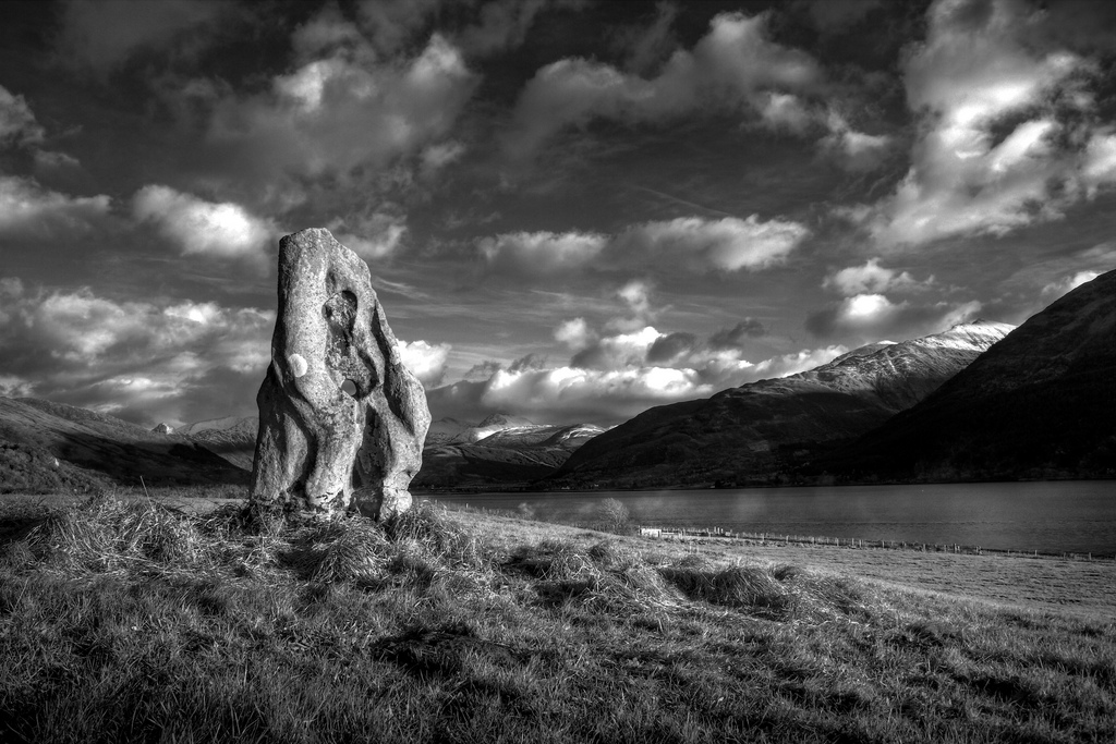
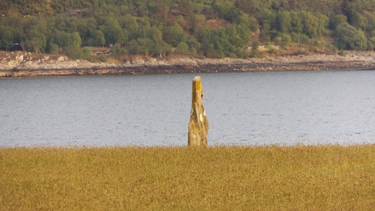
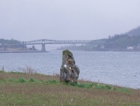
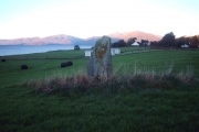
I visited this one on Saturday 18th October just around sunrise. It lies just south of the busy A82 Oban to Fort William road, and parking can be a bit awkward. Head for Oak Cottage, beside the field with the stone in it, as the field belongs to the owner. A lovely lady, originally from Aberdeenshire but who married a local Cameron man. She told me that the stone had been broken many years ago by a horse using it as a rubbing post, but that her husband's grandfather enlisted the help of a local stone mason to pin and re-erect it.
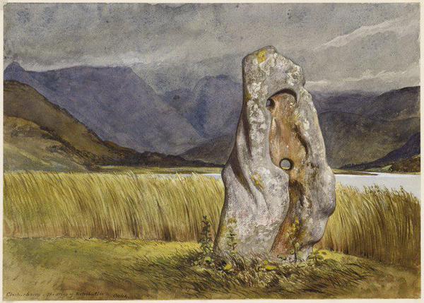
Permission to visit will readily be granted provided the field is not in crop or being used for livestock. She showed me a marvellous photo she was given by a previous visitor, with the stone framed by a rainbow. It's a real beauty, and one of the few surviving holed stones. According to folklore, it is traditionally associated with the slaughter of the two sons of Cummin of Inverlochy, in revenge for wrongs perpetrated on the bride of one of his clansmen.
< Important update since the visit of Nick in 2003:
May 2015. The ever increasing number of visitors is now perceived as a nuisance by the landlady ; in particular those who enter her property without even asking. The landlady explictly told me that she granted me access to her field "just because I had asked for it". If it may help her, I have uploaded a photo in full definition on Wikipedia Commons : Stone_of_Vengeance
Update January 2019: This standing stone is recorded as Canmore ID 23579, which tells us the stone: "measures c.2.2m high by c.1.1m wide by c.0.2m thick. A complete fracture, c.0.3m above the base, has been repaired. The holes appear to be natural".
The Journal of Antiquities also includes an entry for this standing stone - see their entry for Clach-a-Charra, Onich, Inverness-shire, Scotland, which includes directions for finding this stone, together with a drawing of the stone and local folklore.
Note: Please note this stone is located on private land. Please ask at Oak Cottage before visiting.
You may be viewing yesterday's version of this page. To see the most up to date information please register for a free account.
Do not use the above information on other web sites or publications without permission of the contributor.
Click here to see more info for this site
Nearby sites
Key: Red: member's photo, Blue: 3rd party photo, Yellow: other image, Green: no photo - please go there and take one, Grey: site destroyed
Download sites to:
KML (Google Earth)
GPX (GPS waypoints)
CSV (Garmin/Navman)
CSV (Excel)
To unlock full downloads you need to sign up as a Contributory Member. Otherwise downloads are limited to 50 sites.
Turn off the page maps and other distractions
Nearby sites listing. In the following links * = Image available
2.9km ESE 114° Rubha Mor* Cairn (NN05146007)
2.9km SE 126° Ballachulish House* Chambered Cairn (NN04885951)
3.4km ESE 112° North Ballachulish* Rock Art (NN057599)
3.5km ESE 111° Bishop's Rock* Rock Art (NN058599)
7.8km SSW 207° Achara Standing Stone* Standing Stone (Menhir) (NM98665455)
13.4km NE 46° Dun Deardail* Vitrified Fort (NN127701)
14.6km NNE 29° West Highland Museum* Museum (NN102738)
14.6km NE 41° Dun Dige* Round Barrow(s) (NN126720)
15.5km NE 36° Samuel's Stone* Natural Stone / Erratic / Other Natural Feature (NN122735)
16.9km SSW 193° St Cairrell's Well* Holy Well or Sacred Spring (NM980450)
17.2km SSW 213° Cairnbane (Portnacroish) Chambered Cairn (NM926473)
18.1km SE 137° Invercharnan (Glen Etive) Cairn (NN14394761)
20.1km SSW 195° Barcaldine* Standing Stones (NM96374213)
20.9km W 267° Clach a' Phoanais (Strontian)* Standing Stone (Menhir) (NM8158061357)
22.1km SSW 199° Achacha standing stone* Standing Stone (Menhir) (NM94444075)
22.1km SSW 199° Achacha Cairn* Cairn (NM94364076)
22.6km SSW 211° Eriska Crannog* Crannog (NM90114239)
23.1km S 171° Muirheadstone* Natural Stone / Erratic / Other Natural Feature (NN050383)
23.7km SW 220° Cnoc Aingil Cairn (NM86384397)
23.7km SSW 210° Balure Cairns* Cairn (NM89604145)
23.8km SSW 209° Achnamoine 2* Cairn (NM89974104)
23.9km SSW 208° Achnamoine Cairn* Cairn (NM90184082)
24.0km SSW 206° Castle Farm cairns* Cairn (NM91014029)
24.0km SSW 206° Castle Farm standing stone* Standing Stone (Menhir) (NM911402)
24.2km SW 218° Tirefour Castle* Broch or Nuraghe (NM8675542912)
View more nearby sites and additional images


 We would like to know more about this location. Please feel free to add a brief description and any relevant information in your own language.
 Wir möchten mehr über diese Stätte erfahren. Bitte zögern Sie nicht, eine kurze Beschreibung und relevante Informationen in Deutsch hinzuzufügen.
 Nous aimerions en savoir encore un peu sur les lieux. S'il vous plaît n'hesitez pas à ajouter une courte description et tous les renseignements pertinents dans votre propre langue.
 Quisieramos informarnos un poco más de las lugares. No dude en añadir una breve descripción y otros datos relevantes en su propio idioma.