<< Our Photo Pages >> St John's Well (Stepper Point) - Holy Well or Sacred Spring in England in Cornwall
Submitted by Thorgrim on Monday, 11 October 2004 Page Views: 9882
Springs and Holy WellsSite Name: St John's Well (Stepper Point)Country: England County: Cornwall Type: Holy Well or Sacred Spring
Nearest Town: Padstow Nearest Village: Stepper Point
Map Ref: SW914784 Landranger Map Number: 200
Latitude: 50.568016N Longitude: 4.947054W
Condition:
| 5 | Perfect |
| 4 | Almost Perfect |
| 3 | Reasonable but with some damage |
| 2 | Ruined but still recognisable as an ancient site |
| 1 | Pretty much destroyed, possibly visible as crop marks |
| 0 | No data. |
| -1 | Completely destroyed |
| 5 | Superb |
| 4 | Good |
| 3 | Ordinary |
| 2 | Not Good |
| 1 | Awful |
| 0 | No data. |
| 5 | Can be driven to, probably with disabled access |
| 4 | Short walk on a footpath |
| 3 | Requiring a bit more of a walk |
| 2 | A long walk |
| 1 | In the middle of nowhere, a nightmare to find |
| 0 | No data. |
| 5 | co-ordinates taken by GPS or official recorded co-ordinates |
| 4 | co-ordinates scaled from a detailed map |
| 3 | co-ordinates scaled from a bad map |
| 2 | co-ordinates of the nearest village |
| 1 | co-ordinates of the nearest town |
| 0 | no data |
Internal Links:
External Links:
I have visited· I would like to visit
GuyEnglish visited on 1st Jan 0000 Seen this a few years back have pic. Delightful. But seeking it two weeks ago, seems heavy growth is concealing. Strong wind and a wimpy companion meant no proper search.
Rock way down the steep bank, pool from which water poured over edge and to the sea below. Very similar to Mirrose.
I'll put my pic and date up shortly, or see my book.
 (PID:20509)")
Have you visited this site? Please add a comment below.
You may be viewing yesterday's version of this page. To see the most up to date information please register for a free account.
Do not use the above information on other web sites or publications without permission of the contributor.
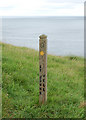
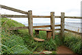
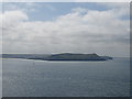
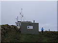
Nearby Images from Geograph Britain and Ireland:
©2009(licence)
©2009(licence)
©2016(licence)
©2012(licence)
©2009(licence)
The above images may not be of the site on this page, they are loaded from Geograph.
Please Submit an Image of this site or go out and take one for us!
Click here to see more info for this site
Nearby sites
Key: Red: member's photo, Blue: 3rd party photo, Yellow: other image, Green: no photo - please go there and take one, Grey: site destroyed
Download sites to:
KML (Google Earth)
GPX (GPS waypoints)
CSV (Garmin/Navman)
CSV (Excel)
To unlock full downloads you need to sign up as a Contributory Member. Otherwise downloads are limited to 50 sites.
Turn off the page maps and other distractions
Nearby sites listing. In the following links * = Image available
1.9km SE 129° Brea Hill* Round Barrow(s) (SW92847714)
2.0km SSE 164° St George's Well (Padstow)* Holy Well or Sacred Spring (SW91887645)
2.1km ESE 122° St Enodoc Church Cross* Ancient Cross (SW93157722)
2.3km NE 53° Pentireglaze Haven barrow* Round Barrow(s) (SW933797)
2.7km NNE 34° Pentire Cairn* Cairn (SW92978056)
2.9km S 176° Fenton Luna* Holy Well or Sacred Spring (SW91477554)
2.9km S 179° Prideaux Place Cross* Ancient Cross (SW91347551)
3.0km S 175° Padstow Cross* Ancient Cross (SW91577539)
3.0km S 174° Cross Shaft and Base at St Petroc's, Padstow.* Ancient Cross (SW91607538)
3.0km SE 129° Jesus Well* Holy Well or Sacred Spring (SW937764)
3.1km S 171° Ladywell (Padstow) Holy Well or Sacred Spring (SW91787535)
3.3km NE 35° The Rumps* Hillfort (SW93408100)
3.9km SE 141° St Michael's Porthilly Churchyard Cross* Ancient Cross (SW937753)
4.5km SW 217° St Cadoc's Well Holy Well or Sacred Spring (SW885749)
4.6km ENE 69° Lundy Hole* Natural Stone / Erratic / Other Natural Feature (SW95777985)
4.8km SW 229° Harlyn Bay* Barrow Cemetery (SW877754)
4.8km WSW 239° Cataclews Point Tumuli* Barrow Cemetery (SW87167610)
5.2km ESE 102° St Minver cross* Ancient Cross (SW965771)
5.3km SSW 198° The Stones, Tresallyn Cross* Modern Stone Circle etc (SW89587340)
6.0km SW 233° St Constantine's Well* Holy Well or Sacred Spring (SW86517496)
6.5km WSW 238° Constantine Island* Barrow Cemetery (SW85727513)
6.8km WSW 249° Dinas Head (Trevose)* Promontory Fort / Cliff Castle (SW84987621)
6.9km WSW 249° Dinas Head Tumulus* Round Barrow(s) (SW84847616)
7.2km ENE 66° Scarnor Point Tumuli* Barrow Cemetery (SW98058110)
7.5km S 171° Trenance Rounds* Ancient Village or Settlement (SW923710)
View more nearby sites and additional images


 We would like to know more about this location. Please feel free to add a brief description and any relevant information in your own language.
 Wir möchten mehr über diese Stätte erfahren. Bitte zögern Sie nicht, eine kurze Beschreibung und relevante Informationen in Deutsch hinzuzufügen.
 Nous aimerions en savoir encore un peu sur les lieux. S'il vous plaît n'hesitez pas à ajouter une courte description et tous les renseignements pertinents dans votre propre langue.
 Quisieramos informarnos un poco más de las lugares. No dude en añadir una breve descripción y otros datos relevantes en su propio idioma.