<< Our Photo Pages >> Glennan Cairn - Cairn in Scotland in Argyll
Submitted by Anonymous on Monday, 22 March 2004 Page Views: 4979
Neolithic and Bronze AgeSite Name: Glennan Cairn Alternative Name: GlasvaarCountry: Scotland County: Argyll Type: Cairn
Nearest Town: Lochgilphead Nearest Village: Kilmartin
Map Ref: NM856011 Landranger Map Number: 55
Latitude: 56.154230N Longitude: 5.453706W
Condition:
| 5 | Perfect |
| 4 | Almost Perfect |
| 3 | Reasonable but with some damage |
| 2 | Ruined but still recognisable as an ancient site |
| 1 | Pretty much destroyed, possibly visible as crop marks |
| 0 | No data. |
| -1 | Completely destroyed |
| 5 | Superb |
| 4 | Good |
| 3 | Ordinary |
| 2 | Not Good |
| 1 | Awful |
| 0 | No data. |
| 5 | Can be driven to, probably with disabled access |
| 4 | Short walk on a footpath |
| 3 | Requiring a bit more of a walk |
| 2 | A long walk |
| 1 | In the middle of nowhere, a nightmare to find |
| 0 | No data. |
| 5 | co-ordinates taken by GPS or official recorded co-ordinates |
| 4 | co-ordinates scaled from a detailed map |
| 3 | co-ordinates scaled from a bad map |
| 2 | co-ordinates of the nearest village |
| 1 | co-ordinates of the nearest town |
| 0 | no data |
Be the first person to rate this site - see the 'Contribute!' box in the right hand menu.
Internal Links:
External Links:
")
Have you visited this site? Please contribute a description or any thoughts by adding a comment.
You may be viewing yesterday's version of this page. To see the most up to date information please register for a free account.
Do not use the above information on other web sites or publications without permission of the contributor.
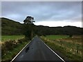
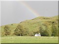
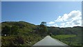
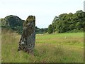
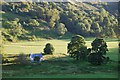
Nearby Images from Geograph Britain and Ireland:
©2022(licence)
©2011(licence)
©2018(licence)
©2020(licence)
©2012(licence)
The above images may not be of the site on this page, they are loaded from Geograph.
Please Submit an Image of this site or go out and take one for us!
Click here to see more info for this site
Nearby sites
Key: Red: member's photo, Blue: 3rd party photo, Yellow: other image, Green: no photo - please go there and take one, Grey: site destroyed
Download sites to:
KML (Google Earth)
GPX (GPS waypoints)
CSV (Garmin/Navman)
CSV (Excel)
To unlock full downloads you need to sign up as a Contributory Member. Otherwise downloads are limited to 50 sites.
![]()
Turn off the page maps and other distractions
Nearby sites listing. In the following links * = Image available
73m ESE 103° Creagantairbh Beag Cairns* Cairn (NM85670108)
131m ENE 78° Glennan Standing Stone* Standing Stone (Menhir) (NM85730112)
577m NE 34° Creagantairbh Beag* Standing Stone (Menhir) (NM85950156)
1.2km W 274° Carnasserie Farm* Rock Art (NM84390125)
1.3km N 353° Creag A Chapuill* Stone Fort or Dun (NM855024)
1.5km WNW 282° Carn Ban (Carnasserie)* Cairn (NM8411101503)
1.7km W 259° Carnasserie Rock Art* Rock Art (NM8389100856)
1.8km NE 35° Loch Ederline* Crannog (NM867025)
1.8km WSW 248° Carnasserie, Kist* Cist (NM83910051)
1.8km NNW 335° Dun Na Nighinn Stone Fort or Dun (NM84910282)
2.2km W 259° Carnasserie Stones* Standing Stones (NM8345400796)
2.2km WSW 256° Carnasserie Cairn* Cairn (NM8338900679)
2.5km NNE 23° Ford Stone (Kilmartin)* Standing Stone (Menhir) (NM8668103317)
2.6km N 354° Dun Chonallaich* Stone Fort or Dun (NM85440365)
2.8km NNE 25° Ford Cist* Cist (NM86890356)
2.8km S 174° Upper Rhudil Chambered Tomb (NR85739831)
3.1km SW 231° Upper Largie Burial Chamber or Dolmen (NR831993)
3.1km SW 222° Kilmartin House* Museum (NR8343298890)
3.1km SW 221° Kilmartin Churchyard* Sculptured Stone (NR8345998859)
3.1km WSW 252° Dun Mac Samhainn Cairn (NM826003)
3.1km SW 220° Kilmartin Churchyard (Poltalloch Enclosure)* Sculptured Stone (NR8346798842)
3.1km SW 221° Kilmartin Churchyard (Lapidarium)* Sculptured Stone (NR8344898839)
3.2km SW 224° Glebe Cairn* Cairn (NR8330098930)
3.3km NNW 329° Salachary* Stone Row / Alignment (NM8405604024)
3.3km SE 143° Loch Leathan* Crannog (NR8745498356)
View more nearby sites and additional images


 We would like to know more about this location. Please feel free to add a brief description and any relevant information in your own language.
 Wir möchten mehr über diese Stätte erfahren. Bitte zögern Sie nicht, eine kurze Beschreibung und relevante Informationen in Deutsch hinzuzufügen.
 Nous aimerions en savoir encore un peu sur les lieux. S'il vous plaît n'hesitez pas à ajouter une courte description et tous les renseignements pertinents dans votre propre langue.
 Quisieramos informarnos un poco más de las lugares. No dude en añadir una breve descripción y otros datos relevantes en su propio idioma.