

<< Our Photo Pages >> Leacaichluaine - Standing Stones in Scotland in Argyll
Submitted by caradoc68 on Wednesday, 29 February 2012 Page Views: 4247
Neolithic and Bronze AgeSite Name: Leacaichluaine Alternative Name: Dunamuck stonesCountry: Scotland County: Argyll Type: Standing Stones
Nearest Town: Lochgilphead Nearest Village: Kilmartin
Map Ref: NR84839232
Latitude: 56.075144N Longitude: 5.458999W
Condition:
| 5 | Perfect |
| 4 | Almost Perfect |
| 3 | Reasonable but with some damage |
| 2 | Ruined but still recognisable as an ancient site |
| 1 | Pretty much destroyed, possibly visible as crop marks |
| 0 | No data. |
| -1 | Completely destroyed |
| 5 | Superb |
| 4 | Good |
| 3 | Ordinary |
| 2 | Not Good |
| 1 | Awful |
| 0 | No data. |
| 5 | Can be driven to, probably with disabled access |
| 4 | Short walk on a footpath |
| 3 | Requiring a bit more of a walk |
| 2 | A long walk |
| 1 | In the middle of nowhere, a nightmare to find |
| 0 | No data. |
| 5 | co-ordinates taken by GPS or official recorded co-ordinates |
| 4 | co-ordinates scaled from a detailed map |
| 3 | co-ordinates scaled from a bad map |
| 2 | co-ordinates of the nearest village |
| 1 | co-ordinates of the nearest town |
| 0 | no data |
Internal Links:
External Links:
I have visited· I would like to visit
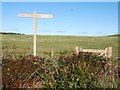
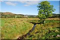
SandyG visited on 14th Mar 2017 - their rating: Cond: 2 Amb: 3 Access: 3 Parking is available at NR 84994 92222. From here walk through gate and head north across the field to NR 84910 92315. A small burn will need to be crossed.
snakefarmer have visited here
")
The following information is taken from Canmore ID 39580: Two large stones, similar to the ancient standing stones, but not standing on end (Ordnance Survey Name Book - ONB 1867). 18th century papers call them "Leacaichluaine". They measure 13' x 5'6" and 10'2" x 5' (Campbell and Sandeman 1964).
(Campbell and Sandeman, quoting Simpson (1868) as a sub-reference, state that one of the stones is sculptured with a cup mark, and an oval cavity 6" x 1 1/2" x 1 1/2", which they could not find. Reading this in context, however, shows that Simpson is referring to NR89SW 27, when describing these marks.)
Refs: Name Book 1867; M Campbell and M Sandeman 1964; J Y Simpson 1868.
NR 8484 9233. Two large prostrate slabs, the westerly of which measures 3.1m by 1.4m by 0.4m, while the other is 4.0m by 1.7m by 0.4m. Neither bears any trace of artificial markings. There is no reason to believe that these stones were not originally standing upright.
There are three groups of standing stones situated NW and NE of Dunamuck on the level ground on the W side of the River Add.
About 470m E of Dunamuck there is the third group, consisting of two stones 3.2m apart, both now fallen (Campbell and Sandeman 1964. The more northerly measures 1.75m by 0.23m and up to 4.lm in length, and the other stone 1.4m by 0.3m and 3.1m in length.
Dunamuck, Cairn.
NR 848 923
In a field above standing stones NR89SW 27 and on the higher ground, are the fallen standing stones NR89SW 24, with the remains of three large cairns - one of them within a few feet of NR89SW 24. 'There are stones also showing the remains of three circles and cairns in the adjoining and lower field, but their true appearance have lately been destroyed by blasting with gunpowder.'
J Y Simpson 1868.
One of Simpson's (1868) "three large cairns" appears to be a house ruin. A spread cairn lies just above NR89SW 24 with a smaller cairn below it. Now very faint.
M Campbell and M Sandeman 1964.
NR 8481 9234. About 25.0m to the W of the recumbent standing stones (NR89SW 24) is a sub-oval area of stony uncultivated ground measuring 18.5m N-S by 16.0m transversely. It is grass-covered and has large stones dumped upon it. The irregular shape of this feature and the absence of any recognisable kerbing make it impossible to determine whether it represents the remains of a cairn or is merely an outcrop of rock. Within this area is a heap of modern field clearance 5.0m in diameter.
NR 8489 9231. On lower ground to the E of NR89SW 24 is a low, amorphous grass-covered stony mound 8.0m E-W by 4.0m.
There is nothing about this feature to suggest its being a burial cairn. There is no trace of any other feature resembling either a cairn or a 'circle' in this vicinity.
Two mounds, both much denuded by ploughing, lie respectively l6.6m NW and 42m ESE of the fallen standing stones (NR89SW 24) and about 450m ENE of Dunamuck. They measure 8.5m by 16m and 0.6m in height and 7.8m by 4m and 0.3m in height respectively, and may represent the only surviving remains of 'three large cairns' whose existence is mentioned in 1862 (one of them said to be 'in a few feet of the recumbent monoliths'). (Campbell and Sandeman 1964; PSAS 1864-6) Three 'circles and cairns, which had been destroyed by gunpowder, are described as lying in an adjacent field, but these have left no visible remains.
You may be viewing yesterday's version of this page. To see the most up to date information please register for a free account.
")
")
Do not use the above information on other web sites or publications without permission of the contributor.
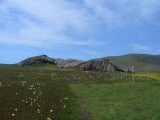
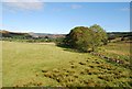
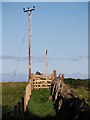
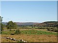
Nearby Images from Geograph Britain and Ireland:
©2010(licence)
©2010(licence)
©2010(licence)
©2010(licence)
©2010(licence)
The above images may not be of the site on this page, they are loaded from Geograph.
Please Submit an Image of this site or go out and take one for us!
Click here to see more info for this site
Nearby sites
Key: Red: member's photo, Blue: 3rd party photo, Yellow: other image, Green: no photo - please go there and take one, Grey: site destroyed
Download sites to:
KML (Google Earth)
GPX (GPS waypoints)
CSV (Garmin/Navman)
CSV (Excel)
To unlock full downloads you need to sign up as a Contributory Member. Otherwise downloads are limited to 50 sites.
Turn off the page maps and other distractions
Nearby sites listing. In the following links * = Image available
173m N 1° Dunamuck South* Standing Stones (NR8484192493)
476m SSW 210° Dunamuck Cairn* Cairn (NR84579192)
482m W 279° Dun Mor, Dunamuck* Stone Fort or Dun (NR8435792420)
602m NNW 346° Dunamuck North* Standing Stones (NR8471392912)
1.4km NW 319° Dunadd Recumbent Stone* Standing Stone (Menhir) (NR83979343)
1.5km SSW 206° Dun Chuain* Stone Fort or Dun (NR841910)
1.5km NE 37° Kilmichael Glassary 1* Rock Art (NR8579793496)
1.5km SSW 210° Cairnbaan 1* Rock Art (NR8398891027)
1.6km NE 36° Kilmichael Glassary 2* Rock Art (NR8580993545)
1.6km SW 214° Cairnbaan 2* Rock Art (NR8387791056)
1.6km NE 39° Kilmichael Glassary Kirk* Ancient Cross (NR8589893521)
1.6km NW 321° Dunadd Standing Stone* Standing Stone (Menhir) (NR8386993612)
1.7km SSE 162° Dun Na Maraig* Stone Fort or Dun (NR85259072)
1.7km SSE 151° Achnabreck Forest Rock Art* Rock Art (NR8556390815)
1.7km NW 315° Dunadd Fort* Hillfort (NR8367693573)
1.8km SSE 154° Achnabreck* Rock Art (NR8555090671)
1.8km SSW 204° Carn Ban (Lochgilphead)* Cairn (NR840907)
1.9km SSE 149° Achnabreck Eastern Rock* Rock Art (NR8572290645)
2.2km SSE 159° Achnabreck Stone* Standing Stone (Menhir) (NR8553790197)
2.3km NNE 29° Torbhlaren Fallen Stone Standing Stone (Menhir) (NR86079428)
2.5km NNE 31° Torbhlaran 1* Rock Art (NR8621394375)
2.5km ESE 117° Auchoish* Chambered Cairn (NR870911)
2.5km SSE 159° Achnabreac* Standing Stones (NR85638992)
2.6km NE 40° Dun Torbhlaran* Stone Fort or Dun (NR866942)
2.7km NNE 32° Torbhlaran 2* Rock Art (NR8635294513)
View more nearby sites and additional images


 We would like to know more about this location. Please feel free to add a brief description and any relevant information in your own language.
 Wir möchten mehr über diese Stätte erfahren. Bitte zögern Sie nicht, eine kurze Beschreibung und relevante Informationen in Deutsch hinzuzufügen.
 Nous aimerions en savoir encore un peu sur les lieux. S'il vous plaît n'hesitez pas à ajouter une courte description et tous les renseignements pertinents dans votre propre langue.
 Quisieramos informarnos un poco más de las lugares. No dude en añadir una breve descripción y otros datos relevantes en su propio idioma.