


<< Our Photo Pages >> Upper Fernoch - Standing Stone (Menhir) in Scotland in Argyll
Submitted by Anonymous on Tuesday, 01 October 2002 Page Views: 7008
Neolithic and Bronze AgeSite Name: Upper FernochCountry: Scotland
NOTE: This site is 1.8 km away from the location you searched for.
County: Argyll Type: Standing Stone (Menhir)
Map Ref: NR72808613 Landranger Map Number: 55
Latitude: 56.014080N Longitude: 5.646624W
Condition:
| 5 | Perfect |
| 4 | Almost Perfect |
| 3 | Reasonable but with some damage |
| 2 | Ruined but still recognisable as an ancient site |
| 1 | Pretty much destroyed, possibly visible as crop marks |
| 0 | No data. |
| -1 | Completely destroyed |
| 5 | Superb |
| 4 | Good |
| 3 | Ordinary |
| 2 | Not Good |
| 1 | Awful |
| 0 | No data. |
| 5 | Can be driven to, probably with disabled access |
| 4 | Short walk on a footpath |
| 3 | Requiring a bit more of a walk |
| 2 | A long walk |
| 1 | In the middle of nowhere, a nightmare to find |
| 0 | No data. |
| 5 | co-ordinates taken by GPS or official recorded co-ordinates |
| 4 | co-ordinates scaled from a detailed map |
| 3 | co-ordinates scaled from a bad map |
| 2 | co-ordinates of the nearest village |
| 1 | co-ordinates of the nearest town |
| 0 | no data |
Internal Links:
External Links:
I have visited· I would like to visit
SumDoood would like to visit
hidebasket visited on 19th Feb 2024 - their rating: Cond: 4 Amb: 5 Access: 4
")
A 2.5 metre tall standing stone.
Canmore site no. 39101.
You may be viewing yesterday's version of this page. To see the most up to date information please register for a free account.
Do not use the above information on other web sites or publications without permission of the contributor.
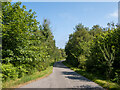
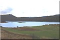
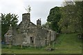
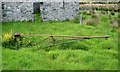
Nearby Images from Geograph Britain and Ireland:

©2007(licence)
©2021(licence)
©2006(licence)
©2007(licence)
©2007(licence)
The above images may not be of the site on this page, they are loaded from Geograph.
Please Submit an Image of this site or go out and take one for us!
Click here to see more info for this site
Nearby sites
Key: Red: member's photo, Blue: 3rd party photo, Yellow: other image, Green: no photo - please go there and take one, Grey: site destroyed
Download sites to:
KML (Google Earth)
GPX (GPS waypoints)
CSV (Garmin/Navman)
CSV (Excel)
To unlock full downloads you need to sign up as a Contributory Member. Otherwise downloads are limited to 50 sites.
![]()
Turn off the page maps and other distractions
Nearby sites listing. In the following links * = Image available
324m NNE 31° Barnashaig* Standing Stone (Menhir) (NR72988640)
5.2km SSE 168° Dun Rostan Stone Fort or Dun (NR73628097)
6.6km NE 49° Holy Well (Kilmory Oib)* Holy Well or Sacred Spring (NR780902)
7.1km NE 47° Kilmory Oib Enclosure* Standing Stones (NR78289070)
7.4km NE 53° Gartnagreanoch* Chambered Cairn (NR789903)
9.2km NNW 328° Cnoc a' Chuirn Moir (Jura) Cairn (NR68299421)
9.5km SE 146° Achahoish* Standing Stone (Menhir) (NR7773778016)
9.7km SSE 163° St Columba's Cave* Cave or Rock Shelter (NR751767)
9.9km NE 36° Crinan Woods Cup Stone* Rock Art (NR79019382)
9.9km SE 141° Caisteal Torr Stone Fort or Dun (NR78567807)
10.8km ENE 57° Barnakill Rock Art (NR82199154)
11.1km NNW 345° Barnhill Cairn (NR70579700)
11.2km S 190° Kilmory Knap* Sculptured Stone (NR703752)
11.3km NE 42° Crinan Moss Stones* Standing Stones (NR80839409)
11.3km NE 42° Crinan Moss Cairn Cairn (NR80909408)
12.1km ENE 65° Carn Ban (Lochgilphead)* Cairn (NR840907)
12.1km ENE 63° Cairnbaan 2* Rock Art (NR8387791056)
12.2km ENE 63° Cairnbaan 1* Rock Art (NR8398891027)
12.2km NE 34° Duntroon Stone Fort or Dun (NR802959)
12.3km ENE 64° Dun Chuain* Stone Fort or Dun (NR841910)
12.4km NNE 26° Dun Ardifuir 1 Stone Fort or Dun (NR789969)
12.7km NE 39° Barsloisnoch* Cist (NR813956)
12.7km WSW 249° Tarbert (Jura)* Standing Stone (Menhir) (NR6062782298)
12.8km NNE 26° Dun Ardifuir 2 Stone Fort or Dun (NR791973)
13.1km ENE 61° Dunamuck Cairn* Cairn (NR84579192)
View more nearby sites and additional images


 We would like to know more about this location. Please feel free to add a brief description and any relevant information in your own language.
 Wir möchten mehr über diese Stätte erfahren. Bitte zögern Sie nicht, eine kurze Beschreibung und relevante Informationen in Deutsch hinzuzufügen.
 Nous aimerions en savoir encore un peu sur les lieux. S'il vous plaît n'hesitez pas à ajouter une courte description et tous les renseignements pertinents dans votre propre langue.
 Quisieramos informarnos un poco más de las lugares. No dude en añadir una breve descripción y otros datos relevantes en su propio idioma.