 with our Megalithic Portal iPhone app")


<< Our Photo Pages >> Camus Nan Geall - Chambered Cairn in Scotland in Argyll
Submitted by Anonymous on Thursday, 15 February 2001 Page Views: 12037
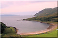
Neolithic and Bronze AgeSite Name: Camus Nan GeallCountry: Scotland County: Argyll Type: Chambered Cairn
Nearest Village: Ardnamurchan
Map Ref: NM560618 Landranger Map Number: 47
Latitude: 56.684042N Longitude: 5.985678W
Condition:
| 5 | Perfect |
| 4 | Almost Perfect |
| 3 | Reasonable but with some damage |
| 2 | Ruined but still recognisable as an ancient site |
| 1 | Pretty much destroyed, possibly visible as crop marks |
| 0 | No data. |
| -1 | Completely destroyed |
| 5 | Superb |
| 4 | Good |
| 3 | Ordinary |
| 2 | Not Good |
| 1 | Awful |
| 0 | No data. |
| 5 | Can be driven to, probably with disabled access |
| 4 | Short walk on a footpath |
| 3 | Requiring a bit more of a walk |
| 2 | A long walk |
| 1 | In the middle of nowhere, a nightmare to find |
| 0 | No data. |
| 5 | co-ordinates taken by GPS or official recorded co-ordinates |
| 4 | co-ordinates scaled from a detailed map |
| 3 | co-ordinates scaled from a bad map |
| 2 | co-ordinates of the nearest village |
| 1 | co-ordinates of the nearest town |
| 0 | no data |
Be the first person to rate this site - see the 'Contribute!' box in the right hand menu.
Internal Links:
External Links:
I have visited· I would like to visit
SumDoood would like to visit
h_fenton has visited here
")
Have you visited this site? Please contribute a description or any thoughts by adding a comment.
You may be viewing yesterday's version of this page. To see the most up to date information please register for a free account.
")
")
")
")
Do not use the above information on other web sites or publications without permission of the contributor.
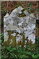
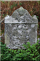
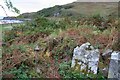
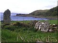
Nearby Images from Geograph Britain and Ireland:
©2007(licence)
©2007(licence)
©2018(licence)
©2008(licence)
©2012(licence)
The above images may not be of the site on this page, they are loaded from Geograph.
Please Submit an Image of this site or go out and take one for us!
Click here to see more info for this site
Nearby sites
Key: Red: member's photo, Blue: 3rd party photo, Yellow: other image, Green: no photo - please go there and take one, Grey: site destroyed
Download sites to:
KML (Google Earth)
GPX (GPS waypoints)
CSV (Garmin/Navman)
CSV (Excel)
To unlock full downloads you need to sign up as a Contributory Member. Otherwise downloads are limited to 50 sites.
![]()
Turn off the page maps and other distractions
Nearby sites listing. In the following links * = Image available
668m ESE 113° St Columba's Well (Ardnamurchan)* Holy Well or Sacred Spring (NM566615)
8.4km NNW 333° Cladh Chatain Standing Stones (NM52696949)
8.6km WNW 281° Greadal Fhinn* Chambered Cairn (NM47656397)
9.1km NNW 348° Cladh Aindreis Chambered Cairn (NM547708)
9.2km SW 222° Dun Urgadul Stone Fort or Dun (NM49475527)
9.7km SW 215° Balliscate* Stone Row / Alignment (NM49965413)
10.2km ESE 121° Greadal Fhinn Passage Grave (NM644560)
10.2km ESE 121° Rahoy. Passage Grave (NM644560)
11.7km S 181° Ardnacross Cairn* Cairn (NM55025014)
11.9km S 181° An Sean Chaisteal* Broch or Nuraghe (NM55104988)
12.7km S 185° Ardnacross North* Stone Row / Alignment (NM5417949181)
12.8km S 185° Ardnacross Cairns* Cairn (NM54184914)
12.8km S 185° Ardnacross South* Stone Row / Alignment (NM5419049135)
13.3km WSW 246° Glengorm* Stone Row / Alignment (NM43475713)
13.8km WSW 250° Dun Ara* Stone Fort or Dun (NM42725771)
14.0km WSW 243° An Sean Dun Stone Fort or Dun (NM43105624)
14.0km NW 304° Fort at Rubha an Duin Bhain* Promontory Fort / Cliff Castle (NM44857040)
15.1km SW 231° Maol Mor* Stone Row / Alignment (NM4360453056)
15.5km SSW 193° Ledmore Crannog (NM51514696)
15.5km SW 228° Dervaig centre* Stone Row / Alignment (NM43905203)
15.6km SW 227° Dervaig D Stone Row / Alignment (NM43935189)
15.6km SW 227° Dervaig 3* Standing Stones (NM43935189)
15.6km SW 227° Priest's Well (Dervaig)* Holy Well or Sacred Spring (NM440518)
15.8km SW 227° Dervaig SSE* Stone Row / Alignment (NM4385951655)
16.0km WSW 242° Quinish (Stone Row)* Stone Row / Alignment (NM41355524)
View more nearby sites and additional images


 We would like to know more about this location. Please feel free to add a brief description and any relevant information in your own language.
 Wir möchten mehr über diese Stätte erfahren. Bitte zögern Sie nicht, eine kurze Beschreibung und relevante Informationen in Deutsch hinzuzufügen.
 Nous aimerions en savoir encore un peu sur les lieux. S'il vous plaît n'hesitez pas à ajouter une courte description et tous les renseignements pertinents dans votre propre langue.
 Quisieramos informarnos un poco más de las lugares. No dude en añadir una breve descripción y otros datos relevantes en su propio idioma.