<< Our Photo Pages >> Garrabost - Standing Stone (Menhir) in Scotland in Isle of Lewis
Submitted by SHUGS on Monday, 28 September 2015 Page Views: 5297
Neolithic and Bronze AgeSite Name: Garrabost Alternative Name: Dursainean, Clach GhlasCountry: Scotland County: Isle of Lewis Type: Standing Stone (Menhir)
Nearest Town: Stornoway Nearest Village: Garrabost
Map Ref: NB52813340
Latitude: 58.219784N Longitude: 6.21099W
Condition:
| 5 | Perfect |
| 4 | Almost Perfect |
| 3 | Reasonable but with some damage |
| 2 | Ruined but still recognisable as an ancient site |
| 1 | Pretty much destroyed, possibly visible as crop marks |
| 0 | No data. |
| -1 | Completely destroyed |
| 5 | Superb |
| 4 | Good |
| 3 | Ordinary |
| 2 | Not Good |
| 1 | Awful |
| 0 | No data. |
| 5 | Can be driven to, probably with disabled access |
| 4 | Short walk on a footpath |
| 3 | Requiring a bit more of a walk |
| 2 | A long walk |
| 1 | In the middle of nowhere, a nightmare to find |
| 0 | No data. |
| 5 | co-ordinates taken by GPS or official recorded co-ordinates |
| 4 | co-ordinates scaled from a detailed map |
| 3 | co-ordinates scaled from a bad map |
| 2 | co-ordinates of the nearest village |
| 1 | co-ordinates of the nearest town |
| 0 | no data |
Internal Links:
External Links:
I have visited· I would like to visit
SumDoood would like to visit
rrmoser ravensidhe have visited here
")
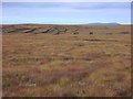
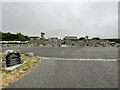
Standing stone to the South East of Garrabost on the Isle of Lewis, easy access either from the road or a round trip from Dursainen chambered Cairn to the South West
Canmore ID:- 4398
You may be viewing yesterday's version of this page. To see the most up to date information please register for a free account.
")
")
Do not use the above information on other web sites or publications without permission of the contributor.
Nearby Images from Geograph Britain and Ireland:
©2005(licence)
©2018(licence)
©2024(licence)
©2008(licence)
©2023(licence)
The above images may not be of the site on this page, they are loaded from Geograph.
Please Submit an Image of this site or go out and take one for us!
Click here to see more info for this site
Nearby sites
Key: Red: member's photo, Blue: 3rd party photo, Yellow: other image, Green: no photo - please go there and take one, Grey: site destroyed
Download sites to:
KML (Google Earth)
GPX (GPS waypoints)
CSV (Garmin/Navman)
CSV (Excel)
To unlock full downloads you need to sign up as a Contributory Member. Otherwise downloads are limited to 50 sites.
Turn off the page maps and other distractions
Nearby sites listing. In the following links * = Image available
540m SW 229° Cnoc Nan Dursainean* Cairn (NB52383307)
3.2km SSW 197° Loch an Duin (Eye Peninsula)* Stone Fort or Dun (NB51683043)
4.6km SSW 202° Teampull* Misc. Earthwork (NB50782924)
10.4km N 351° Dun Beinn Earba Stone Fort or Dun (NB518438)
10.7km NNW 338° Dun Beinn Ivor Stone Fort or Dun (NB495436)
11.7km W 277° Benside Newmarket* Stone Circle (NB4129735652)
11.8km W 275° Priest's Glen* Stone Circle (NB41103516)
11.8km NNW 328° Carn A' Mharc Chambered Cairn (NB4722543846)
12.9km W 270° Loch Airidh Na Lic* Crannog (NB39923410)
14.8km WSW 255° Druim Dubh* Stone Circle (NB382305)
17.9km SW 221° Dun Cromore* Stone Fort or Dun (NB4012320699)
19.4km SW 222° Torastay* Cairn (NB38881976)
21.4km WSW 255° Achmore* Stone Circle (NB31742926)
24.5km NW 324° Steinacleit* Chambered Tomb (NB39635408)
24.8km NW 325° Clach Stei Lin* Stone Circle (NB3969454546)
24.9km NW 324° Loch an Dùin (Shader)* Broch or Nuraghe (NB39295435)
25.4km NW 320° Clach An Truishal* Standing Stone (Menhir) (NB3756053775)
25.9km NW 308° Barabhas* Modern Stone Circle etc (NB333506)
26.6km NNW 330° Tobar Bhrìghde* Holy Well or Sacred Spring (NB41035738)
27.4km NNW 338° Dun Sabhuill Stone Fort or Dun (NB44305956)
27.9km SW 235° Cnoc nan Clach (Hillock of Stone)* Cairn (NB2886718971)
27.9km WNW 296° Loch an Duna* Broch or Nuraghe (NB285473)
28.2km W 260° Callanish 6* Standing Stones (NB24653034)
28.6km WSW 258° Callanish 18* Standing Stone (Menhir) (NB24402923)
29.0km W 264° Callanish 17* Stone Circle (NB237320)
View more nearby sites and additional images


 We would like to know more about this location. Please feel free to add a brief description and any relevant information in your own language.
 Wir möchten mehr über diese Stätte erfahren. Bitte zögern Sie nicht, eine kurze Beschreibung und relevante Informationen in Deutsch hinzuzufügen.
 Nous aimerions en savoir encore un peu sur les lieux. S'il vous plaît n'hesitez pas à ajouter une courte description et tous les renseignements pertinents dans votre propre langue.
 Quisieramos informarnos un poco más de las lugares. No dude en añadir una breve descripción y otros datos relevantes en su propio idioma.