Featured: Current Archaeology Book of the Year 2019!

Current Archaeology Book of the Year 2019!

Random Image


Dun Gerashader

Serpent’s Gold by Sam Osman

Serpent’s Gold by Sam Osman

Who's Online

There are currently, 393 guests and 2 members online.

You are a guest. To join in, please register for free by clicking here

Sponsors

<< Our Photo Pages >> Mulfra Quoit - Portal Tomb in England in Cornwall

Submitted by hamish on Thursday, 08 March 2012  Page Views: 16837

Neolithic and Bronze AgeSite Name: Mulfra Quoit
Country: England County: Cornwall Type: Portal Tomb
Nearest Town: Penzance  Nearest Village: Mulfra
Map Ref: SW45183536  Landranger Map Number: 203
Latitude: 50.163378N  Longitude: 5.569367W
Condition:
5Perfect
4Almost Perfect
3Reasonable but with some damage
2Ruined but still recognisable as an ancient site
1Pretty much destroyed, possibly visible as crop marks
0No data.
-1Completely destroyed
3 Ambience:
5Superb
4Good
3Ordinary
2Not Good
1Awful
0No data.
4 Access:
5Can be driven to, probably with disabled access
4Short walk on a footpath
3Requiring a bit more of a walk
2A long walk
1In the middle of nowhere, a nightmare to find
0No data.
4 Accuracy:
5co-ordinates taken by GPS or official recorded co-ordinates
4co-ordinates scaled from a detailed map
3co-ordinates scaled from a bad map
2co-ordinates of the nearest village
1co-ordinates of the nearest town
0no data
5

Internal Links:
External Links:

I have visited· I would like to visit

PAB KieKa would like to visit

micske visited on 1st Sep 2023 - their rating: Cond: 3 Amb: 5 Access: 3

LiveAndrew visited on 30th Jul 2021 - their rating: Cond: 3 Amb: 4 Access: 4

Catrinm visited on 25th Mar 2019 - their rating: Cond: 4 Amb: 4 Access: 3

lucasn visited on 24th Jul 2018 - their rating: Cond: 4 Amb: 4 Access: 4

ocifant visited on 1st Oct 2013 - their rating: Cond: 3 Amb: 4 Access: 3

coin visited on 1st Jan 2013 - their rating: Cond: 3 Amb: 5 Access: 3 A great site with fantastic ambience

jeffrep visited on 13th May 2011 - their rating: Cond: 3 Amb: 4 Access: 4 Short but steep walk from the minor road to the top of Mulfra Hill.

kernowek Bladup Andy B h_fenton rldixon paulcall TimPrevett JimChampion hamish cazzyjane have visited here

Average ratings for this site from all visit loggers: Condition: 3.29 Ambience: 4.29 Access: 3.43
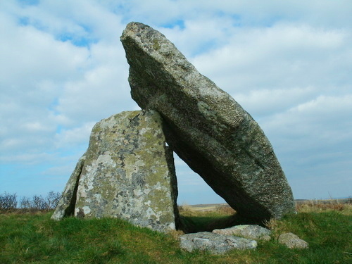
Mulfra Quoit
Mulfra Quoit submitted by Bladup : Mulfra Quoit. (Vote or comment on this photo)
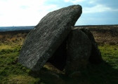
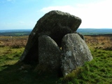
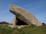
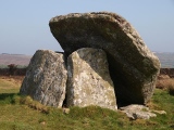
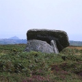
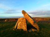
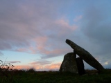
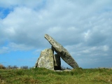
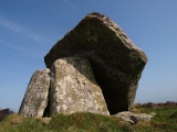
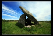
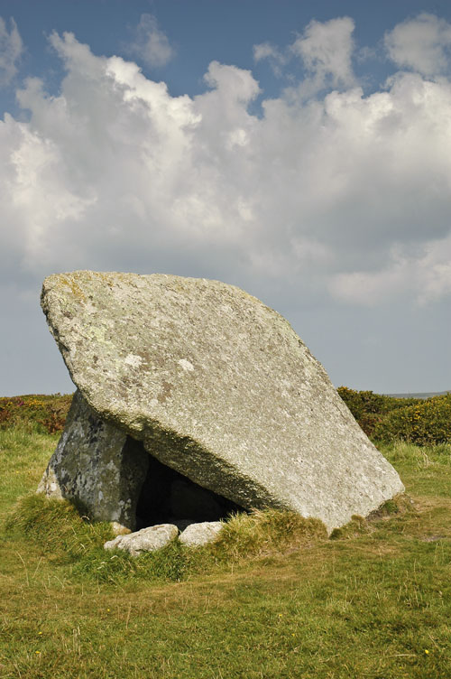
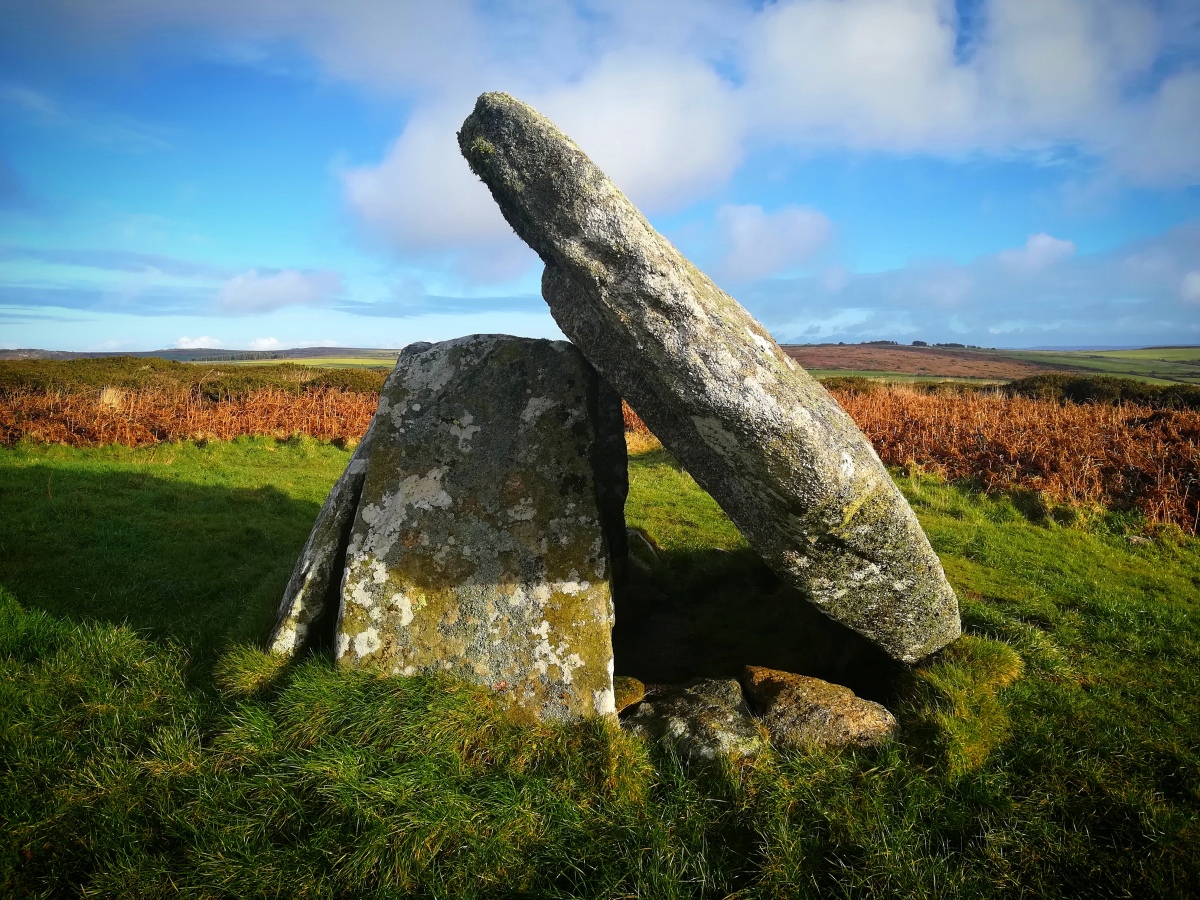
One of the smallest Penwith chamber tombs. Only 3 of the 4 support stones remain so that the 2.9m square capstone has slipped and leans against the 3m x 1.7m x 1.7m high chamber

This site is similar to Chun Quoit but sadly not as well preserved. The capstone has fallen and now leans on the two remaining uprights. There is a possible cupmark on the capstone.

The path to get here is not for the faint hearted,it is very rutted and slippery.When you get to the Quoit the effort is well worth while. A magnificent monument with tremendous views.

Note: Ancient sites threatened and possibly damaged as 'controlled burn' goes out of control in strong winds on Mulfra Hill
You may be viewing yesterday's version of this page. To see the most up to date information please register for a free account.
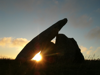
Mulfra Quoit
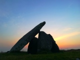
Mulfra Quoit submitted by Bladup : Mulfra Quoit at sunset. (Vote or comment on this photo)

Mulfra Quoit
Mulfra Quoit submitted by cazzyjane : Oil on canvas. (7 comments - Vote or comment on this photo)

Mulfra Quoit
Mulfra Quoit submitted by Manja : Mulfra Quoit in September 2007. We almost missed the burial chamber after we had climbed up the hill in the hot sun at noon. This tranquil place was worth not giving up. (Vote or comment on this photo)

Mulfra Quoit
Mulfra Quoit submitted by Bladup : Mulfra Quoit on the Winter Solstice 2022 (2 comments - Vote or comment on this photo)

Mulfra Quoit
Mulfra Quoit submitted by enkidu41 : One of the smallest Penwith chamber tombs. Only 3 of the 4 support stones remain so that the 2.9m square capstone has slipped and leans against the 3m x 1.7m x 1.7m high chamber SW 4518 3536 (Vote or comment on this photo)

Mulfra Quoit
Mulfra Quoit submitted by Morrigan23 : Mulfra Quoit, showing fallen capstone. (1 comment)

Mulfra Quoit
Mulfra Quoit submitted by LiveAndrew : Mulfra Quoit with Mount's Bay in the distance

Mulfra Quoit
Mulfra Quoit submitted by Bladup : Mulfra Quoit.

Mulfra Quoit
Mulfra Quoit submitted by Bladup

Mulfra Quoit
Mulfra Quoit submitted by BazCross : Mulfra Quoit, March 2012.

Mulfra Quoit
Mulfra Quoit submitted by BazCross

Mulfra Quoit
Mulfra Quoit submitted by BazCross : St Michaels Mount in the distance behind Mulfra Quoit.

Mulfra Quoit
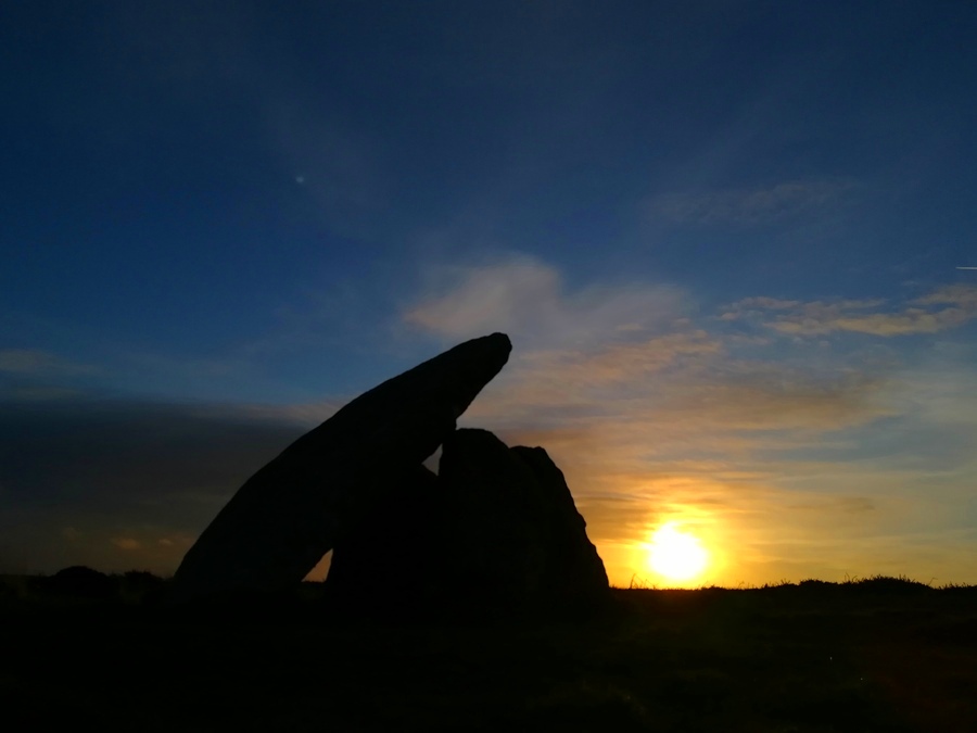
Mulfra Quoit submitted by Bladup : Mulfra Quoit and the setting Sun

Mulfra Quoit
Mulfra Quoit submitted by Bladup : Setting Sunlight shining onto Mulfra Quoit

Mulfra Quoit
Mulfra Quoit submitted by Bladup : Mulfra Quoit. (1 comment)

Mulfra Quoit
Mulfra Quoit submitted by Bladup (2 comments)

Mulfra Quoit
Mulfra Quoit submitted by Bladup (2 comments)

Mulfra Quoit
Mulfra Quoit submitted by BazCross : Mulfra Quoit, March 2012.

Mulfra Quoit
Mulfra Quoit submitted by cazzyjane : Mulfra Quoit. August 2011. (2 comments)

Mulfra Quoit
Mulfra Quoit submitted by cazzyjane : Mulfra Quoit. Oil on Board.

Mulfra Quoit
Mulfra Quoit submitted by croppy : Mulfra Quoit 2007 (1 comment)

Mulfra Quoit
Mulfra Quoit submitted by Bladup : Mulfra Quoit and a spring equinox Sunset

Mulfra Quoit
Mulfra Quoit submitted by Horatio : Interesting seeing the underneath of the capstone, looks almost like its been worked to slot on to the uprights. Any way I booked 9 days in Cornwall and over 1100 miles travelled and at the best guess, we had a day and half when it wasn't raining misty and breakneck windspeeds...this day wasn't one of them.

Mulfra Quoit
Mulfra Quoit submitted by lucasn : Mulfra Quoit on a nice day

Mulfra Quoit
Mulfra Quoit submitted by Bladup : Mulfra Quoit.

These are just the first 25 photos of Mulfra Quoit. If you log in with a free user account you will be able to see our entire collection.

Do not use the above information on other web sites or publications without permission of the contributor.
Click here to see more info for this site

Nearby sites

Click here to view sites on an interactive OS map

Key: Red: member's photo, Blue: 3rd party photo, Yellow: other image, Green: no photo - please go there and take one, Grey: site destroyed

Download sites to:
KML (Google Earth)
GPX (GPS waypoints)
CSV (Garmin/Navman)
CSV (Excel)

To unlock full downloads you need to sign up as a Contributory Member. Otherwise downloads are limited to 50 sites.


Turn off the page maps and other distractions

Nearby sites listing. In the following links * = Image available
 368m NW 308° Mulfra Hill Tumuli* Barrow Cemetery (SW449356)
 509m SSE 152° Mulfra Settlement* Ancient Village or Settlement (SW454349)
 617m WNW 298° Bodrifty Cairns* Cairn (SW44653568)
 679m W 271° Bodrifty Settlement* Ancient Village or Settlement (SW445354)
 708m N 6° Tolcreeg Barrow* Chambered Cairn (SW45293606)
 791m SW 225° Tredinnick* Stone Circle (SW44593483)
 798m SW 220° Boskednan Cist Cairn (SW44643477)
 871m ESE 113° Try Menhir (Cornwall)* Standing Stone (Menhir) (SW4596434975)
 975m ENE 76° Trye Settlement* Ancient Village or Settlement (SW46143555)
 987m WSW 247° Boskednan 3 Ancient Village or Settlement (SW44253502)
 1.1km WNW 301° Treen Settlement* Ancient Village or Settlement (SW44283595)
 1.1km ENE 67° Try Round* Ancient Village or Settlement (SW46243575)
 1.2km NW 323° Treen Common (The Beacon)* Barrow Cemetery (SW44523633)
 1.2km WSW 256° Gulval 2 Round Barrow(s) (SW43973511)
 1.3km SW 236° Park Vorn* Souterrain (Fogou, Earth House) (SW44043467)
 1.4km NE 50° St Senara Holy Well or Sacred Spring (SW4631136232)
 1.4km SE 139° Cranken Courtyard Houses* Ancient Village or Settlement (SW46073424)
 1.5km NE 36° Huel Creek barrow* Round Barrow(s) (SW46093650)
 1.5km NNW 328° Porthmeor Circle* Stone Circle (SW44463665)
 1.5km WNW 292° Bosporthennis 2* Ancient Village or Settlement (SW43793599)
 1.5km W 262° Boskednan 2* Cairn (SW43653521)
 1.5km ENE 78° Carnaquidden Downs* Ancient Village or Settlement (SW467356)
 1.6km NW 306° Bosporthennis Well* Holy Well or Sacred Spring (SW4396436335)
 1.6km WNW 293° Bosporthennis Beehive Hut* Souterrain (Fogou, Earth House) (SW43773604)
 1.6km SE 146° Lower Crankan Settlement* Ancient Village or Settlement (SW460340)
View more nearby sites and additional images

<< Laubenheimer Stein

Klasies River Caves >>

Please add your thoughts on this site

Cornovia: Ancient Sites of Cornwall and Scilly, Craig Weatherhill

Cornovia: Ancient Sites of Cornwall and Scilly, Craig Weatherhill

Sponsors

Auto-Translation (Google)

Translate from English into:

"Mulfra Quoit" | Login/Create an Account | 9 News and Comments
  
Go back to top of page    Comments are owned by the poster. We aren't responsible for their content.
Mulfra Quoit Radioactivity by lucasn on Tuesday, 07 April 2020
(User Info | Send a Message)
[ Reply to This ]

Mulfra Quoit by lucasn on Friday, 17 August 2018
(User Info | Send a Message)
[ Reply to This ]

Re: Mulfra Quoit by Anonymous on Monday, 12 March 2012
The Quoit was undamaged as the short grass covering where its surrounding cairn stood acted as a fire break, but the hill is blackened all around this green clrcle. It'll take a while to inspect all the other prehistoric remains.

Craig Weatherhill
[ Reply to This ]
    Re: Mulfra Quoit by Anonymous on Monday, 12 March 2012
    I forgot to mention that Ian Cooke and Jan Beare have been there to take photos.

    Craig W.
    [ Reply to This ]
      Re: Mulfra Quoit by Anonymous on Tuesday, 13 March 2012
      Thank you very much for the update information. That's very good news.
      [ Reply to This ]

'Controlled burn' goes out of control in strong winds on Mulfra Hill by Andy B on Thursday, 08 March 2012
(User Info | Send a Message)
Four fire crews were on Mulfra Hill near Penzance this afternoon fighting a gorse blaze.

Cornwall Fire and Rescue service confirmed "At 11:58 this morning we received a call to a controlled burning which had gotten [sic] out of control. Fire crews reported from the scene that there was a 100 metre fire front which was being allowed to burn towards natural breaks, and crews were using beaters. Strong winds fanned the fire and by one o clock the gorse was burning over Mulfra hill."

By 4.20pm a total of four engines from Penzance, St Just and St Ives, with twenty seven men were on site. Electrical engineers were asked to attend as overhead power lines have been affected. The fire was out by 6pm and all appliances have now returned from this incident.

Local author and Save Penwith Moors campaigner Craig Weatherhill told the Megalithic Portal: "Several barrows, hut circles and prehistoric field boundaries will have been denuded and laid open to direct exposure and erosion. They may be fire-damaged as well, but inspection will not be possible until the ground has cooled suffiiciently to allow access."

"The fire was within yards of Mulfra Quoit early this afternoon, but it's not known at present whether it reached the site. I suspect that it may have done. Who was stupid enough to attempt a 'controlled burn' in a strong wind? This reminds me of what happened at Carn Kenidjack in 2002 when a burn by a so-called responsible farmer was attempted in 35mph winds and took the entire hill out."
[ Reply to This ]
    Re: 'Controlled burn' goes out of control in strong winds on Mulfra Hill by Anonymous on Monday, 12 March 2012
    4 days later now. Any more recent news or photos from the site after the fire? Did anybody visit there?
    [ Reply to This ]
    'Controlled' fire raged across moorland with flames reaching 30 feet by Andy B on Friday, 16 March 2012
    (User Info | Send a Message)
    Natural England are investigating after the controlled burning of land at Mulfra Hill, near Penzance went badly wrong as strong winds carried the blaze across the area.

    At its height 27 firefighters were tackling the flames, which could be seen from miles around. It took seven hours to extinguish the fire thanks to the combined effort of crews from Penzance, St Ives and St Just.

    "This appalling fire has destroyed a huge area of pristine heathland," said Ian McNeil Cooke, co-ordinator of the Save Penwith Moors group. "Thankfully the quoit remained untouched although other prehistoric remains will be left vulnerable to erosion by wind and rain."

    More at
    http://www.thisiscornwall.co.uk/Controlled-raged-moorland-flames-reaching-30-feet/story-15522065-detail/story.html
    [ Reply to This ]

Re: Mulfra Quoit by enkidu41 on Tuesday, 03 August 2004
(User Info | Send a Message)
This site has many access points - all on foot. It may be reached by the right of way footpath up from Mulfra, a winding path up from the Bodrifty Settlement and from a number of points along the minor road along the Try Valley between Treen and Newmill. All climbs are strenuous and on none can you see the chamber until the top of the hill has been almost reached!
[ Reply to This ]

Your Name: Anonymous [ Register Now ]
Subject:


Add your comment or contribution to this page. Spam or offensive posts are deleted immediately, don't even bother

<<< What is five plus one as a number? (Please type the answer to this question in the little box on the left)
You can also embed videos and other things. For Youtube please copy and paste the 'embed code'.
For Google Street View please include Street View in the text.
Create a web link like this: <a href="https://www.megalithic.co.uk">This is a link</a>  

Allowed HTML is:
<p> <b> <i> <a> <img> <em> <br> <strong> <blockquote> <tt> <li> <ol> <ul> <object> <param> <embed> <iframe>

We would like to know more about this location. Please feel free to add a brief description and any relevant information in your own language.
Wir möchten mehr über diese Stätte erfahren. Bitte zögern Sie nicht, eine kurze Beschreibung und relevante Informationen in Deutsch hinzuzufügen.
Nous aimerions en savoir encore un peu sur les lieux. S'il vous plaît n'hesitez pas à ajouter une courte description et tous les renseignements pertinents dans votre propre langue.
Quisieramos informarnos un poco más de las lugares. No dude en añadir una breve descripción y otros datos relevantes en su propio idioma.