


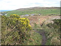
<< Our Photo Pages >> Bosullow Trehyllys Fogou - Souterrain (Fogou, Earth House) in England in Cornwall
Submitted by vicky on Monday, 07 October 2002 Page Views: 8328
Iron Age and Later PrehistorySite Name: Bosullow Trehyllys FogouCountry: England County: Cornwall Type: Souterrain (Fogou, Earth House)
Map Ref: SW40933422 Landranger Map Number: 203
Latitude: 50.151303N Longitude: 5.627975W
Condition:
| 5 | Perfect |
| 4 | Almost Perfect |
| 3 | Reasonable but with some damage |
| 2 | Ruined but still recognisable as an ancient site |
| 1 | Pretty much destroyed, possibly visible as crop marks |
| 0 | No data. |
| -1 | Completely destroyed |
| 5 | Superb |
| 4 | Good |
| 3 | Ordinary |
| 2 | Not Good |
| 1 | Awful |
| 0 | No data. |
| 5 | Can be driven to, probably with disabled access |
| 4 | Short walk on a footpath |
| 3 | Requiring a bit more of a walk |
| 2 | A long walk |
| 1 | In the middle of nowhere, a nightmare to find |
| 0 | No data. |
| 5 | co-ordinates taken by GPS or official recorded co-ordinates |
| 4 | co-ordinates scaled from a detailed map |
| 3 | co-ordinates scaled from a bad map |
| 2 | co-ordinates of the nearest village |
| 1 | co-ordinates of the nearest town |
| 0 | no data |
Internal Links:
External Links:
I have visited· I would like to visit
lucasn visited on 4th Nov 2018 - their rating: Cond: 2 Amb: 4 Access: 3
LiveAndrew have visited here
")
Have you visited this site? Please add a comment below.
Note: This site is on private land and there is no public access.
You may be viewing yesterday's version of this page. To see the most up to date information please register for a free account.
Do not use the above information on other web sites or publications without permission of the contributor.
Nearby Images from Geograph Britain and Ireland:

©2016(licence)

©2008(licence)

©2016(licence)
©2008(licence)

©2016(licence)
The above images may not be of the site on this page, they are loaded from Geograph.
Please Submit an Image of this site or go out and take one for us!
Click here to see more info for this site
Nearby sites
Key: Red: member's photo, Blue: 3rd party photo, Yellow: other image, Green: no photo - please go there and take one, Grey: site destroyed
Download sites to:
KML (Google Earth)
GPX (GPS waypoints)
CSV (Garmin/Navman)
CSV (Excel)
To unlock full downloads you need to sign up as a Contributory Member. Otherwise downloads are limited to 50 sites.
Turn off the page maps and other distractions
Nearby sites listing. In the following links * = Image available
73m ESE 103° Bosullow Trehyllys Settlement* Ancient Village or Settlement (SW410342)
501m SW 236° Chun Castle Well* Holy Well or Sacred Spring (SW40503396)
506m SW 235° Chun Castle* Hillfort (SW40503395)
534m W 276° Chun Tumulus Round Barrow(s) (SW404343)
568m E 89° Kerrow Bosullow Standing stone* Standing Stone (Menhir) (SW415342)
605m NE 35° The Carn Field System* Misc. Earthwork (SW413347)
754m WSW 247° Chun Quoit* Chambered Cairn (SW40223396)
788m W 264° Tor Noon Tumulus and Homestead* Round Barrow(s) (SW40143418)
790m NNW 348° Carne Farm Hut Circle* Ancient Village or Settlement (SW408350)
799m N 358° Trevowhan standing stones* Standing Stones (SW40943502)
800m NE 38° Bosullow Quoit* Modern Stone Circle etc (SW41453483)
883m NW 309° Carne Farm Settlement* Ancient Village or Settlement (SW40273481)
900m N 355° Trevowhan Standing Stone* Standing Stone (Menhir) (SW40893512)
1.0km SW 223° Chun Downs Tumulus* Round Barrow(s) (SW402335)
1.1km NE 49° Dakota Homestead Ancient Village or Settlement (SW418349)
1.2km NNE 21° Watch Croft Settlements* Ancient Village or Settlement (SW414353)
1.3km ESE 111° West Lanyon Settlement Ancient Village or Settlement (SW421337)
1.3km NE 51° Dakota Standing Stone* Standing Stone (Menhir) (SW41993498)
1.3km ENE 61° Burnt Down Hut Circles* Ancient Village or Settlement (SW42133482)
1.4km E 95° Lanyon Farm menhir* Modern Stone Circle etc (SW42353403)
1.4km ESE 105° West Lanyon Quoit* Chambered Tomb (SW42313378)
1.6km S 189° Boswens Common Hut Circles* Ancient Village or Settlement (SW406327)
1.6km SSW 212° Boswens Menhir* Standing Stone (Menhir) (SW40013289)
1.6km E 93° Lanyon Farm Standing Stones* Marker Stone (SW42573406)
1.7km ENE 59° Burnt Downs Holed Stone* Holed Stone (SW424350)
View more nearby sites and additional images


 We would like to know more about this location. Please feel free to add a brief description and any relevant information in your own language.
 Wir möchten mehr über diese Stätte erfahren. Bitte zögern Sie nicht, eine kurze Beschreibung und relevante Informationen in Deutsch hinzuzufügen.
 Nous aimerions en savoir encore un peu sur les lieux. S'il vous plaît n'hesitez pas à ajouter une courte description et tous les renseignements pertinents dans votre propre langue.
 Quisieramos informarnos un poco más de las lugares. No dude en añadir una breve descripción y otros datos relevantes en su propio idioma.