<< Text Pages >> Dun Barraglom - Broch or Nuraghe in Scotland in Isle of Lewis
Submitted by SolarMegalith on Thursday, 03 May 2012 Page Views: 3209
Iron Age and Later PrehistorySite Name: Dun BarraglomCountry: Scotland County: Isle of Lewis Type: Broch or Nuraghe
Map Ref: NB16773435
Latitude: 58.206618N Longitude: 6.823518W
Condition:
| 5 | Perfect |
| 4 | Almost Perfect |
| 3 | Reasonable but with some damage |
| 2 | Ruined but still recognisable as an ancient site |
| 1 | Pretty much destroyed, possibly visible as crop marks |
| 0 | No data. |
| -1 | Completely destroyed |
| 5 | Superb |
| 4 | Good |
| 3 | Ordinary |
| 2 | Not Good |
| 1 | Awful |
| 0 | No data. |
| 5 | Can be driven to, probably with disabled access |
| 4 | Short walk on a footpath |
| 3 | Requiring a bit more of a walk |
| 2 | A long walk |
| 1 | In the middle of nowhere, a nightmare to find |
| 0 | No data. |
| 5 | co-ordinates taken by GPS or official recorded co-ordinates |
| 4 | co-ordinates scaled from a detailed map |
| 3 | co-ordinates scaled from a bad map |
| 2 | co-ordinates of the nearest village |
| 1 | co-ordinates of the nearest town |
| 0 | no data |
Internal Links:
External Links:
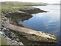
Broch in Isle of Lewis
This Iron Age structure is more likely to be a broch than a dun. Remains of the wall (15 m in diameter) are located on a promontory.
Read More at ScotlandsPlaces.
You may be viewing yesterday's version of this page. To see the most up to date information please register for a free account.
Do not use the above information on other web sites or publications without permission of the contributor.
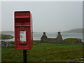
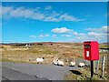
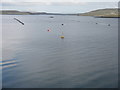
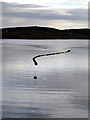
Nearby Images from Geograph Britain and Ireland:
©2013(licence)
©2024(licence)
©2016(licence)
©2015(licence)
©2016(licence)
The above images may not be of the site on this page, they are loaded from Geograph.
Please Submit an Image of this site or go out and take one for us!
Click here to see more info for this site
Nearby sites
Key: Red: member's photo, Blue: 3rd party photo, Yellow: other image, Green: no photo - please go there and take one, Grey: site destroyed
Download sites to:
KML (Google Earth)
GPX (GPS waypoints)
CSV (Garmin/Navman)
CSV (Excel)
To unlock full downloads you need to sign up as a Contributory Member. Otherwise downloads are limited to 50 sites.
Turn off the page maps and other distractions
Nearby sites listing. In the following links * = Image available
86m SW 230° Barraglom Cup-Marked Rock Rock Art (NB167343)
365m WSW 248° Callanish 8* Stone Circle (NB16423424)
441m SSW 213° Callanish 8A* Standing Stone (Menhir) (NB165340)
938m ENE 77° Callanish 15* Standing Stone (Menhir) (NB177345)
1.7km NW 312° Dun Baravat* Stone Fort or Dun (NB1559835563)
4.5km ENE 71° Cnoc a Phrionnsa* Chambered Cairn (NB211355)
4.5km E 93° Callanish 16* Standing Stone (Menhir) (NB213338)
4.7km ESE 102° Callanish I* Stone Circle (NB2128633009)
4.7km ESE 102° Callanish* Stone Circle (NB2129833013)
4.7km E 89° Callanish 13* Standing Stones (NB215341)
4.8km ENE 79° Callanish 12* Standing Stone (Menhir) (NB2155634967)
5.0km E 82° Olcote Kerbed Cairn* Cairn (NB2179634733)
5.2km E 100° Callanish 19* Stone Circle (NB218331)
5.6km ENE 72° Callanish 11* Standing Stone (Menhir) (NB22233569)
5.7km NW 323° Carnan Gibegeo Propped Stone CG1* Rock Outcrop (NB13653911)
5.7km ESE 104° Callanish 2* Stone Circle (NB2221432614)
5.7km NW 323° Carnan Gibegeo Propped Stone CG2* Rock Outcrop (NB13653913)
5.7km ESE 105° Loch Roag Timber Circle (NB222325)
5.8km NW 325° Carnan Gibegeo Propped Stone CG4* Rock Outcrop (NB13843932)
5.8km NW 325° Carnan Gibegeo Propped Stone CG3* Rock Outcrop (NB13833932)
5.9km NW 325° Stiogha Chnap Propped Stone SC1* Rock Outcrop (NB1371539472)
6.0km ESE 102° Callanish 3* Stone Circle (NB2251532710)
6.0km NW 325° Stiogha Chnap Propped Stone SC2* Rock Outcrop (NB13703947)
6.2km E 99° Callanish 14* Standing Stone (Menhir) (NB228329)
6.2km E 93° Callanish 10* Stone Circle (NB22973362)
View more nearby sites and additional images


 We would like to know more about this location. Please feel free to add a brief description and any relevant information in your own language.
 Wir möchten mehr über diese Stätte erfahren. Bitte zögern Sie nicht, eine kurze Beschreibung und relevante Informationen in Deutsch hinzuzufügen.
 Nous aimerions en savoir encore un peu sur les lieux. S'il vous plaît n'hesitez pas à ajouter une courte description et tous les renseignements pertinents dans votre propre langue.
 Quisieramos informarnos un poco más de las lugares. No dude en añadir una breve descripción y otros datos relevantes en su propio idioma.