<< Our Photo Pages >> Callanish 8 - Stone Circle in Scotland in Isle of Lewis
Submitted by Gerald_Ponting on Tuesday, 17 April 2001 Page Views: 16107
Neolithic and Bronze AgeSite Name: Callanish 8 Alternative Name: Cleitir, Callanish VIIICountry: Scotland
NOTE: This site is 0.2 km away from the location you searched for.
County: Isle of Lewis Type: Stone Circle
Nearest Town: Stornoway Nearest Village: Callanish
Map Ref: NB16423424 Landranger Map Number: 13
Latitude: 58.205409N Longitude: 6.829318W
Condition:
| 5 | Perfect |
| 4 | Almost Perfect |
| 3 | Reasonable but with some damage |
| 2 | Ruined but still recognisable as an ancient site |
| 1 | Pretty much destroyed, possibly visible as crop marks |
| 0 | No data. |
| -1 | Completely destroyed |
| 5 | Superb |
| 4 | Good |
| 3 | Ordinary |
| 2 | Not Good |
| 1 | Awful |
| 0 | No data. |
| 5 | Can be driven to, probably with disabled access |
| 4 | Short walk on a footpath |
| 3 | Requiring a bit more of a walk |
| 2 | A long walk |
| 1 | In the middle of nowhere, a nightmare to find |
| 0 | No data. |
| 5 | co-ordinates taken by GPS or official recorded co-ordinates |
| 4 | co-ordinates scaled from a detailed map |
| 3 | co-ordinates scaled from a bad map |
| 2 | co-ordinates of the nearest village |
| 1 | co-ordinates of the nearest town |
| 0 | no data |
Internal Links:
External Links:
I have visited· I would like to visit
bishop_pam visited on 8th Sep 2024 - their rating: Cond: 5 Amb: 5 Access: 4
drolaf visited on 28th May 2024 - their rating: Cond: 3 Amb: 4 Access: 4
kateperring visited on 23rd Sep 2020 - their rating: Cond: 3 Amb: 5 Access: 4 Visited on a sparkling bright and warm day in September 2020, when Scotland had opened a small window for tourism. I was the only soul around for miles with no sound but the industrious insects buzzing about their business. An exquisitely serene site, the views alone are worth the little clamber, but the semi circle itself has become my absolute favourite ancient site for ambience and unknowability...i spent a blissful couple of hours wandering from stone to stone,sitting, thinking and looking...just pondering the hows whys and why nots of the construction......just here, so high and so deliberately halved by the cliff.
madmark23 visited on 3rd Jul 2017 - their rating: Cond: 3 Amb: 5 Access: 4
rrmoser visited on 27th Jun 2017 - their rating: Cond: 4 Amb: 5 Access: 4
markhewins visited on 1st Jul 2016 The old man of the Loch
MUSIC & DOCUMENT:
https://www.facebook.com/markhewins/videos/10155071540154488/
SandyG visited on 8th Sep 2014 - their rating: Cond: 3 Amb: 5 Access: 4
markj99 visited on 3rd Jul 2011 - their rating: Cond: 3 Amb: 4 Access: 4 Callanish 8 "stone semi-circle" is one of the most unusual megalithic site I have visited. It is a must visit if you are in the area.
BolshieBoris visited on 1st Jul 2004 - their rating: Cond: 3 Amb: 4 Access: 4
jeffrep tom_bullock have visited here
Average ratings for this site from all visit loggers: Condition: 3.38 Ambience: 4.63 Access: 4

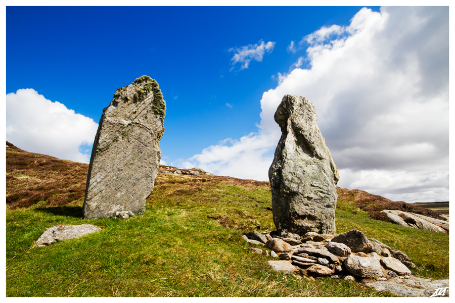
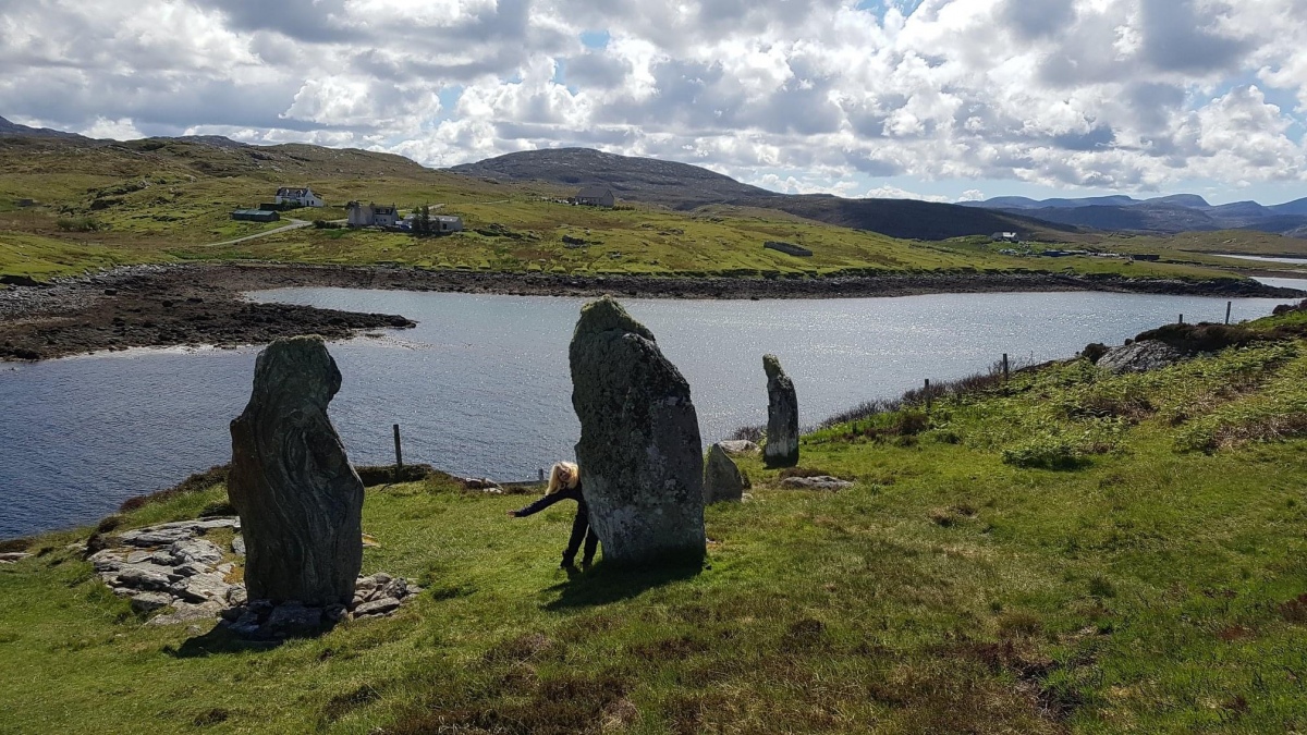
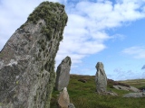
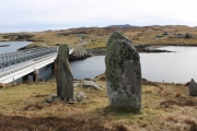
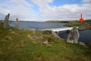
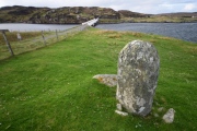
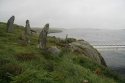
Cleitir is a fascinating site which has no parallel elsewhere in the British Isles. It may be called a "stone circle" but actually it is a semi-circle in an unique position. J.G.Callandar described it well; "Occupying a very unusual position on a steep rocky slope ending in a cliff, which rises sheer some 40 feet out of the water at the narrow strait ... on the south shore ot Great Bernera ... are three standing stones and a prostrate pillar stone."
On a calm winter's day, when the sun is low over the Narrows, an uncanny experience can occur at the site. As one walks between a tall megalith and the water, a distinct double shadow is cast on the stone. One shadow is produced by the sun, the other by the sun's brilliant reflection in the water.
As Somerville pointed out, the diameter of the semi-circle is formed by the sheer cliff face. There is no evidence that the cliff subsided and took half a stone circle with it. The shape and position of the site seem to have been chosen deliberately.
Of three published plans, Somerville's is the most complete. Thom's sketch omitted the fallen stone while the Glasgow Survey omitted the cliff face and the easternmost, three feet tall stone, now between the fence and the cliff (The other two erect stones stand 7ft and 9ft tall.)
The site is not a "Guardianship site", so it receives scant official protection. (The only minor sites which are in Guardianship are II, III and IV. 5 During the 1970s and early '80s the site was disturbed in several ways. A pair of poles was erected for Electricity cables. Bedrock was blasted to lay a water main through the middle of the site. A stock proof fence was erected through the area. A workman on one of these projects later stated that he regretted that, while he had had a JCB on site, he had not re-erected the fallen stone! I believe it is important that this site should be taken into Guardianship and the disfigurements corrected.
It is a matter of opinion whether or not Cleitir should be considered as part of the Callanish Complex. It was first labelled as "Callanish VIII" by the Glasgow geographers. Thom had stated that the site was not "so far as is known "intervisibie with any of the Callanish sites. In fact, Callanish VI can be seen, about nine kilometres away, though a practised eye may be needed.
Somerville and Thorn both linked this site with hill top boulders and cairns visible on the horizon, though these are now considered dubious astronomical markers.
In "Decoding the Callanish Complex...", Margaret and I pointed out two interesting astronomical connections. The flat face of the most westerly stone indicates one of the Dig mountains, forming a rough indication of moonset at the southern extreme of the minor standstill.
Subjectively, we felt that the position of the site demanded observation of the southern horizon; two of Somerville's boulders are placed at almost due south. Therefore we prepared a horizon profile, with interesting results. When taking its most southerly path (major standstill) the moon never fully rose. Indeed, under some circumstances, it would remain below the horizon for its full transit. However, at minimum perturbation (one extreme of the "wobble" in the moon's orbit) the moon just peeps over the horizon for a short time.
In a fanciful moment, one cannot help wondering if a semi-circular site was deliberately constructed for observation of the half-risen moon. The whole of the moon could have been seen merely by moving a short distance up the slope behind the site.
The rise of the same moon can be observed from site XV, only a short, distance away - and may have acted as a "warning" for the transit at site VIII
ACCESS: Starting from the north (Bernera) end of the Bernera Bridge, go up the rough path which starts by the roadside and through the gate. Beware of children straying near the cliff edge. (Visible from middle of bridge.)
Text taken from "The Stones around Callanish" by Gerald Ponting and Margaret Ponting (now Margaret Curtis).
http://home.clara.net/gponting/
Canmore site no. 4112.
You may be viewing yesterday's version of this page. To see the most up to date information please register for a free account.










These are just the first 25 photos of Callanish 8. If you log in with a free user account you will be able to see our entire collection.
Do not use the above information on other web sites or publications without permission of the contributor.
Click here to see more info for this site
Nearby sites
Key: Red: member's photo, Blue: 3rd party photo, Yellow: other image, Green: no photo - please go there and take one, Grey: site destroyed
Download sites to:
KML (Google Earth)
GPX (GPS waypoints)
CSV (Garmin/Navman)
CSV (Excel)
To unlock full downloads you need to sign up as a Contributory Member. Otherwise downloads are limited to 50 sites.
Turn off the page maps and other distractions
Nearby sites listing. In the following links * = Image available
252m SSE 157° Callanish 8A* Standing Stone (Menhir) (NB165340)
285m ENE 74° Barraglom Cup-Marked Rock Rock Art (NB167343)
365m ENE 68° Dun Barraglom Broch or Nuraghe (NB16773435)
1.3km ENE 74° Callanish 15* Standing Stone (Menhir) (NB177345)
1.6km NW 324° Dun Baravat* Stone Fort or Dun (NB1559835563)
3.9km N 10° Eilean Mor Standing Stone (Menhir) (NB1736138041)
4.8km ENE 71° Cnoc a Phrionnsa* Chambered Cairn (NB211355)
4.9km E 91° Callanish 16* Standing Stone (Menhir) (NB213338)
5.0km E 100° Callanish I* Stone Circle (NB2128633009)
5.0km E 100° Callanish* Stone Circle (NB2129833013)
5.1km E 87° Callanish 13* Standing Stones (NB215341)
5.2km ENE 78° Callanish 12* Standing Stone (Menhir) (NB2155634967)
5.4km E 81° Olcote Kerbed Cairn* Cairn (NB2179634733)
5.5km E 98° Callanish 19* Stone Circle (NB218331)
5.5km E 86° Breasclete Park Stone Circle (NB21923426)
5.6km NNW 326° Carnan Gibegeo Propped Stone CG1* Rock Outcrop (NB13653911)
5.6km NNW 326° Carnan Gibegeo Propped Stone CG2* Rock Outcrop (NB13653913)
5.7km NNW 329° Carnan Gibegeo Propped Stone CG4* Rock Outcrop (NB13843932)
5.7km NNW 329° Carnan Gibegeo Propped Stone CG3* Rock Outcrop (NB13833932)
5.8km E 80° Cnoc Gearraidh Nighean Choinnich Stone Circle (NB22183484)
5.9km NNW 329° Stiogha Chnap Propped Stone SC1* Rock Outcrop (NB1371539472)
5.9km NNW 328° Stiogha Chnap Propped Stone SC2* Rock Outcrop (NB13703947)
6.0km ENE 72° Callanish 11* Standing Stone (Menhir) (NB22233569)
6.0km ESE 102° Callanish 2* Stone Circle (NB2221432614)
6.0km ESE 103° Loch Roag Timber Circle (NB222325)
View more nearby sites and additional images


 We would like to know more about this location. Please feel free to add a brief description and any relevant information in your own language.
 Wir möchten mehr über diese Stätte erfahren. Bitte zögern Sie nicht, eine kurze Beschreibung und relevante Informationen in Deutsch hinzuzufügen.
 Nous aimerions en savoir encore un peu sur les lieux. S'il vous plaît n'hesitez pas à ajouter une courte description et tous les renseignements pertinents dans votre propre langue.
 Quisieramos informarnos un poco más de las lugares. No dude en añadir una breve descripción y otros datos relevantes en su propio idioma.