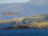
<< Our Photo Pages >> Clach Mhic Leoid - Standing Stone (Menhir) in Scotland in Isle of Harris
Submitted by Anonymous on Friday, 13 February 2004 Page Views: 22750
Neolithic and Bronze AgeSite Name: Clach Mhic Leoid Alternative Name: MacLeod's Stone, NisabostCountry: Scotland County: Isle of Harris Type: Standing Stone (Menhir)
Nearest Town: Tarbert Nearest Village: Horgabost
Map Ref: NG04109718 Landranger Map Number: 18
Latitude: 57.865732N Longitude: 6.991604W
Condition:
| 5 | Perfect |
| 4 | Almost Perfect |
| 3 | Reasonable but with some damage |
| 2 | Ruined but still recognisable as an ancient site |
| 1 | Pretty much destroyed, possibly visible as crop marks |
| 0 | No data. |
| -1 | Completely destroyed |
| 5 | Superb |
| 4 | Good |
| 3 | Ordinary |
| 2 | Not Good |
| 1 | Awful |
| 0 | No data. |
| 5 | Can be driven to, probably with disabled access |
| 4 | Short walk on a footpath |
| 3 | Requiring a bit more of a walk |
| 2 | A long walk |
| 1 | In the middle of nowhere, a nightmare to find |
| 0 | No data. |
| 5 | co-ordinates taken by GPS or official recorded co-ordinates |
| 4 | co-ordinates scaled from a detailed map |
| 3 | co-ordinates scaled from a bad map |
| 2 | co-ordinates of the nearest village |
| 1 | co-ordinates of the nearest town |
| 0 | no data |
Internal Links:
External Links:
I have visited· I would like to visit
43559959 SolarMegalith would like to visit
drolaf visited on 28th May 2024 - their rating: Cond: 4 Amb: 4 Access: 3 On a hill overlooking a pristine sandy beach. Stone. Aligns east west
rrmoser visited on 29th Jun 2017 - their rating: Cond: 4 Amb: 5 Access: 3
SandyG PAB tom_bullock have visited here
Average ratings for this site from all visit loggers: Condition: 4 Ambience: 4.5 Access: 3

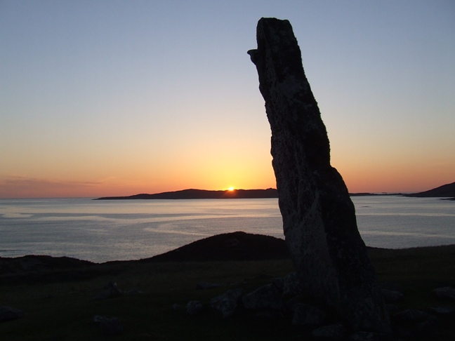
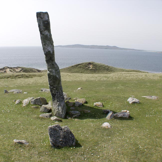
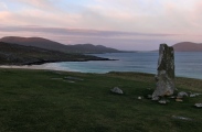
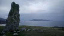
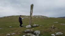
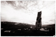
For more information see Canmore Site ID 10532, which, in a 1914 site visit, described this standing stone as: "a very fine standing stone 10' 6" in height, 4' 6" in breadth and from 10-16" in diameter. The base is packed with small boulders to a distance of from 3-4ft, while two slabs (over 3' long) are set on edge, at right angles to the face of the standing stone, and 8'6" distant from it, to the W."
A more recent visit in 1969 adds: "The other two slabs resemble the kerb stones of a cairn, and a large quantity of rubble stones around the standing stone, about 6.0m in diameter, suggest that there may have been a cairn here, but insufficient remains to be certain".
You may be viewing yesterday's version of this page. To see the most up to date information please register for a free account.





Do not use the above information on other web sites or publications without permission of the contributor.
Click here to see more info for this site
Nearby sites
Key: Red: member's photo, Blue: 3rd party photo, Yellow: other image, Green: no photo - please go there and take one, Grey: site destroyed
Download sites to:
KML (Google Earth)
GPX (GPS waypoints)
CSV (Garmin/Navman)
CSV (Excel)
To unlock full downloads you need to sign up as a Contributory Member. Otherwise downloads are limited to 50 sites.
Turn off the page maps and other distractions
Nearby sites listing. In the following links * = Image available
826m SE 128° Coire Na Feinne* Chambered Cairn (NG0471896628)
3.2km S 188° Dun Borve (nr Scarista)* Broch or Nuraghe (NG034940)
3.8km SSW 206° S46 Scarista* Stone Row / Alignment (NG0217793898)
3.9km SSW 208° Borvemore* Stone Row / Alignment (NG02029392)
4.6km NW 318° Clach An Teampuill (Taransay)* Standing Stone (Menhir) (NB01280077)
9.2km SW 226° Rubh' an Teampuill, Toe Head* Broch or Nuraghe (NF97019133)
9.2km SW 226° Harris, Rubh' An Teampuill* Rock Art (NF96969129)
10.5km SSW 201° Rubha Charnain* Rock Art (NF996877)
12.0km SSW 206° Ensay Rock Art (NF981868)
12.1km SSW 206° Taigh Easaigh Standing Stone Standing Stone (Menhir) (NF9804186677)
12.1km S 186° Dun Innisgall Stone Fort or Dun (NG01948521)
13.9km S 172° Dun Rodil Broch or Nuraghe (NG05018330)
14.1km S 174° Roghadal (Rodel) Stone Circle (NG045831)
16.3km NNW 346° Loch Crabhadail* Ancient Village or Settlement (NB01401333)
17.1km WSW 246° Bhruist (Shillay) Stone Circle (NF880913)
17.8km SW 231° Bailenacille Cairn Cairn (NF8932087100)
18.5km SW 215° Bhruist Stone Circle* Stone Circle (NF92418279)
19.3km SSW 213° Cnoc na Greana* Stone Row / Alignment (NF9230781876)
20.5km SW 216° Sgalabraig* Souterrain (Fogou, Earth House) (NF90718153)
20.9km SSW 214° Cladh Maolrithe* Standing Stone (Menhir) (NF91218068)
22.6km N 353° Aird Sleitenish Stone Circle (NB031198)
23.9km SW 214° Port nan Long Souterrain (Fogou, Earth House) (NF892784)
23.9km SSW 214° Crois Mhic Jamain* Stone Row / Alignment (NF89397820)
24.2km SSW 212° Dun an Sticir* Broch or Nuraghe (NF897776)
24.5km SSW 211° Beinn A Chaolais Stone Circle (NF900770)
View more nearby sites and additional images


 We would like to know more about this location. Please feel free to add a brief description and any relevant information in your own language.
 Wir möchten mehr über diese Stätte erfahren. Bitte zögern Sie nicht, eine kurze Beschreibung und relevante Informationen in Deutsch hinzuzufügen.
 Nous aimerions en savoir encore un peu sur les lieux. S'il vous plaît n'hesitez pas à ajouter une courte description et tous les renseignements pertinents dans votre propre langue.
 Quisieramos informarnos un poco más de las lugares. No dude en añadir una breve descripción y otros datos relevantes en su propio idioma.