


<< Text Pages >> Port nan Long - Souterrain (Fogou, Earth House) in Scotland in North Uist
Submitted by Andy B on Friday, 08 September 2006 Page Views: 11979
Iron Age and Later PrehistorySite Name: Port nan LongCountry: Scotland County: North Uist Type: Souterrain (Fogou, Earth House)
Nearest Village: Newtonferry
Map Ref: NF892784
Latitude: 57.687643N Longitude: 7.217354W
Condition:
| 5 | Perfect |
| 4 | Almost Perfect |
| 3 | Reasonable but with some damage |
| 2 | Ruined but still recognisable as an ancient site |
| 1 | Pretty much destroyed, possibly visible as crop marks |
| 0 | No data. |
| -1 | Completely destroyed |
| 5 | Superb |
| 4 | Good |
| 3 | Ordinary |
| 2 | Not Good |
| 1 | Awful |
| 0 | No data. |
| 5 | Can be driven to, probably with disabled access |
| 4 | Short walk on a footpath |
| 3 | Requiring a bit more of a walk |
| 2 | A long walk |
| 1 | In the middle of nowhere, a nightmare to find |
| 0 | No data. |
| 5 | co-ordinates taken by GPS or official recorded co-ordinates |
| 4 | co-ordinates scaled from a detailed map |
| 3 | co-ordinates scaled from a bad map |
| 2 | co-ordinates of the nearest village |
| 1 | co-ordinates of the nearest town |
| 0 | no data |
Be the first person to rate this site - see the 'Contribute!' box in the right hand menu.
Internal Links:
External Links:
Souterrain in North Uist. An underground chamber undisturbed since the Iron Age was revealed on North Uist when a 10ft hole opened beneath the wheel of a tractor. Archaeologists assessed the find at Port nan Long at the north of the island, which has been sealed off from the public.
Archaeologists assessed the find at Port nan Long at the north of the island, which has been sealed off from the public. Dr Mary MacLeod, Western Isles Council's archaeologist, was delighted to declare the hole an Iron Age souterrain, or underground chamber.
She said: "It is particularly exciting because it is so well preserved. "It has lain undisturbed for 2000 years. I think there has been a very large pre-historic settlement on this site, possibly over thousands of years."
The souterrain is an oval structure over three metres in diameter, the top of it lying just under a metre below the surface. The passage leading off it is less than a metre high. Dr Chris Barrowman, Historic Scotland's monument warden, said the configuration was typical of Iron Age souterrains. The archaeologists agreed that the passage was likely to lead to a house, possibly a wheelhouse – a circular drystone building with a single entrance divided by a number of stone piers arranged like the spokes of a wheel leading to a central room.
Kate MacDonald, a Sheffield University archaeologist based at South Uist, climbed inside the souterrain and entered the passage leading off it. She carried out a visual assessment of the site and took photographs, measurements and GPS readings.
She found cattle bones showing butcher marks, some inserted into cavities in the wall. An intact lamb's skull was discovered at the back of the chamber. "Bones held a lot of significance for Iron Age people, but it's impossible to guess at this stage why the bones were placed like that. The souterrain itself is still a mystery. If it was a food store, why the tiny passage leading to it? Did some kind of ritual go on here?"
Souterrains are normally found along the Atlantic seaboard of Scotland, Brittany, Cornwall, and Ireland. Most of the 57 known in the Western Isles were uncovered in the 19th century. The most recent was found in the 1970s during road-building near Gress in Lewis.
More: The Herald
Note: Iron Age chamber found under tractor
You may be viewing yesterday's version of this page. To see the most up to date information please register for a free account.
Do not use the above information on other web sites or publications without permission of the contributor.
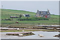
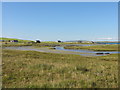
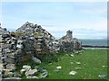
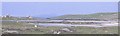
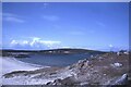
Nearby Images from Geograph Britain and Ireland:
©2013(licence)
©2013(licence)
©2006(licence)
©2006(licence)
©2021(licence)
The above images may not be of the site on this page, they are loaded from Geograph.
Please Submit an Image of this site or go out and take one for us!
Click here to see more info for this site
Nearby sites
Key: Red: member's photo, Blue: 3rd party photo, Yellow: other image, Green: no photo - please go there and take one, Grey: site destroyed
Download sites to:
KML (Google Earth)
GPX (GPS waypoints)
CSV (Garmin/Navman)
CSV (Excel)
To unlock full downloads you need to sign up as a Contributory Member. Otherwise downloads are limited to 50 sites.
Turn off the page maps and other distractions
Nearby sites listing. In the following links * = Image available
275m SE 132° Crois Mhic Jamain* Stone Row / Alignment (NF89397820)
941m SE 144° Dun an Sticir* Broch or Nuraghe (NF897776)
1.3km S 187° Baile Mhic' Phàil Stone Setting* Cairn (NF88937711)
1.6km SE 146° Beinn A Chaolais Stone Circle (NF900770)
2.8km SSW 205° Dun Rosail Stone Fort or Dun (NF87837595)
3.0km NE 37° Cladh Maolrithe* Standing Stone (Menhir) (NF91218068)
3.5km NNE 21° Sgalabraig* Souterrain (Fogou, Earth House) (NF90718153)
4.0km SW 219° Druim na h-Uamha earth house* Souterrain (Fogou, Earth House) (NF86457546)
4.6km NE 37° Cnoc na Greana* Stone Row / Alignment (NF9230781876)
4.7km S 179° Dun Torcuill Stone Fort or Dun (NF8888573730)
5.4km NNE 32° Bhruist Stone Circle* Stone Circle (NF92418279)
6.2km SSW 203° Maari Standing Stone (Menhir) (NF864729)
6.7km S 180° Na Fir Bhreige* Standing Stones (NF8873671734)
6.8km W 264° Udal (Grenitote)* Ancient Village or Settlement (NF82387822)
7.2km SSW 205° Barpa nam Feannag* Chambered Cairn (NF85687204)
7.9km WSW 240° Dun Toloman Stone Fort or Dun (NF82077492)
8.6km SSW 202° Skeal Traval* Stone Row / Alignment (NF8538370672)
9.0km WSW 244° Dun Skellor Broch or Nuraghe (NF80757507)
9.6km WSW 247° Sollas, Machair Leathann Ancient Village or Settlement (NF80117533)
10.0km ESE 117° Dun Mhic Laitheann Stone Fort or Dun (NF9778873187)
10.3km WSW 255° Leac nan Cailleacha Dubha Standing Stones (NF79087650)
10.6km SSW 209° Tigh Cloiche Chambered Cairn* Chambered Cairn (NF83316958)
10.6km SSE 160° Taigh Chearsabhagh Museum and Arts Centre Museum (NF920681)
10.7km SSW 209° Tigh Cloiche Standing Stone* Standing Stone (Menhir) (NF83246953)
10.8km SSE 165° Dun Leiravay Stone Fort or Dun (NF91266778)
View more nearby sites and additional images


 We would like to know more about this location. Please feel free to add a brief description and any relevant information in your own language.
 Wir möchten mehr über diese Stätte erfahren. Bitte zögern Sie nicht, eine kurze Beschreibung und relevante Informationen in Deutsch hinzuzufügen.
 Nous aimerions en savoir encore un peu sur les lieux. S'il vous plaît n'hesitez pas à ajouter une courte description et tous les renseignements pertinents dans votre propre langue.
 Quisieramos informarnos un poco más de las lugares. No dude en añadir una breve descripción y otros datos relevantes en su propio idioma.