<< Our Photo Pages >> Dun Ibrig - Stone Fort or Dun in Scotland in Isle of Tiree
Submitted by markj99 on Friday, 09 October 2020 Page Views: 594
Iron Age and Later PrehistorySite Name: Dun IbrigCountry: Scotland County: Isle of Tiree Type: Stone Fort or Dun
Nearest Village: Scarinish
Map Ref: NM02594440
Latitude: 56.497383N Longitude: 6.834575W
Condition:
| 5 | Perfect |
| 4 | Almost Perfect |
| 3 | Reasonable but with some damage |
| 2 | Ruined but still recognisable as an ancient site |
| 1 | Pretty much destroyed, possibly visible as crop marks |
| 0 | No data. |
| -1 | Completely destroyed |
| 5 | Superb |
| 4 | Good |
| 3 | Ordinary |
| 2 | Not Good |
| 1 | Awful |
| 0 | No data. |
| 5 | Can be driven to, probably with disabled access |
| 4 | Short walk on a footpath |
| 3 | Requiring a bit more of a walk |
| 2 | A long walk |
| 1 | In the middle of nowhere, a nightmare to find |
| 0 | No data. |
| 5 | co-ordinates taken by GPS or official recorded co-ordinates |
| 4 | co-ordinates scaled from a detailed map |
| 3 | co-ordinates scaled from a bad map |
| 2 | co-ordinates of the nearest village |
| 1 | co-ordinates of the nearest town |
| 0 | no data |
Internal Links:
External Links:
I have visited· I would like to visit
markj99 visited on 29th Aug 2018 - their rating: Cond: 2 Amb: 4 Access: 3 It is ironic that Dun Ibrig is so close to civilisation (Scarinish) and so difficult to access. On my visit the marshland approach was waterlogged and Dun Ibrig was surrounded by a moat of deep water.
")
Dun Ibrig lies 1 mile W of Scarinish, the largest community on Tiree. The site may be a ruined broch or a dun according to Canmore ID 21533.
The Broch/Dun is situated on a virtual island surrounded by very boggy marshland leading up to a circle of water. I made my way carefully to the edge of the dun but the water was too deep to proceed further. I did get to see the outer stone wall surrounding large stones in the centre.
From Scarinish head W and take the 1st R after 1.5 miles. After 400 yards park up and head due E into the bog. Maybe Dun Ibrig will be accessible in a dry summer or frozen winter.
You may be viewing yesterday's version of this page. To see the most up to date information please register for a free account.
")
")
Do not use the above information on other web sites or publications without permission of the contributor.
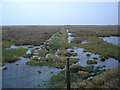
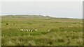
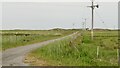
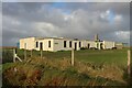
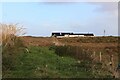
Nearby Images from Geograph Britain and Ireland:
©2007(licence)
©2023(licence)
©2023(licence)
©2023(licence)
©2023(licence)
The above images may not be of the site on this page, they are loaded from Geograph.
Please Submit an Image of this site or go out and take one for us!
Click here to see more info for this site
Nearby sites
Key: Red: member's photo, Blue: 3rd party photo, Yellow: other image, Green: no photo - please go there and take one, Grey: site destroyed
Download sites to:
KML (Google Earth)
GPX (GPS waypoints)
CSV (Garmin/Navman)
CSV (Excel)
To unlock full downloads you need to sign up as a Contributory Member. Otherwise downloads are limited to 50 sites.
Turn off the page maps and other distractions
Nearby sites listing. In the following links * = Image available
725m NNE 30° Loch A' Bhleoghan* Stone Circle (NM030450)
1.2km NNW 347° Loch A Chapuil* Stone Circle (NM024456)
1.4km NE 41° Beinn Ghott* Cairn (NM03594540)
1.6km ESE 123° Dun Heanish* Stone Fort or Dun (NM039434)
2.4km NE 53° Dun Ghott* Stone Fort or Dun (NM04584567)
3.7km WNW 285° Kenovay Cup-Marked Rocks Rock Art (NL99064560)
4.3km N 357° Tiree Ringing Rock* Natural Stone / Erratic / Other Natural Feature (NM02684869)
5.1km NNE 15° Dun Mor Vaul* Broch or Nuraghe (NM04234927)
5.3km NNE 19° Dun Beag (Vaul)* Stone Fort or Dun (NM04634926)
5.6km WSW 247° Ceasabh Standing stone* Standing Stone (Menhir) (NL97314259)
5.7km SW 233° Cadruim* Rock Art (NL9782241299)
6.5km NE 48° Caolas Standing Stone* Standing Stone (Menhir) (NM07744835)
6.6km ENE 57° Dun Mor A'Chaolais* Broch or Nuraghe (NM084476)
6.7km W 272° Hough - NNE* Stone Circle (NL95894515)
6.8km W 271° Hough Cairn* Cairn (NL95834505)
6.8km W 271° Hough - SSW* Stone Circle (NL95814504)
7.8km SW 217° Dun Na Cleite* Stone Fort or Dun (NL97403850)
8.0km WSW 256° Middleton Standing Stone (Isle of Tiree)* Standing Stone (Menhir) (NL94694300)
8.2km SW 235° Dunan Nighean* Stone Fort or Dun (NL95594014)
8.2km WNW 289° Dun Boraige Beag* Stone Fort or Dun (NL94944757)
8.3km SW 224° Dun Hiader* Stone Fort or Dun (NL964389)
8.5km WNW 288° Dun Boraige Moire* Broch or Nuraghe (NL94684756)
8.7km W 267° Kilkenneth Cairn* Cairn (NL939445)
15.4km NE 51° Traigh Chrossapol Standing Stone (Menhir) (NM1518853301)
18.2km NE 46° Totronald* Standing Stones (NM1666455985)
View more nearby sites and additional images


 We would like to know more about this location. Please feel free to add a brief description and any relevant information in your own language.
 Wir möchten mehr über diese Stätte erfahren. Bitte zögern Sie nicht, eine kurze Beschreibung und relevante Informationen in Deutsch hinzuzufügen.
 Nous aimerions en savoir encore un peu sur les lieux. S'il vous plaît n'hesitez pas à ajouter une courte description et tous les renseignements pertinents dans votre propre langue.
 Quisieramos informarnos un poco más de las lugares. No dude en añadir una breve descripción y otros datos relevantes en su propio idioma.