<< Text Pages >> Nisbet 2 - Sculptured Stone in Scotland in Scottish Borders
Submitted by alligator on Monday, 24 March 2003 Page Views: 4072
Multi-periodSite Name: Nisbet 2Country: Scotland County: Scottish Borders Type: Sculptured Stone
Map Ref: NT67322572 Landranger Map Number: 74
Latitude: 55.524121N Longitude: 2.51919W
Condition:
| 5 | Perfect |
| 4 | Almost Perfect |
| 3 | Reasonable but with some damage |
| 2 | Ruined but still recognisable as an ancient site |
| 1 | Pretty much destroyed, possibly visible as crop marks |
| 0 | No data. |
| -1 | Completely destroyed |
| 5 | Superb |
| 4 | Good |
| 3 | Ordinary |
| 2 | Not Good |
| 1 | Awful |
| 0 | No data. |
| 5 | Can be driven to, probably with disabled access |
| 4 | Short walk on a footpath |
| 3 | Requiring a bit more of a walk |
| 2 | A long walk |
| 1 | In the middle of nowhere, a nightmare to find |
| 0 | No data. |
| 5 | co-ordinates taken by GPS or official recorded co-ordinates |
| 4 | co-ordinates scaled from a detailed map |
| 3 | co-ordinates scaled from a bad map |
| 2 | co-ordinates of the nearest village |
| 1 | co-ordinates of the nearest town |
| 0 | no data |
Internal Links:
External Links:
Sculptured Stone
Have you visited this site, please add a photo or leave a comment below if you have any information.
You may be viewing yesterday's version of this page. To see the most up to date information please register for a free account.
Do not use the above information on other web sites or publications without permission of the contributor.
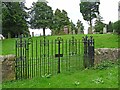
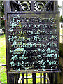
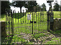
Nearby Images from Geograph Britain and Ireland:
©2012(licence)
©2008(licence)
©2008(licence)
©2023(licence)
©2008(licence)
The above images may not be of the site on this page, they are loaded from Geograph.
Please Submit an Image of this site or go out and take one for us!
Click here to see more info for this site
Nearby sites
Key: Red: member's photo, Blue: 3rd party photo, Yellow: other image, Green: no photo - please go there and take one, Grey: site destroyed
Download sites to:
KML (Google Earth)
GPX (GPS waypoints)
CSV (Garmin/Navman)
CSV (Excel)
To unlock full downloads you need to sign up as a Contributory Member. Otherwise downloads are limited to 50 sites.
Turn off the page maps and other distractions
Nearby sites listing. In the following links * = Image available
1.8km SE 125° Crailing Cross* Ancient Cross (NT6879724676)
2.8km WSW 258° Woodside (Crailing) Standing Stone (Menhir) (NT64552517)
2.8km NNW 347° Fairnington Stone Circle (NT667285)
3.6km WSW 241° Harestanes (Ancrum) Stone Circle (NT641240)
3.7km WSW 242° Harestanes (Ancrum) Stone Circle (NT640240)
3.9km W 274° Harrietsfield Standing Stone (Menhir) (NT63442599)
5.0km W 260° Castle Hill (Ancrum)* Hillfort (NT6239424909)
5.0km ENE 77° Haughhead Kip (Eckford)* Sculptured Stone (NT72212683)
5.2km W 260° Ancrum Old Church* Sculptured Stone (NT6215024885)
5.7km N 360° The Law (Scottish Borders) Artificial Mound (NT6735831447)
5.8km SSW 202° Jedburgh Rock Art Rock Art (NT651204)
5.8km SSW 203° Jedburgh Ancient Christian Stones* Ancient Cross (NT65052038)
7.5km NW 306° Maxton Burgh (St Boswells)* Ancient Cross (NT61333020)
8.1km NW 305° Hier Well (Benrig)* Holy Well or Sacred Spring (NT60703042)
8.2km NW 305° St Boswell's Old Church* Ancient Cross (NT6063730533)
8.4km NW 316° Mertoun Kirk (St Boswells)* Sculptured Stone (NT6155231821)
8.4km NW 307° Crystal Well (Benrig)* Holy Well or Sacred Spring (NT6064030847)
9.8km SSW 201° Gilliestongues Promontory Fort / Cliff Castle (NT63721659)
10.4km NW 311° Font Stone (Dryburgh)* Ancient Cross (NT59543258)
10.6km ENE 70° Frogden Stone Circle (NT77372922)
10.7km SW 223° Bedrule Parish Church* Sculptured Stone (NT5992217925)
10.8km SW 226° Fast Castle (Bedrule)* Misc. Earthwork (NT59531822)
11.0km SW 225° Bedrule Sculptured Stone (NT59501793)
11.6km NNW 332° Brothers' Stones* Standing Stones (NT61903600)
11.7km NNW 333° Cow Stone (Scottish Borders)* Standing Stone (Menhir) (NT62163620)
View more nearby sites and additional images


 We would like to know more about this location. Please feel free to add a brief description and any relevant information in your own language.
 Wir möchten mehr über diese Stätte erfahren. Bitte zögern Sie nicht, eine kurze Beschreibung und relevante Informationen in Deutsch hinzuzufügen.
 Nous aimerions en savoir encore un peu sur les lieux. S'il vous plaît n'hesitez pas à ajouter une courte description et tous les renseignements pertinents dans votre propre langue.
 Quisieramos informarnos un poco más de las lugares. No dude en añadir una breve descripción y otros datos relevantes en su propio idioma.