<< Text Pages >> Dolmen de Monteil - Burial Chamber or Dolmen in France in Limousin:Haute-Vienne (87)
Submitted by TheCaptain on Saturday, 16 April 2005 Page Views: 3151
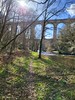
Neolithic and Bronze AgeSite Name: Dolmen de MonteilCountry: France Département: Limousin:Haute-Vienne (87) Type: Burial Chamber or Dolmen
Nearest Town: Limoges Nearest Village: Folles
Latitude: 46.113031N Longitude: 1.443578E
Condition:
| 5 | Perfect |
| 4 | Almost Perfect |
| 3 | Reasonable but with some damage |
| 2 | Ruined but still recognisable as an ancient site |
| 1 | Pretty much destroyed, possibly visible as crop marks |
| 0 | No data. |
| -1 | Completely destroyed |
| 5 | Superb |
| 4 | Good |
| 3 | Ordinary |
| 2 | Not Good |
| 1 | Awful |
| 0 | No data. |
| 5 | Can be driven to, probably with disabled access |
| 4 | Short walk on a footpath |
| 3 | Requiring a bit more of a walk |
| 2 | A long walk |
| 1 | In the middle of nowhere, a nightmare to find |
| 0 | No data. |
| 5 | co-ordinates taken by GPS or official recorded co-ordinates |
| 4 | co-ordinates scaled from a detailed map |
| 3 | co-ordinates scaled from a bad map |
| 2 | co-ordinates of the nearest village |
| 1 | co-ordinates of the nearest town |
| 0 | no data |
Be the first person to rate this site - see the 'Contribute!' box in the right hand menu.
Internal Links:
External Links:
Dolmen in Haute-Vienne
Location Source: T4T35.fr
You may be viewing yesterday's version of this page. To see the most up to date information please register for a free account.
Do not use the above information on other web sites or publications without permission of the contributor.
Nearby Images from Flickr
![[SNCF] BB 69480 (+BB 69448)](https://farm66.static.flickr.com/65535/53246211618_57f8cfb3a8_t.jpg)
The above images may not be of the site on this page, but were taken nearby. They are loaded from Flickr so please click on them for image credits.
Click here to see more info for this site
Nearby sites
Click here to view sites on an interactive map of the areaKey: Red: member's photo, Blue: 3rd party photo, Yellow: other image, Green: no photo - please go there and take one, Grey: site destroyed
Download sites to:
KML (Google Earth)
GPX (GPS waypoints)
CSV (Garmin/Navman)
CSV (Excel)
To unlock full downloads you need to sign up as a Contributory Member. Otherwise downloads are limited to 50 sites.
Turn off the page maps and other distractions
Nearby sites listing. In the following links * = Image available
1.2km ENE 74° Dolmen du Cluzeau* Burial Chamber or Dolmen
1.6km NW 309° Dolmen de Goudour* Burial Chamber or Dolmen
4.3km NNW 347° Menhir des Fichades* Standing Stone (Menhir)
4.7km N 351° Bagnol Dolmen* Burial Chamber or Dolmen
5.4km NNW 336° Menhir de Chanliat Standing Stone (Menhir)
6.4km ENE 58° Dolmen de Beauvais Burial Chamber or Dolmen
8.2km N 1° Menhir de la Faye Standing Stone (Menhir)
8.8km E 85° Pierre des Trois Filles 3 Burial Chamber or Dolmen
8.8km E 85° Pierre des Trois Filles 2 Burial Chamber or Dolmen
8.8km E 85° Pierre des Trois Filles 1 Burial Chamber or Dolmen
9.0km SSE 159° Oppidum du Maillorat Ancient Village or Settlement
9.2km NE 37° Dolmen de Chiroux* Burial Chamber or Dolmen
9.9km E 86° Dolmen des Quatre Routes* Burial Chamber or Dolmen
10.1km SW 215° Motte féodale de l'Age* Ancient Village or Settlement
10.4km NNW 344° La Bachellerie Dolmen* Burial Chamber or Dolmen
10.5km E 85° Dolmen de Bois Neuf 2* Burial Chamber or Dolmen
10.5km E 84° Dolmen de Bois Neuf 3* Burial Chamber or Dolmen
11.2km NE 50° Menhir de la Rebeyrolle* Standing Stone (Menhir)
12.8km NE 36° Pierre Folle de Saint-Priest-la-Feuille* Burial Chamber or Dolmen
12.8km N 354° La Jarrige tumuli Chambered Tomb
13.0km NNE 15° Borne de la Gerafie dite Menhir* Marker Stone
13.1km W 274° Pierre de l'Etrade Natural Stone / Erratic / Other Natural Feature
14.7km E 83° Dolmen dit l'Antre des Fades* Burial Chamber or Dolmen
16.2km ESE 106° Dolmen du Four des Fades 1* Burial Chamber or Dolmen
16.2km ESE 106° Dolmen du Four des Fades 2* Burial Chamber or Dolmen
View more nearby sites and additional images


 We would like to know more about this location. Please feel free to add a brief description and any relevant information in your own language.
 Wir möchten mehr über diese Stätte erfahren. Bitte zögern Sie nicht, eine kurze Beschreibung und relevante Informationen in Deutsch hinzuzufügen.
 Nous aimerions en savoir encore un peu sur les lieux. S'il vous plaît n'hesitez pas à ajouter une courte description et tous les renseignements pertinents dans votre propre langue.
 Quisieramos informarnos un poco más de las lugares. No dude en añadir una breve descripción y otros datos relevantes en su propio idioma.