

<< Our Photo Pages >> Su Angioni Nuraghe - Broch or Nuraghe in Italy in Sardinia (Sardegna)
Submitted by SolarMegalith on Monday, 15 August 2022 Page Views: 347
Neolithic and Bronze AgeSite Name: Su Angioni NuragheCountry: Italy Region: Sardinia (Sardegna) Type: Broch or Nuraghe
Nearest Village: Villaperuccio
Latitude: 39.131962N Longitude: 8.663345E
Condition:
| 5 | Perfect |
| 4 | Almost Perfect |
| 3 | Reasonable but with some damage |
| 2 | Ruined but still recognisable as an ancient site |
| 1 | Pretty much destroyed, possibly visible as crop marks |
| 0 | No data. |
| -1 | Completely destroyed |
| 5 | Superb |
| 4 | Good |
| 3 | Ordinary |
| 2 | Not Good |
| 1 | Awful |
| 0 | No data. |
| 5 | Can be driven to, probably with disabled access |
| 4 | Short walk on a footpath |
| 3 | Requiring a bit more of a walk |
| 2 | A long walk |
| 1 | In the middle of nowhere, a nightmare to find |
| 0 | No data. |
| 5 | co-ordinates taken by GPS or official recorded co-ordinates |
| 4 | co-ordinates scaled from a detailed map |
| 3 | co-ordinates scaled from a bad map |
| 2 | co-ordinates of the nearest village |
| 1 | co-ordinates of the nearest town |
| 0 | no data |
Internal Links:
External Links:
I have visited· I would like to visit
SolarMegalith visited on 5th May 2022 - their rating: Cond: 2 Amb: 4 Access: 4
")
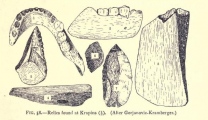
Nuraghe Su Angioni is a complex structure with partly preserved main tower and collapsed lateral towers. The monument is located west of the Neolithic necropolis of Montessu and can be reached by a footpath leading from the parking lot located below the rock-cut tombs.
You may be viewing yesterday's version of this page. To see the most up to date information please register for a free account.
")
")
")
Do not use the above information on other web sites or publications without permission of the contributor.
Nearby Images from Flickr


The above images may not be of the site on this page, but were taken nearby. They are loaded from Flickr so please click on them for image credits.
Click here to see more info for this site
Nearby sites
Click here to view sites on an interactive map of the areaKey: Red: member's photo, Blue: 3rd party photo, Yellow: other image, Green: no photo - please go there and take one, Grey: site destroyed
Download sites to:
KML (Google Earth)
GPX (GPS waypoints)
CSV (Garmin/Navman)
CSV (Excel)
To unlock full downloads you need to sign up as a Contributory Member. Otherwise downloads are limited to 50 sites.
Turn off the page maps and other distractions
Nearby sites listing. In the following links * = Image available
446m ENE 73° Montessu Necropolis* Rock Cut Tomb
582m E 83° Corona Sa Figu Nuraghe* Broch or Nuraghe
2.5km SSE 163° S'Arriorgiu Nuraghe* Broch or Nuraghe
2.8km S 179° Niedda Nuraghe Broch or Nuraghe
2.9km SSE 165° Is Pedras Crocadas Menhirs* Stone Row / Alignment
3.1km SSE 155° Is Pireddas Menhir* Standing Stone (Menhir)
3.1km S 170° Luxia Arrabiosa* Standing Stone (Menhir)
3.7km NW 325° Pesus Nuraghe* Broch or Nuraghe
4.3km WNW 296° Sa Idda Nuraghe* Broch or Nuraghe
4.5km SSE 162° Sanna Nuraghe* Broch or Nuraghe
4.9km ENE 69° Pranedda Domus de Janas* Rock Cut Tomb
5.1km SSE 154° Pani Loriga* Ancient Village or Settlement
5.2km ENE 70° Ega Is Marsinis Nuraghe* Broch or Nuraghe
6.1km S 187° Is Ulmus Nuraghe Broch or Nuraghe
6.5km WNW 300° Sitzia Nuraghe Broch or Nuraghe
6.6km E 93° Tattinu Villaggio Nuragico* Ancient Village or Settlement
6.7km E 92° Tattinu Pozzo Sacro* Holy Well or Sacred Spring
6.7km SSE 166° Corongiu Longus Nuraghe Broch or Nuraghe
8.4km WSW 251° Tratalias Nuraghe* Broch or Nuraghe
9.8km ESE 111° Barrancu Mannu Tomba di Giganti* Chambered Tomb
10.1km SE 128° Cirixi Nuraghe Broch or Nuraghe
10.4km SW 232° Monte di Palma Nuraghe Broch or Nuraghe
10.5km SW 234° Trullu Nuraghe Broch or Nuraghe
10.6km SSW 209° Cambulas Nuraghe Broch or Nuraghe
10.8km WSW 250° Candelargiu Nuraghe* Broch or Nuraghe
View more nearby sites and additional images


 We would like to know more about this location. Please feel free to add a brief description and any relevant information in your own language.
 Wir möchten mehr über diese Stätte erfahren. Bitte zögern Sie nicht, eine kurze Beschreibung und relevante Informationen in Deutsch hinzuzufügen.
 Nous aimerions en savoir encore un peu sur les lieux. S'il vous plaît n'hesitez pas à ajouter une courte description et tous les renseignements pertinents dans votre propre langue.
 Quisieramos informarnos un poco más de las lugares. No dude en añadir una breve descripción y otros datos relevantes en su propio idioma.