

<< Text Pages >> St Glassen's Well (Rerrick) - Holy Well or Sacred Spring in Scotland in Dumfries and Galloway
Submitted by Anne T on Monday, 27 June 2022 Page Views: 402
Springs and Holy WellsSite Name: St Glassen's Well (Rerrick)Country: Scotland County: Dumfries and Galloway Type: Holy Well or Sacred Spring
Nearest Town: Kirkcudbright Nearest Village: Rerrick / Dundrennan
Map Ref: NX75964691
Latitude: 54.801674N Longitude: 3.931162W
Condition:
| 5 | Perfect |
| 4 | Almost Perfect |
| 3 | Reasonable but with some damage |
| 2 | Ruined but still recognisable as an ancient site |
| 1 | Pretty much destroyed, possibly visible as crop marks |
| 0 | No data. |
| -1 | Completely destroyed |
| 5 | Superb |
| 4 | Good |
| 3 | Ordinary |
| 2 | Not Good |
| 1 | Awful |
| 0 | No data. |
| 5 | Can be driven to, probably with disabled access |
| 4 | Short walk on a footpath |
| 3 | Requiring a bit more of a walk |
| 2 | A long walk |
| 1 | In the middle of nowhere, a nightmare to find |
| 0 | No data. |
| 5 | co-ordinates taken by GPS or official recorded co-ordinates |
| 4 | co-ordinates scaled from a detailed map |
| 3 | co-ordinates scaled from a bad map |
| 2 | co-ordinates of the nearest village |
| 1 | co-ordinates of the nearest town |
| 0 | no data |
Be the first person to rate this site - see the 'Contribute!' box in the right hand menu.
Internal Links:
External Links:
Holy Well or Sacred Spring in Dumfries and Galloway
Classified as a holy well by Canmore - see their record for Site ID 64387 - 'St Glassen's Well', the 1926 entry of which reads: "This holy well comprises an irregularly-shaped hollow in the ground, filled with clear water, through which the masonry of the well may be seen. It is situated in a little recess by the roadside, screened on three sides by a tall hedge. McKerlie gives the dedication to St. Glassen, also called Maglastian, who is not mentioned by Watson (c/f St. Glass's Well Kinglassie".
Canmore added a further comment to their site record in 1971 which tells us: "This well is now encased by a 1.0m diameter glazed pipe, the exposed end of which is covered by a cast-iron lid. No further information".
The well is also described by the Can You Dig It: Lost Wells of Galloway (LWoG) project. The LWoG researcher, Kathy Keeling tells us: "St Glassen's Well sits along the roadside opposite the cottages known as Rerrick High Row and to the north of where the remains of Rerrick Church have been located. It first appears on the 1st edition Ordnance Survey 6-inch map of 1854 and continues to appear through to current mapping".
Kathy adds: "The Ordnance Survey name book ... describes it as 'an excellent spring well on the farm of Upper Rerrick and situated on the road side leading from Rerrick Church to Auchencairn. It is not known in the locality how it got the name, but presumably from some saint called Glassen".
The LWoG entry quotes from several other sources which give relevant information, including:
History of the Lands and their Owners in Galloway by P.H. M'Kerlie (1878): 'North of the parish church is Saint Glassen's Well. We do not find any church dedicated to such a saint but in Keith's lists of Scottish Saints there is MacGlastian, a bishop in Scotland in 814, whose festival day was the 30th January. .... In Butler's saints, we find Saint Glastian mentioned as a native of Fifeshire, who died at Kinglace in 830, and was particularly honoured there, as also in Kintyre. Bishop Forbes gives the same history, and of Kinglassie, near Kirkcaldy, but calls him Glascianus, thus Latinizing the name".
LWoG goes onto say "The Saints in Scottish Place Names website states: "The well is covered and lies at the side of the road running north from the site of Rerrick Old Church, at a distance of 185 metres. This kirk was originally a chapel ... given the dedication of the well, it may have been St Glassen's Chapel." They tell us the well is also recorded on the Dumfries and Galloway Historic Environment Record as MDG3976.
If anyone has visited this well (or its site) and has photographs, would you be kind enough to add them to this site page? Also, if anyone has information about if the water from this well was used for healing and/or restorative purposes, please leave a comment here. Thank you!
The Lost Wells of Galloway project is a community project, "setting out to map and better understand lost wells in Galloway, considering how we relate to these historic features now and how this has changed over time".
You may be viewing yesterday's version of this page. To see the most up to date information please register for a free account.
Do not use the above information on other web sites or publications without permission of the contributor.
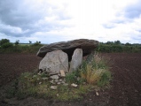
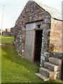
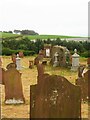
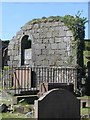
Nearby Images from Geograph Britain and Ireland:
©2010(licence)
©2022(licence)
©2005(licence)
©2009(licence)
©2009(licence)
The above images may not be of the site on this page, they are loaded from Geograph.
Please Submit an Image of this site or go out and take one for us!
Click here to see more info for this site
Nearby sites
Key: Red: member's photo, Blue: 3rd party photo, Yellow: other image, Green: no photo - please go there and take one, Grey: site destroyed
Download sites to:
KML (Google Earth)
GPX (GPS waypoints)
CSV (Garmin/Navman)
CSV (Excel)
To unlock full downloads you need to sign up as a Contributory Member. Otherwise downloads are limited to 50 sites.
Turn off the page maps and other distractions
Nearby sites listing. In the following links * = Image available
3.3km NW 305° Newlaw Hill* Rock Art (NX73324887)
3.3km E 85° Thirl's Well (Rerrick) Holy Well or Sacred Spring (NX7925047100)
4.0km WNW 299° Castlecreavie Rock Art* Rock Art (NX7255748944)
4.0km WNW 299° Castlecreavie Dun* Stone Fort or Dun (NX72544894)
4.3km WNW 302° Castlecreavie Settlement* Ancient Village or Settlement (NX72374925)
4.5km NW 308° Bombie 2* Rock Art (NX7248049736)
4.5km NW 309° Bombie 3* Rock Art (NX7250349821)
4.6km NW 309° Bombie North* Rock Art (NX7249449901)
4.7km NW 308° Bombie 1 Rock Art (NX72294994)
4.9km WNW 287° Galtway Hill Cairn (NX71294845)
5.4km WNW 290° High Banks Farm* Rock Art (NX70914895)
6.1km WNW 293° High Banks Northern Cairn* Cairn (NX70454947)
6.1km WNW 292° High Banks Southern Cairn* Cairn (NX70394934)
6.3km W 270° Townhead* Rock Art (NX69644705)
6.6km W 266° Blackhill Cottage* Rock Art (NX69334663)
6.7km WSW 241° St Margaret's Well (Kirkcudbright) Holy Well or Sacred Spring (NX69994378)
7.1km W 273° Grange 3 (Dumfries and Galloway)* Rock Art (NX6883947526)
7.2km WSW 251° Little Balmae Stone Circle (NX691447)
7.2km W 260° Drummore Castle* Stone Circle (NX688459)
7.2km W 260° Drummore* Stone Circle (NX688459)
7.2km W 260° Drummore Hillfort* Hillfort (NX688458)
7.4km WSW 252° Craikness Hill 1* Rock Art (NX6879644847)
7.6km NW 316° Culdoach* Rock Art (NX70835250)
8.0km W 261° Torrs 2* Rock Art (NX68054586)
8.1km WSW 255° Knockshinnie Stone Circle (NX681450)
View more nearby sites and additional images


 We would like to know more about this location. Please feel free to add a brief description and any relevant information in your own language.
 Wir möchten mehr über diese Stätte erfahren. Bitte zögern Sie nicht, eine kurze Beschreibung und relevante Informationen in Deutsch hinzuzufügen.
 Nous aimerions en savoir encore un peu sur les lieux. S'il vous plaît n'hesitez pas à ajouter une courte description et tous les renseignements pertinents dans votre propre langue.
 Quisieramos informarnos un poco más de las lugares. No dude en añadir una breve descripción y otros datos relevantes en su propio idioma.