<< Our Photo Pages >> Stone nr Trowan - Standing Stone (Menhir) in England in Cornwall
Submitted by flannel on Tuesday, 05 October 2021 Page Views: 493
Modern SitesSite Name: Stone nr TrowanCountry: England County: Cornwall Type: Standing Stone (Menhir)
Nearest Town: St. Ives
Map Ref: SW495403
Latitude: 50.209564N Longitude: 5.512254W
Condition:
| 5 | Perfect |
| 4 | Almost Perfect |
| 3 | Reasonable but with some damage |
| 2 | Ruined but still recognisable as an ancient site |
| 1 | Pretty much destroyed, possibly visible as crop marks |
| 0 | No data. |
| -1 | Completely destroyed |
| 5 | Superb |
| 4 | Good |
| 3 | Ordinary |
| 2 | Not Good |
| 1 | Awful |
| 0 | No data. |
| 5 | Can be driven to, probably with disabled access |
| 4 | Short walk on a footpath |
| 3 | Requiring a bit more of a walk |
| 2 | A long walk |
| 1 | In the middle of nowhere, a nightmare to find |
| 0 | No data. |
| 5 | co-ordinates taken by GPS or official recorded co-ordinates |
| 4 | co-ordinates scaled from a detailed map |
| 3 | co-ordinates scaled from a bad map |
| 2 | co-ordinates of the nearest village |
| 1 | co-ordinates of the nearest town |
| 0 | no data |
Internal Links:
External Links:
")
Standing stone, could be old or modern, there are no nearby boundaries on the OS map so unlikely to be a boundary stone.
You may be viewing yesterday's version of this page. To see the most up to date information please register for a free account.
")
")
Do not use the above information on other web sites or publications without permission of the contributor.
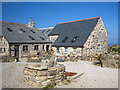
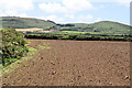
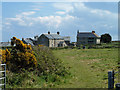
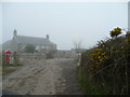
Nearby Images from Geograph Britain and Ireland:
©2010(licence)
©2008(licence)
©2013(licence)
©2008(licence)
©2008(licence)
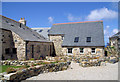
The above images may not be of the site on this page, they are loaded from Geograph.
Please Submit an Image of this site or go out and take one for us!
Click here to see more info for this site
Nearby sites
Key: Red: member's photo, Blue: 3rd party photo, Yellow: other image, Green: no photo - please go there and take one, Grey: site destroyed
Download sites to:
KML (Google Earth)
GPX (GPS waypoints)
CSV (Garmin/Navman)
CSV (Excel)
To unlock full downloads you need to sign up as a Contributory Member. Otherwise downloads are limited to 50 sites.
Turn off the page maps and other distractions
Nearby sites listing. In the following links * = Image available
399m W 267° Possible Quoit nr Trevalgan* Natural Stone / Erratic / Other Natural Feature (SW491403)
779m NW 307° Standing stones nr coast path* Modern Stone Circle etc (SW489408)
908m WNW 298° The Merry Harvesters* Modern Stone Circle etc (SW48724077)
1.1km SW 226° Trevalgan Hill Settlement* Ancient Village or Settlement (SW487396)
1.1km E 93° Carnello Standing Stone (Menhir) (SW506402)
1.1km SW 221° Little Trevalgan* Ancient Village or Settlement (SW48733950)
1.2km SSW 197° Rosewall Hill Cairn* Cairn (SW491392)
1.3km SE 135° Carnstabba Cave* Cave or Rock Shelter (SW504393)
1.3km ESE 106° Penbeagle Cross* Ancient Cross (SW50783988)
1.6km S 174° Bussow Farm Hut Circles Ancient Village or Settlement (SW496387)
1.7km SE 134° Carn Stabba* Natural Stone / Erratic / Other Natural Feature (SW50663906)
1.8km SE 145° Halsetown Cross* Ancient Cross (SW50463879)
2.0km ENE 75° Venton Ia* Holy Well or Sacred Spring (SW51494074)
2.3km SW 222° Trendrine Hill Round Barrows* Round Barrow(s) (SW479387)
2.3km E 82° St Ives Cross* Ancient Cross (SW51824051)
2.4km SSW 199° Towednack Church Cornish Crosses* Ancient Cross (SW486381)
2.6km ENE 72° St Ives Head Fort* Promontory Fort / Cliff Castle (SW520410)
2.7km SW 235° Wicca Cists* Cist (SW47203887)
2.9km SW 226° Sperris Croft* Ancient Village or Settlement (SW473384)
3.1km SSW 206° Amalveor settlement* Ancient Village or Settlement (SW48023756)
3.2km SW 227° Sperris Quoit* Burial Chamber or Dolmen (SW47093826)
3.2km SSW 209° Amalveor downs tumuli* Barrow Cemetery (SW478376)
3.3km SSE 165° Giew Mine* Standing Stone (Menhir) (SW502371)
3.3km SSE 162° Trink Hill* Round Barrow(s) (SW504371)
3.5km SW 226° Zennor Quoit* Portal Tomb (SW46883802)
View more nearby sites and additional images


 We would like to know more about this location. Please feel free to add a brief description and any relevant information in your own language.
 Wir möchten mehr über diese Stätte erfahren. Bitte zögern Sie nicht, eine kurze Beschreibung und relevante Informationen in Deutsch hinzuzufügen.
 Nous aimerions en savoir encore un peu sur les lieux. S'il vous plaît n'hesitez pas à ajouter une courte description et tous les renseignements pertinents dans votre propre langue.
 Quisieramos informarnos un poco más de las lugares. No dude en añadir una breve descripción y otros datos relevantes en su propio idioma.