

<< Our Photo Pages >> Castle Ring (Derbyshire) - Hillfort in England in Derbyshire
Submitted by vicky on Monday, 29 December 2003 Page Views: 17414
Iron Age and Later PrehistorySite Name: Castle Ring (Derbyshire)Country: England County: Derbyshire Type: Hillfort
Nearest Town: Bakewell Nearest Village: Elton
Map Ref: SK221628 Landranger Map Number: 119
Latitude: 53.161870N Longitude: 1.670919W
Condition:
| 5 | Perfect |
| 4 | Almost Perfect |
| 3 | Reasonable but with some damage |
| 2 | Ruined but still recognisable as an ancient site |
| 1 | Pretty much destroyed, possibly visible as crop marks |
| 0 | No data. |
| -1 | Completely destroyed |
| 5 | Superb |
| 4 | Good |
| 3 | Ordinary |
| 2 | Not Good |
| 1 | Awful |
| 0 | No data. |
| 5 | Can be driven to, probably with disabled access |
| 4 | Short walk on a footpath |
| 3 | Requiring a bit more of a walk |
| 2 | A long walk |
| 1 | In the middle of nowhere, a nightmare to find |
| 0 | No data. |
| 5 | co-ordinates taken by GPS or official recorded co-ordinates |
| 4 | co-ordinates scaled from a detailed map |
| 3 | co-ordinates scaled from a bad map |
| 2 | co-ordinates of the nearest village |
| 1 | co-ordinates of the nearest town |
| 0 | no data |
Internal Links:
External Links:
I have visited· I would like to visit
Marko saw from a distance on 21st Mar 2020 - their rating: Cond: 3 Amb: 3 Access: 3
Aurora_skygazer nicoladidsbury TimPrevett have visited here
 (PID:1054)")
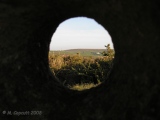
The Castle Ring hillfort is located on a small hill at 244m (800ft) on private land behind Harthill Moor Farm, to the north-west of Nine Stone Close stone circle and near to the defended site at Cratcliff Rocks.
The fort is the smallest of those known in the region, enclosing an area of only 0.3 hectares (0.75 acres). It is oval in shape and protected by two banks and a ditch to all sides, apart from the south-east where all traces have disappeared.
You may be viewing yesterday's version of this page. To see the most up to date information please register for a free account.
 (PID:131754)")
 (PID:120830)")
 (PID:101296)")
 (PID:15286)")
 (PID:5294)")
 (PID:101295)")
 (PID:101294)")
 (PID:101299)")
 (PID:101298)")
 (PID:101297)")
Do not use the above information on other web sites or publications without permission of the contributor.
Click here to see more info for this site
Nearby sites
Key: Red: member's photo, Blue: 3rd party photo, Yellow: other image, Green: no photo - please go there and take one, Grey: site destroyed
Download sites to:
KML (Google Earth)
GPX (GPS waypoints)
CSV (Garmin/Navman)
CSV (Excel)
To unlock full downloads you need to sign up as a Contributory Member. Otherwise downloads are limited to 50 sites.
Turn off the page maps and other distractions
Nearby sites listing. In the following links * = Image available
441m E 85° Nine Stones Cup Mark (Harthill) Rock Art (SK22546284)
453m E 83° Harthill Cairn* Cairn (SK22556286)
463m ESE 110° Nine Stones Close* Stone Circle (SK2253762643)
565m SE 135° Robin Hood's Stride* Rock Outcrop (SK225624)
629m SE 132° Robin Hoods Settlement* Ancient Village or Settlement (SK22576238)
662m SSE 146° Robin Hood's Stride* Rock Art (SK22476225)
780m SE 130° Cratcliff Rocks* Hillfort (SK227623)
854m SSE 160° Dudwood* Stone Circle (SK224620)
1.3km ESE 124° Rockingstone Farm* Rock Outcrop (SK2322062065)
1.6km ESE 114° Rowtor Rocks* Rock Art (SK23556215)
1.6km ESE 116° St Michael’s Church (Birchover)* Carving (SK23576210)
1.7km ESE 115° The Megalithic Portal Live in the Derbyshire Peak District Natural Stone / Erratic / Other Natural Feature (SK236621)
1.7km E 88° Doll Tor* Stone Circle (SK2383062873)
1.8km NNW 330° All Saints Church (Youlgreave)* Carving (SK21206437)
1.9km E 85° Andle Stone (Stanton Moor)* Natural Stone / Erratic / Other Natural Feature (SK2403162993)
2.0km W 265° Larks Low Bowl Barrow* Round Barrow(s) (SK20086260)
2.2km E 90° Stanton Moor Cairn T14* Cairn (SK24306281)
2.2km E 88° Stanton Moor Cairn T13* Round Cairn (SK243629)
2.2km E 91° Cork Stone* Natural Stone / Erratic / Other Natural Feature (SK2434662788)
2.5km E 86° Stanton Moor Cairn T25* Cairn (SK24656297)
2.6km E 90° Stanton Moor Cairn (TBC)* Cairn (SK2467562791)
2.6km E 88° Stanton Moor 4* Ring Cairn (SK24716290)
2.6km NNW 347° Haddon Fields Bowl Barrow 1* Round Barrow(s) (SK21486535)
2.7km E 81° Stanton Moor 3* Stone Circle (SK24806326)
2.7km E 83° Stanton Moor Cairn T55* Round Cairn (SK24826313)
View more nearby sites and additional images


 We would like to know more about this location. Please feel free to add a brief description and any relevant information in your own language.
 Wir möchten mehr über diese Stätte erfahren. Bitte zögern Sie nicht, eine kurze Beschreibung und relevante Informationen in Deutsch hinzuzufügen.
 Nous aimerions en savoir encore un peu sur les lieux. S'il vous plaît n'hesitez pas à ajouter une courte description et tous les renseignements pertinents dans votre propre langue.
 Quisieramos informarnos un poco más de las lugares. No dude en añadir una breve descripción y otros datos relevantes en su propio idioma.