

<< Our Photo Pages >> Moorsholm Moor Cup Marked Rock - Rock Art in England in Yorkshire (North)
Submitted by johndhunter on Wednesday, 25 October 2017 Page Views: 1160
Rock ArtSite Name: Moorsholm Moor Cup Marked RockCountry: England County: Yorkshire (North) Type: Rock Art
Map Ref: NZ6861911919
Latitude: 54.497964N Longitude: 0.942011W
Condition:
| 5 | Perfect |
| 4 | Almost Perfect |
| 3 | Reasonable but with some damage |
| 2 | Ruined but still recognisable as an ancient site |
| 1 | Pretty much destroyed, possibly visible as crop marks |
| 0 | No data. |
| -1 | Completely destroyed |
| 5 | Superb |
| 4 | Good |
| 3 | Ordinary |
| 2 | Not Good |
| 1 | Awful |
| 0 | No data. |
| 5 | Can be driven to, probably with disabled access |
| 4 | Short walk on a footpath |
| 3 | Requiring a bit more of a walk |
| 2 | A long walk |
| 1 | In the middle of nowhere, a nightmare to find |
| 0 | No data. |
| 5 | co-ordinates taken by GPS or official recorded co-ordinates |
| 4 | co-ordinates scaled from a detailed map |
| 3 | co-ordinates scaled from a bad map |
| 2 | co-ordinates of the nearest village |
| 1 | co-ordinates of the nearest town |
| 0 | no data |
Be the first person to rate this site - see the 'Contribute!' box in the right hand menu.
Internal Links:
External Links:
")
Reference Brown & Chappel’s book “Prehistoric Rock Art in the NY Moors” 2012 edition page 277. This rock is described as an earth fast boulder (60 x 35cm) with five cup marks on the upper surface. They also comment that it is located near several cairns and to the north of an oval enclosure though to be an enclosed cremation cemetery.
You may be viewing yesterday's version of this page. To see the most up to date information please register for a free account.
")
")
Do not use the above information on other web sites or publications without permission of the contributor.
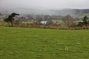
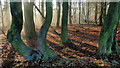
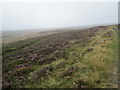
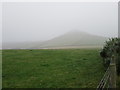
Nearby Images from Geograph Britain and Ireland:
©2020(licence)
©2014(licence)
©2014(licence)
©2020(licence)
©2005(licence)
The above images may not be of the site on this page, they are loaded from Geograph.
Please Submit an Image of this site or go out and take one for us!
Click here to see more info for this site
Nearby sites
Key: Red: member's photo, Blue: 3rd party photo, Yellow: other image, Green: no photo - please go there and take one, Grey: site destroyed
Download sites to:
KML (Google Earth)
GPX (GPS waypoints)
CSV (Garmin/Navman)
CSV (Excel)
To unlock full downloads you need to sign up as a Contributory Member. Otherwise downloads are limited to 50 sites.
Turn off the page maps and other distractions
Nearby sites listing. In the following links * = Image available
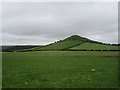
792m NNE 27° Freebrough Hill* Natural Stone / Erratic / Other Natural Feature (NZ68971263)
934m S 185° Job Cross (Middle Heads)* Ancient Cross (NZ6855210987)
1.2km W 274° Old Castle Hill* Stone Row / Alignment (NZ67391199)
1.3km SSE 162° Haw Rigg (Danby Low Moor)* Round Barrow(s) (NZ6901910721)
1.3km WSW 242° Brown Hill RB1 (Moorsholm High Moor)* Round Barrow(s) (NZ6745511289)
1.3km SSW 212° White Cross (Three Howes Rigg)* Marker Stone (NZ67931078)
1.5km SSW 200° Three Howes Rigg (East)* Round Barrow(s) (NZ68121052)
1.6km W 263° Haredale Head BS1* Marker Stone (NZ6704511715)
1.7km W 267° Tod Howe* Round Barrow(s) (NZ6694911814)
1.7km W 273° Quakers Causeway RB4* Round Barrow(s) (NZ6689911991)
1.7km SSW 198° Three Howes Rigg (West)* Round Barrow(s) (NZ68101027)
1.8km E 89° Gerrick Moor Hut Circles* Ancient Village or Settlement (NZ7037411965)
1.8km E 93° Gerrick Moor Enclosure E1* Ancient Village or Settlement (NZ7043711855)
1.8km E 96° Herd Howe (Gerrick Moor)* Round Barrow(s) (NZ7044611768)
1.9km E 93° Gerrick Moor RB1* Round Barrow(s) (NZ7052011834)
1.9km WNW 283° Quakers Causeway RB3* Round Barrow(s) (NZ6673312324)
2.0km ESE 102° Robin Hoods Butts 2* Round Barrow(s) (NZ70571155)
2.1km W 272° Skelderskew Moor North East* Marker Stone (NZ6652011951)
2.1km SE 128° Siss Cross* Marker Stone (NZ7032510614)
2.2km WNW 286° Black Howes (Quakers Causeway)* Round Barrow(s) (NZ6651212491)
2.2km NNW 329° Ticksey How* Marker Stone (NZ6744213814)
2.3km WNW 288° Quakers Causeway RB2* Round Barrow(s) (NZ6644812607)
2.4km S 180° Pike Howe (Three Howes Rigg)* Round Barrow(s) (NZ6864509546)
2.4km E 98° Gerrick Moor Standing Stone SS1* Standing Stone (Menhir) (NZ7100111625)
2.4km ESE 102° Robin Hoods Butts 3* Round Barrow(s) (NZ7102411434)
View more nearby sites and additional images


 We would like to know more about this location. Please feel free to add a brief description and any relevant information in your own language.
 Wir möchten mehr über diese Stätte erfahren. Bitte zögern Sie nicht, eine kurze Beschreibung und relevante Informationen in Deutsch hinzuzufügen.
 Nous aimerions en savoir encore un peu sur les lieux. S'il vous plaît n'hesitez pas à ajouter une courte description et tous les renseignements pertinents dans votre propre langue.
 Quisieramos informarnos un poco más de las lugares. No dude en añadir una breve descripción y otros datos relevantes en su propio idioma.