


<< Our Photo Pages >> Ballygomartin Standing Stone - Standing Stone (Menhir) in Ireland (Northern) in Co. Antrim
Submitted by Desi on Thursday, 02 July 2020 Page Views: 3072
Neolithic and Bronze AgeSite Name: Ballygomartin Standing StoneCountry: Ireland (Northern) County: Co. Antrim Type: Standing Stone (Menhir)
Nearest Town: Belfast
Latitude: 54.617800N Longitude: 6.00979W
Condition:
| 5 | Perfect |
| 4 | Almost Perfect |
| 3 | Reasonable but with some damage |
| 2 | Ruined but still recognisable as an ancient site |
| 1 | Pretty much destroyed, possibly visible as crop marks |
| 0 | No data. |
| -1 | Completely destroyed |
| 5 | Superb |
| 4 | Good |
| 3 | Ordinary |
| 2 | Not Good |
| 1 | Awful |
| 0 | No data. |
| 5 | Can be driven to, probably with disabled access |
| 4 | Short walk on a footpath |
| 3 | Requiring a bit more of a walk |
| 2 | A long walk |
| 1 | In the middle of nowhere, a nightmare to find |
| 0 | No data. |
| 5 | co-ordinates taken by GPS or official recorded co-ordinates |
| 4 | co-ordinates scaled from a detailed map |
| 3 | co-ordinates scaled from a bad map |
| 2 | co-ordinates of the nearest village |
| 1 | co-ordinates of the nearest town |
| 0 | no data |
Internal Links:
External Links:
I have visited· I would like to visit
dohagan visited - their rating: Cond: 4 Amb: 4 Access: 3 Ran from quarry on Ligoneil Road/Ballyhill Road across Heath Walk. Joined the mast service road and soon noted the stone around 30 m east of the road. There is a fence running north to south on the west of the stone. When this is climbed there is a small path to the edge of a bank where in clear weather a fine view of Belfast can be had.
dohagan visited - their rating: Cond: 4 Amb: 4 Access: 3 Ran from quarry on Ligoneil Road/Ballyhill Road across Heath Walk. Joined the mast service road and soon noted the stone around 30 m east of the road. There is a fence running north to south on the west of the stone. When this is climbed there is a small path to the edge of a bank where in clear weather a fine view of Belfast can be had.
Average ratings for this site from all visit loggers: Condition: 4 Ambience: 4 Access: 3
")
Page originally by SavageEarthHeart
You may be viewing yesterday's version of this page. To see the most up to date information please register for a free account.
Do not use the above information on other web sites or publications without permission of the contributor.
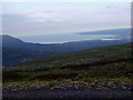
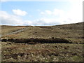
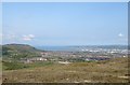
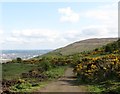
Nearby Images from Geograph Britain and Ireland:
©2008(licence)
©2012(licence)
©2012(licence)
©2012(licence)

©2009(licence)
The above images may not be of the site on this page, they are loaded from Geograph.
Please Submit an Image of this site or go out and take one for us!
Click here to see more info for this site
Nearby sites
Click here to view sites on an interactive map of the areaKey: Red: member's photo, Blue: 3rd party photo, Yellow: other image, Green: no photo - please go there and take one, Grey: site destroyed
Download sites to:
KML (Google Earth)
GPX (GPS waypoints)
CSV (Garmin/Navman)
CSV (Excel)
To unlock full downloads you need to sign up as a Contributory Member. Otherwise downloads are limited to 50 sites.
Turn off the page maps and other distractions
Nearby sites listing. In the following links * = Image available
3.2km N 9° Ballyutoag Court Tomb Court Tomb
3.9km WSW 242° Tournagrough Stone Row / Alignment (J252743)
4.1km NE 42° Ballyaghagan Cashel Ancient Village or Settlement (J31287936)
5.1km NE 48° Ballyaghagan Cairn* Cairn
5.1km NE 51° McArts Fort* Stone Fort or Dun
5.2km NE 40° Collinward Cairn* Cairn
5.4km NE 49° The Devil's Punchbowl Cave or Rock Shelter
6.1km SE 129° Belfast (Ulster Museum)* Court Tomb (J335725)
7.1km SSW 212° White Mountain, Lisburn and Castlereagh Standing Stone (Menhir) (J2502870021)
8.1km N 350° Craigarogan* Chambered Tomb (J270842)
9.4km SSE 156° Ballynahatty* Henge (J32726770)
12.6km NNW 345° Moyadam* Standing Stone (Menhir) (J2510388312)
13.5km NNE 24° West Division Stone Row / Alignment (J338887)
14.2km NNW 327° Donegore Moat* Artificial Mound
14.8km NNW 333° Donegore Hill Causewayed Enclosure
15.1km NNW 345° Doagh* Holed Stone (J2416590683)
16.1km E 101° Greengraves* Portal Tomb (J4454073630)
16.2km NNW 333° Tobergill Stone Circle (J20839051)
18.0km NNW 335° Browndod Court Tomb* Court Tomb
20.7km ESE 117° Ballygraffan Portal Tomb* Portal Tomb
20.7km E 87° Conlig Standing Stone* Standing Stone (Menhir) (J49377783)
20.8km NNE 19° Tureagh Stone Circle (J350960)
21.5km NNE 13° Carndoo* Court Tomb (J32849731)
22.3km E 79° North Down Museum* Museum (NW634352)
23.1km NNE 21° Ballrickard More Stone Circle (J362981)
View more nearby sites and additional images


 We would like to know more about this location. Please feel free to add a brief description and any relevant information in your own language.
 Wir möchten mehr über diese Stätte erfahren. Bitte zögern Sie nicht, eine kurze Beschreibung und relevante Informationen in Deutsch hinzuzufügen.
 Nous aimerions en savoir encore un peu sur les lieux. S'il vous plaît n'hesitez pas à ajouter une courte description et tous les renseignements pertinents dans votre propre langue.
 Quisieramos informarnos un poco más de las lugares. No dude en añadir una breve descripción y otros datos relevantes en su propio idioma.