<< Our Photo Pages >> Mamoa do Monte dos Condes - Round Barrow(s) in Portugal in Évora
Submitted by Bak_teria on Sunday, 14 February 2016 Page Views: 1723
Neolithic and Bronze AgeSite Name: Mamoa do Monte dos Condes Alternative Name: Monte dos Condes 2Country: Portugal Distrito: Évora Type: Round Barrow(s)
Nearest Town: Pavia Nearest Village: Malarranha
Latitude: 38.917056N Longitude: 7.954897W
Condition:
| 5 | Perfect |
| 4 | Almost Perfect |
| 3 | Reasonable but with some damage |
| 2 | Ruined but still recognisable as an ancient site |
| 1 | Pretty much destroyed, possibly visible as crop marks |
| 0 | No data. |
| -1 | Completely destroyed |
| 5 | Superb |
| 4 | Good |
| 3 | Ordinary |
| 2 | Not Good |
| 1 | Awful |
| 0 | No data. |
| 5 | Can be driven to, probably with disabled access |
| 4 | Short walk on a footpath |
| 3 | Requiring a bit more of a walk |
| 2 | A long walk |
| 1 | In the middle of nowhere, a nightmare to find |
| 0 | No data. |
| 5 | co-ordinates taken by GPS or official recorded co-ordinates |
| 4 | co-ordinates scaled from a detailed map |
| 3 | co-ordinates scaled from a bad map |
| 2 | co-ordinates of the nearest village |
| 1 | co-ordinates of the nearest town |
| 0 | no data |
Internal Links:
External Links:
I have visited· I would like to visit
Bak_teria visited on 13th Feb 2016 - their rating: Cond: 4 Amb: 4 Access: 3
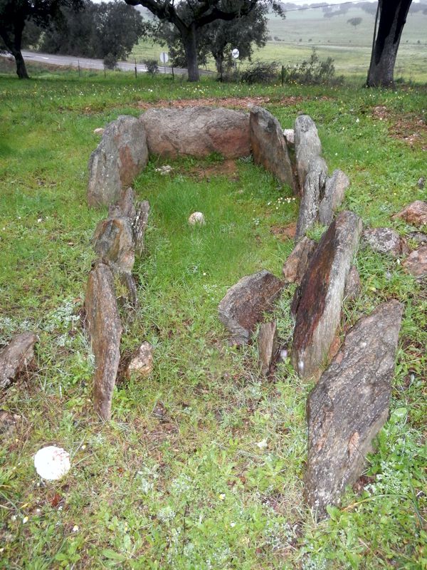
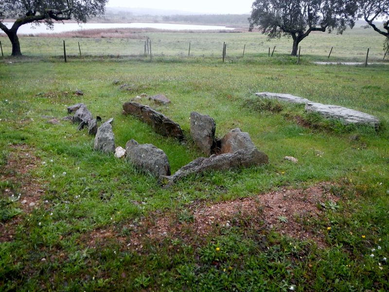
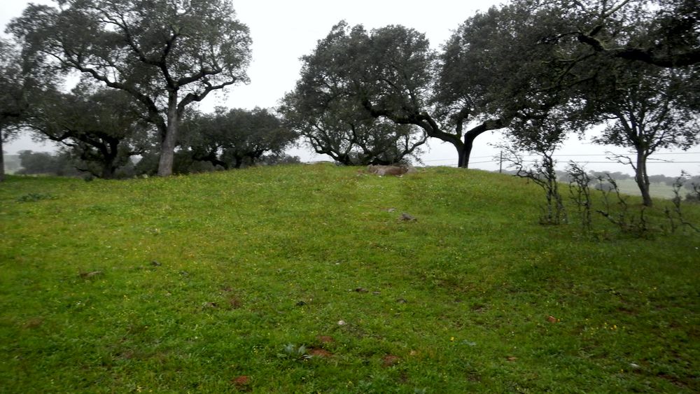
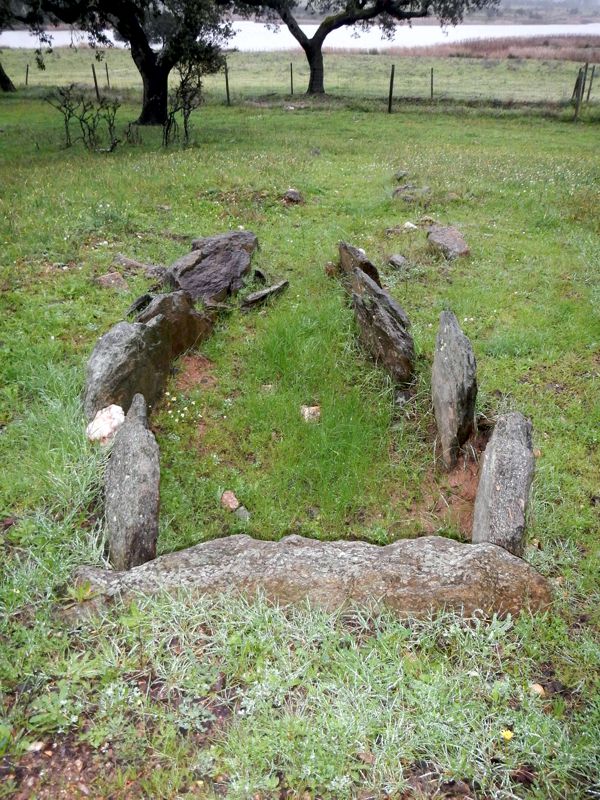
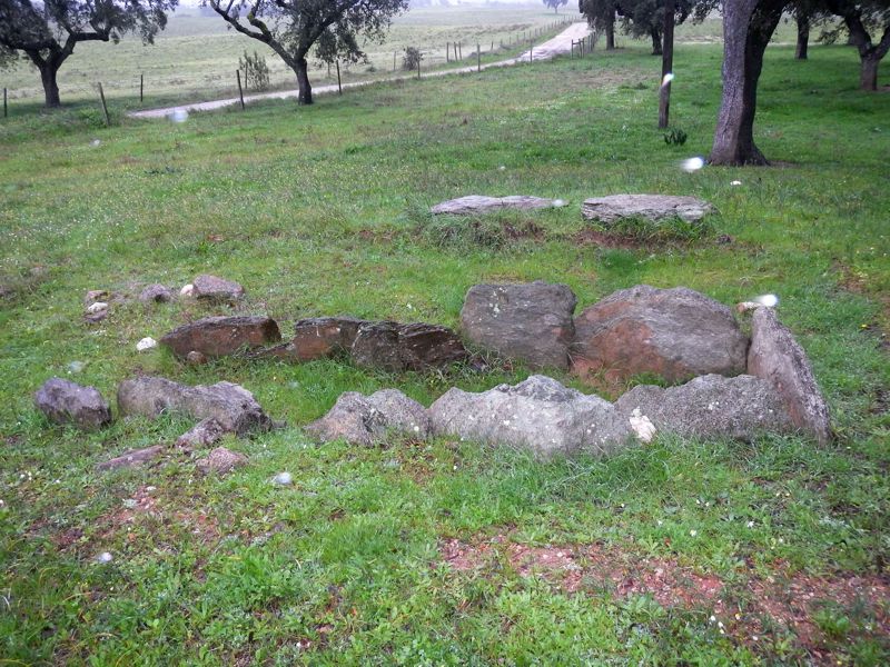
Monte dos Condes is a well preserved Round Barrow or Mamoa (as we say in Portugal) with about 20m in diameter and it was identified in 1993 by Leonor Rocha. Only later was intervened, in 2009 and 2010. The excavations were coordinated by Leonor Rocha and Pedro Manuel Carvalho Alvim. By the time of its discovery only part of two pillars of the chamber were visible at the top of the mound and also a possible corridor cover, that was located at about 6m from the chamber. One megalithic grave made of schist stone was found in the course of the excavation work. It was concluded that this burial chamber was used in the Neolithic period and reused in the Bronze Age. This monument is not yet classified but still is in pretty good conditions.
About the burials
The first evidencies that came to support its dating were two typically similar vessels to those used in Neolithic burials in the region and its unique location can mean the existence of at least two separate burials, one at the head and one by the entrance of the chamber. Its conservation status suggests that its reuse in the Bronze Age has not reached the lower levels of the monument, which is also supported by the absence of scattered and fragmented estate outside the grave. On the other side it was found for the first time in the Mora municipality, apparently the burial reuse of a Neolithic monument in the protohistory (Bronze Age) and that is unparalleled in that region, thus appearing a little decontextualized. It is believed that future work in other monuments of the county, can bring more light on the funerary contexts of the Bronze Age in the Mora and Pavia area, allowing a better understanding of the data gathered on the round barrow of Monte dos Condes.
About the access
This monument is located by the road and the tumulus is very visible. The access is located inside private property and is not directly opened. You can choose to walk about 2 km to get to the monument or you can try your luck and jump the fence and that is not advisable (there's a lot of barbed wire and the owners may not find it very funny). Always remember to be sympathetic towards the locals and always explain the meaning of your intentions. If you do that you should have no problem to visit this wonderful piece of history.
Links and information sources (all texts written in Portuguese):
- Portal do Arqueólogo
Aditional information:
- You are entering in private property but the access can be possible.
- The entrance to the zone of the monuments may be blocked by fences, they were essentially made to demarcate the land and not allow the escape of livestock.
Usually there are spaces in the fences within these demarcated areas where the access is possible. When entering in demarcated land never forget to close the access gate of the location, you need to be very aware because cattle can escape.
- There are no signs prohibiting us from entering so the access can be open but be careful when you explore every time you see this red plaques that alert you for the Hunting Zones. Remind yourself that usually hunters can only hunt at selected hunting days (Thursdays, Sundays and on public holidays).
- If you should always try to ask permission to visit the site, country people are usually very nice and there should be no problem.
You may be viewing yesterday's version of this page. To see the most up to date information please register for a free account.
Do not use the above information on other web sites or publications without permission of the contributor.
Click here to see more info for this site
Nearby sites
Click here to view sites on an interactive map of the areaKey: Red: member's photo, Blue: 3rd party photo, Yellow: other image, Green: no photo - please go there and take one, Grey: site destroyed
Download sites to:
KML (Google Earth)
GPX (GPS waypoints)
CSV (Garmin/Navman)
CSV (Excel)
To unlock full downloads you need to sign up as a Contributory Member. Otherwise downloads are limited to 50 sites.
Turn off the page maps and other distractions
Nearby sites listing. In the following links * = Image available
3.1km SSW 211° Alinhamento da Têra* Stone Row / Alignment
3.3km S 178° Anta da Caeira 7 Burial Chamber or Dolmen
3.4km S 175° Anta da Caeira 6 Burial Chamber or Dolmen
3.4km S 181° Anta da Caeira 8 Burial Chamber or Dolmen
3.6km S 177° Anta da Caeira 3 Burial Chamber or Dolmen
3.7km S 178° Anta da Caeira 4 Burial Chamber or Dolmen
3.9km S 176° Anta da Caeira 5 Burial Chamber or Dolmen
3.9km S 172° Anta da Caeira 2 Burial Chamber or Dolmen
4.0km WSW 243° Cromeleque do Monte das Figueiras* Stone Circle
4.1km S 172° Menir da Caeira* Standing Stone (Menhir)
4.6km S 175° Antas da Caeira* Burial Chamber or Dolmen
5.1km NW 308° Antas das Figueirinhas* Burial Chamber or Dolmen
5.4km WSW 239° Anta da Lapeira II* Burial Chamber or Dolmen
5.7km SSW 200° Anta da Cré 3* Burial Chamber or Dolmen
5.7km WSW 237° Anta da Lapeira I* Burial Chamber or Dolmen
6.0km WSW 245° Anta de Pavia* Burial Chamber or Dolmen
6.0km WNW 295° Anta da Gonçala* Burial Chamber or Dolmen
6.0km WNW 297° Anta da Ordem 7 Burial Chamber or Dolmen
6.0km WNW 301° Anta da Ordem 1* Burial Chamber or Dolmen
6.0km WNW 297° Anta da Ordem 8* Burial Chamber or Dolmen
6.1km WNW 300° Anta da Ordem 2* Burial Chamber or Dolmen
6.1km WNW 300° Anta da Ordem 3 Burial Chamber or Dolmen
6.1km WNW 301° Anta da Ordem 4* Burial Chamber or Dolmen
6.3km WNW 298° Anta da Ordem 5 Burial Chamber or Dolmen
6.4km WNW 299° Anta da Ordem 6* Burial Chamber or Dolmen
View more nearby sites and additional images





 We would like to know more about this location. Please feel free to add a brief description and any relevant information in your own language.
 Wir möchten mehr über diese Stätte erfahren. Bitte zögern Sie nicht, eine kurze Beschreibung und relevante Informationen in Deutsch hinzuzufügen.
 Nous aimerions en savoir encore un peu sur les lieux. S'il vous plaît n'hesitez pas à ajouter une courte description et tous les renseignements pertinents dans votre propre langue.
 Quisieramos informarnos un poco más de las lugares. No dude en añadir una breve descripción y otros datos relevantes en su propio idioma.