<< Our Photo Pages >> Luath's Stone - Standing Stone (Menhir) in Scotland in Aberdeenshire
Submitted by golux on Monday, 04 April 2011 Page Views: 8591
Neolithic and Bronze AgeSite Name: Luath's Stone Alternative Name: Lulach's Stone, Macbeth's StoneCountry: Scotland County: Aberdeenshire Type: Standing Stone (Menhir)
Nearest Town: Alford Nearest Village: Whitehouse
Map Ref: NJ64041489
Latitude: 57.223329N Longitude: 2.597153W
Condition:
| 5 | Perfect |
| 4 | Almost Perfect |
| 3 | Reasonable but with some damage |
| 2 | Ruined but still recognisable as an ancient site |
| 1 | Pretty much destroyed, possibly visible as crop marks |
| 0 | No data. |
| -1 | Completely destroyed |
| 5 | Superb |
| 4 | Good |
| 3 | Ordinary |
| 2 | Not Good |
| 1 | Awful |
| 0 | No data. |
| 5 | Can be driven to, probably with disabled access |
| 4 | Short walk on a footpath |
| 3 | Requiring a bit more of a walk |
| 2 | A long walk |
| 1 | In the middle of nowhere, a nightmare to find |
| 0 | No data. |
| 5 | co-ordinates taken by GPS or official recorded co-ordinates |
| 4 | co-ordinates scaled from a detailed map |
| 3 | co-ordinates scaled from a bad map |
| 2 | co-ordinates of the nearest village |
| 1 | co-ordinates of the nearest town |
| 0 | no data |
Internal Links:
External Links:
")
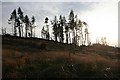
Situated on a saddle between two summits at 350m, it stands in a prominent position yet has a limited outlook (whereas the hilltop only 300 meters away at Pile of Stones offers superb views westward over the Vale of Alford and eastward down the Don valley, overlooking many neolithic sites).
The name may refer to Luath the hound of the Gaelic demi-god Cuchullin or perhaps commemorate King Lulach (d.1058), stepson of Macbeth (cf: Lulach's Stone at Mossat).
(Information taken from RCAHMS webpage)
Access:
1. Take the B993 SE from Monymusk, after 3km turn right following signs for Whitehills Stone Circle and Pitfichie Forest Cycle Trail. At the cycle trail car-park check the map displayed (printable copy here) and notice junction 3 where the red trail begins, then follow the track past Whitehill stone circle and look for the red cycle trail on the left side (indicated by a red chevron on the post on the right side) which takes you up to, and then northwards along, the ridge of Green Hill. Follow this path past the summit at Pile of Stones (marked by a pile of stones of course) and when the path comes close to the fence on your left, you will see Luath's Stone on your left, about 100m below you by the 3 trees. Total distance from car-park = 2 miles, half easy going and half hard.
BEWARE CYCLISTS coming downhill - they cannot stop!
2. Devotees of the sport of bouldering may know the alternative route from the west (apparently the slopes of Green Hill below Luath's Stone offer a fine selection of climbable boulders). Directions available here.
You may be viewing yesterday's version of this page. To see the most up to date information please register for a free account.
")
")
")
")
Do not use the above information on other web sites or publications without permission of the contributor.
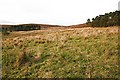
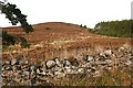
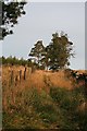
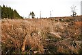
Nearby Images from Geograph Britain and Ireland:
©2008(licence)
©2008(licence)
©2008(licence)
©2008(licence)
©2008(licence)
The above images may not be of the site on this page, they are loaded from Geograph.
Please Submit an Image of this site or go out and take one for us!
Click here to see more info for this site
Nearby sites
Key: Red: member's photo, Blue: 3rd party photo, Yellow: other image, Green: no photo - please go there and take one, Grey: site destroyed
Download sites to:
KML (Google Earth)
GPX (GPS waypoints)
CSV (Garmin/Navman)
CSV (Excel)
To unlock full downloads you need to sign up as a Contributory Member. Otherwise downloads are limited to 50 sites.
Turn off the page maps and other distractions
Nearby sites listing. In the following links * = Image available
1.4km S 169° Whitehill Stone Circle* Stone Circle (NJ643135)
1.8km ENE 78° Monymusk 2 Early Christian Sculptured Stone (NJ65801524)
3.9km E 99° Tombeg* Standing Stone (Menhir) (NJ67931426)
4.4km E 80° Deer Park* Stone Circle (NJ68341564)
4.5km E 85° Monymusk* Class II Pictish Symbol Stone (NJ68501524)
5.4km NNW 334° Cothiemuir Wood* Stone Circle (NJ61711980)
5.7km WSW 259° North Strone* Stone Circle (NJ584138)
5.9km SSW 195° Auld Kirk O Tough* Stone Circle (NJ625092)
6.3km NW 315° Old Keig* Stone Circle (NJ59651939)
6.3km WNW 303° Crookmore Stone Circle (NJ588184)
6.3km WNW 303° Crookmore Multiple Stone Rows / Avenue (NJ588184)
6.6km NW 321° Barmkyn of North Keig* Hillfort (NJ59912004)
6.8km WNW 294° Druidsfield* Multiple Stone Rows / Avenue (NJ578177)
6.8km WNW 294° Druidsfield* Stone Circle (NJ578177)
7.0km E 83° Nether Coullie* Stone Circle (NJ70981565)
7.1km ESE 101° Woodend of Cluny* Standing Stone (Menhir) (NJ7105613433)
7.3km S 171° Tomnagorn* Stone Circle (NJ651077)
7.3km SW 235° Howemill* Stone Circle (NJ580107)
7.7km ENE 58° Chapel O' Sink* Stone Circle (NJ706189)
7.7km NNW 341° Druidstone (Brackla)* Stone Circle (NJ6152922206)
7.8km ESE 107° Castle Fraser circle* Stone Circle (NJ71501253)
8.0km ESE 107° Castle Fraser Row* Stone Row / Alignment (NJ71741252)
8.3km E 89° Lang Stane o' Craigearn* Standing Stone (Menhir) (NJ72381493)
8.3km ESE 105° John Bell's Stone* Standing Stone (Menhir) (NJ72111271)
8.6km NNE 28° Mither Tap* Hillfort (NJ682224)
View more nearby sites and additional images


 We would like to know more about this location. Please feel free to add a brief description and any relevant information in your own language.
 Wir möchten mehr über diese Stätte erfahren. Bitte zögern Sie nicht, eine kurze Beschreibung und relevante Informationen in Deutsch hinzuzufügen.
 Nous aimerions en savoir encore un peu sur les lieux. S'il vous plaît n'hesitez pas à ajouter une courte description et tous les renseignements pertinents dans votre propre langue.
 Quisieramos informarnos un poco más de las lugares. No dude en añadir una breve descripción y otros datos relevantes en su propio idioma.