


<< Our Photo Pages >> Pen Y Gaer (Llanddeiniolen) - Hillfort in Wales in Gwynedd
Submitted by coldrum on Sunday, 31 January 2010 Page Views: 4722
Iron Age and Later PrehistorySite Name: Pen Y Gaer (Llanddeiniolen) Alternative Name: GlascoedCountry: Wales County: Gwynedd Type: Hillfort
Map Ref: SH54776440
Latitude: 53.156868N Longitude: 4.173464W
Condition:
| 5 | Perfect |
| 4 | Almost Perfect |
| 3 | Reasonable but with some damage |
| 2 | Ruined but still recognisable as an ancient site |
| 1 | Pretty much destroyed, possibly visible as crop marks |
| 0 | No data. |
| -1 | Completely destroyed |
| 5 | Superb |
| 4 | Good |
| 3 | Ordinary |
| 2 | Not Good |
| 1 | Awful |
| 0 | No data. |
| 5 | Can be driven to, probably with disabled access |
| 4 | Short walk on a footpath |
| 3 | Requiring a bit more of a walk |
| 2 | A long walk |
| 1 | In the middle of nowhere, a nightmare to find |
| 0 | No data. |
| 5 | co-ordinates taken by GPS or official recorded co-ordinates |
| 4 | co-ordinates scaled from a detailed map |
| 3 | co-ordinates scaled from a bad map |
| 2 | co-ordinates of the nearest village |
| 1 | co-ordinates of the nearest town |
| 0 | no data |
Be the first person to rate this site - see the 'Contribute!' box in the right hand menu.
Internal Links:
External Links:
 (PID:239316)")
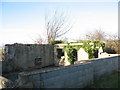
"The defended enclosure at Pen-y-Gaer is a rectangular enclosure of about 38m, demarcated by a 3m thick rubble wall, which was faced with large orthostats. The remains of the entrance can be seen on the NE side. The enclosure wall has been used as a stone dump and is surmounted in places by a modern stone wall. There are traces of a rectangular building in the SE corner."
Source: Coflein.
You may be viewing yesterday's version of this page. To see the most up to date information please register for a free account.
 (PID:239319)")
Do not use the above information on other web sites or publications without permission of the contributor.
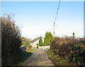
Nearby Images from Geograph Britain and Ireland:
©2007(licence)
©2007(licence)
©2007(licence)
©2006(licence)
©2007(licence)
The above images may not be of the site on this page, they are loaded from Geograph.
Please Submit an Image of this site or go out and take one for us!
Click here to see more info for this site
Nearby sites
Key: Red: member's photo, Blue: 3rd party photo, Yellow: other image, Green: no photo - please go there and take one, Grey: site destroyed
Download sites to:
KML (Google Earth)
GPX (GPS waypoints)
CSV (Garmin/Navman)
CSV (Excel)
To unlock full downloads you need to sign up as a Contributory Member. Otherwise downloads are limited to 50 sites.
Turn off the page maps and other distractions
Nearby sites listing. In the following links * = Image available
308m NNW 345° Glascoed Ancient Village* Ancient Village or Settlement (SH547647)
504m N 350° Glyn Arthur* Cairn (SH547649)
855m NE 54° Ffynnon Cegin Arthur Holy Well or Sacred Spring (SH55486488)
909m N 6° Dinas Dinorwig* Hillfort (SH549653)
1.1km SE 130° Cae Corniog Enclosed Hut Group* Ancient Village or Settlement (SH55576368)
2.2km ENE 66° Coed y Castell Enclosed Hut Circle Settlement* Ancient Village or Settlement (SH5681065230)
2.5km E 82° Enclosed Hut Group SW of Cae'r Mynydd* Ancient Village or Settlement (SH57256469)
2.6km S 180° Parc-y-Gleision Standing Stone* Standing Stone (Menhir) (SH54706180)
2.7km SSE 166° Pen-y-bwlch settlement Ancient Village or Settlement (SH55336177)
2.7km S 176° Parc Y Gleision Hut Circle Settlement* Ancient Village or Settlement (SH549617)
2.8km SSW 193° Hafodlas Cairn Circle* Cairn (SH54056170)
3.2km SW 228° Pant Afon Bach Maenhir* Standing Stone (Menhir) (SH52366236)
3.6km SW 217° Pant Ifan Maenhir* Standing Stone (Menhir) (SH52506160)
3.7km SW 231° Cilgwythwch Maenhir* Standing Stone (Menhir) (SH51866217)
3.9km N 350° Cader Elwa* Standing Stone (Menhir) (SH542683)
4.3km ENE 65° Ty'n Llidiard Hut Circle Settlement* Ancient Village or Settlement (SH5873066090)
4.5km S 169° Chwarel Fawr Stones* Rock Art (SH5549660004)
4.6km ENE 67° Carnedd Moel Y Ci* Round Cairn (SH591661)
5.4km NNW 326° Bryn yr Hen Bobl* Chambered Cairn (SH5188869005)
5.6km N 6° Goetre Uchaf Barrow* Round Barrow(s) (SH5556069900)
5.8km WNW 294° Maen Morddwyd Early Christian Sculptured Stone (SH495669)
5.9km SE 140° Parc Bach* Chambered Tomb (SH5846359778)
6.0km NNW 331° Plas Newydd Burial Chamber* Chambered Tomb (SH5199069722)
6.3km ENE 64° Sling (Llandegai)* Chambered Tomb (SH60556695)
6.4km W 261° Modern Stone Circle (Caernarfon)* Modern Stone Circle etc (SH4835463629)
View more nearby sites and additional images


 We would like to know more about this location. Please feel free to add a brief description and any relevant information in your own language.
 Wir möchten mehr über diese Stätte erfahren. Bitte zögern Sie nicht, eine kurze Beschreibung und relevante Informationen in Deutsch hinzuzufügen.
 Nous aimerions en savoir encore un peu sur les lieux. S'il vous plaît n'hesitez pas à ajouter une courte description et tous les renseignements pertinents dans votre propre langue.
 Quisieramos informarnos un poco más de las lugares. No dude en añadir una breve descripción y otros datos relevantes en su propio idioma.