 with our Megalithic Portal iPhone app")

<< Our Photo Pages >> Boa Island - Sculptured Stone in Ireland (Northern) in Co. Fermanagh
Submitted by jeffrep on Friday, 14 August 2009 Page Views: 10689
Multi-periodSite Name: Boa IslandCountry: Ireland (Northern) County: Co. Fermanagh Type: Sculptured Stone
Nearest Town: Kesh Nearest Village: Dreenan
Map Ref: H08516198
Latitude: 54.506168N Longitude: 7.86938W
Condition:
| 5 | Perfect |
| 4 | Almost Perfect |
| 3 | Reasonable but with some damage |
| 2 | Ruined but still recognisable as an ancient site |
| 1 | Pretty much destroyed, possibly visible as crop marks |
| 0 | No data. |
| -1 | Completely destroyed |
| 5 | Superb |
| 4 | Good |
| 3 | Ordinary |
| 2 | Not Good |
| 1 | Awful |
| 0 | No data. |
| 5 | Can be driven to, probably with disabled access |
| 4 | Short walk on a footpath |
| 3 | Requiring a bit more of a walk |
| 2 | A long walk |
| 1 | In the middle of nowhere, a nightmare to find |
| 0 | No data. |
| 5 | co-ordinates taken by GPS or official recorded co-ordinates |
| 4 | co-ordinates scaled from a detailed map |
| 3 | co-ordinates scaled from a bad map |
| 2 | co-ordinates of the nearest village |
| 1 | co-ordinates of the nearest town |
| 0 | no data |
Internal Links:
External Links:
I have visited· I would like to visit
DrewParsons would like to visit
jeffrep visited on 26th Apr 2009 - their rating: Cond: 3 Amb: 4 Access: 5
X-Ice visited on 21st Jul 1982 - their rating: Cond: 4 Amb: 5 Access: 4
Average ratings for this site from all visit loggers: Condition: 3.5 Ambience: 4.5 Access: 4.5
")
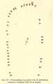
The larger of the figures is the Boa Island bilateral figure. It is called a Janus-figure because it has two faces. It is thought to represent a Celtic deity and could represent a Celtic goddess as readily as a god, especially given the name of the island. The smaller figure is known as the Lustyman, because it was found on the nearby island of Lusty More. Some claim it is in fact a female figure.
Boa Island is an island located near the north shore of Lower Lough Erne in County Fermanagh, Northern Ireland, and is 15-1/2 miles from Enniskillen. The A47 road goes through the length of the island. This road joins each end of the island to the mainland by bridges leading west toward Castle Caldwell and east toward Kesh.
The Journal of Antiquities also features a page for this site - see their entry for Boa Island Statue Stones, Lower Lough Erne, Co. Fermanagh, Northern Ireland, which includes a description, directions for finding this site, together with other sources of information and related websites. The Journal includes a quotation from the Rough Guide to Ireland (1999), which tells us: "“This ancient Christian burial ground of broken moss-covered tombstones, shaded by low, encircling hazel trees, has an almost druidic setting."
You may be viewing yesterday's version of this page. To see the most up to date information please register for a free account.
")
")
")
")
")
")
")
Do not use the above information on other web sites or publications without permission of the contributor.
Click here to see more info for this site
Nearby sites
Click here to view sites on an interactive map of the areaKey: Red: member's photo, Blue: 3rd party photo, Yellow: other image, Green: no photo - please go there and take one, Grey: site destroyed
Download sites to:
KML (Google Earth)
GPX (GPS waypoints)
CSV (Garmin/Navman)
CSV (Excel)
To unlock full downloads you need to sign up as a Contributory Member. Otherwise downloads are limited to 50 sites.
Turn off the page maps and other distractions
Nearby sites listing. In the following links * = Image available
3.7km E 84° Cruninish Island Ring Barrow Round Barrow(s) (H12256239)
9.2km ESE 103° White Island (Lower Lough Erne) Sculptured Stone (H175600)
9.2km NE 53° Formil Multiple Stone Rows / Avenue (H159675)
9.3km NE 53° Formil Stone Circle (H159676)
9.3km NE 53° Formil Stone Row / Alignment (H159676)
10.7km S 188° Doagh Glebe Promontory Fort / Cliff Castle (H0709051350)
11.5km S 188° Rossinure Beg Court Tomb (H06915053)
11.6km S 184° Rossinure More Court Tomb (H07715039)
12.7km NE 56° Montiaghroe NW Stone Row / Alignment (H190692)
12.8km NE 56° Montiaghroe SW* Stone Circle
12.8km NE 55° Montiaghroe SE Stone Circle (H191693)
13.0km SSW 210° Skaghlea Cairn Court Tomb (H01985070)
13.1km E 88° Kiltierney Stone Circle (H216625)
13.1km NE 56° Montiaghroe Stone Row / Alignment (H194693)
13.1km NE 55° Montiaghroe Centre* Stone Circle (H19326948)
13.3km ENE 57° Montiaghroe, SE* Stone Row / Alignment (H197693)
14.4km SE 124° Killadeas Standing Stones (H205540)
14.5km NE 53° Drumskinny* Stone Circle (H2008670721)
15.2km NE 35° Cashelenny Stone Circle (H172745)
15.4km ESE 115° Cantytrindle Stone Row / Alignment (H225555)
15.7km W 273° Creevery Upper* Chambered Tomb (G92766277)
16.2km SSE 159° Ross Lough Crannog (H14294677)
16.4km NE 52° Meenacloy Standing Stones* Standing Stones
16.4km E 90° Sheemuldoon Stone Circle (H250620)
16.7km NE 49° Scraghy SE Stone Circle (H211730)
View more nearby sites and additional images


 We would like to know more about this location. Please feel free to add a brief description and any relevant information in your own language.
 Wir möchten mehr über diese Stätte erfahren. Bitte zögern Sie nicht, eine kurze Beschreibung und relevante Informationen in Deutsch hinzuzufügen.
 Nous aimerions en savoir encore un peu sur les lieux. S'il vous plaît n'hesitez pas à ajouter une courte description et tous les renseignements pertinents dans votre propre langue.
 Quisieramos informarnos un poco más de las lugares. No dude en añadir una breve descripción y otros datos relevantes en su propio idioma.