<< Text Pages >> Ross Lough - Crannog in Ireland (Northern) in Co. Fermanagh
Submitted by SolarMegalith on Tuesday, 18 December 2012 Page Views: 2918
Iron Age and Later PrehistorySite Name: Ross LoughCountry: Ireland (Northern) County: Co. Fermanagh Type: Crannog
Map Ref: H14294677
Latitude: 54.369403N Longitude: 7.780887W
Condition:
| 5 | Perfect |
| 4 | Almost Perfect |
| 3 | Reasonable but with some damage |
| 2 | Ruined but still recognisable as an ancient site |
| 1 | Pretty much destroyed, possibly visible as crop marks |
| 0 | No data. |
| -1 | Completely destroyed |
| 5 | Superb |
| 4 | Good |
| 3 | Ordinary |
| 2 | Not Good |
| 1 | Awful |
| 0 | No data. |
| 5 | Can be driven to, probably with disabled access |
| 4 | Short walk on a footpath |
| 3 | Requiring a bit more of a walk |
| 2 | A long walk |
| 1 | In the middle of nowhere, a nightmare to find |
| 0 | No data. |
| 5 | co-ordinates taken by GPS or official recorded co-ordinates |
| 4 | co-ordinates scaled from a detailed map |
| 3 | co-ordinates scaled from a bad map |
| 2 | co-ordinates of the nearest village |
| 1 | co-ordinates of the nearest town |
| 0 | no data |
Be the first person to rate this site - see the 'Contribute!' box in the right hand menu.
Internal Links:
External Links:
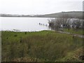
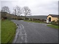
Crannog in Co. Fermanagh
An Iron Age crannog in Ross Lough.
You may be viewing yesterday's version of this page. To see the most up to date information please register for a free account.
Do not use the above information on other web sites or publications without permission of the contributor.
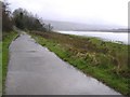
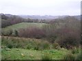
Nearby Images from Geograph Britain and Ireland:
©2008(licence)
©2008(licence)
©2008(licence)
©2008(licence)
©2008(licence)
The above images may not be of the site on this page, they are loaded from Geograph.
Please Submit an Image of this site or go out and take one for us!
Click here to see more info for this site
Nearby sites
Click here to view sites on an interactive map of the areaKey: Red: member's photo, Blue: 3rd party photo, Yellow: other image, Green: no photo - please go there and take one, Grey: site destroyed
Download sites to:
KML (Google Earth)
GPX (GPS waypoints)
CSV (Garmin/Navman)
CSV (Excel)
To unlock full downloads you need to sign up as a Contributory Member. Otherwise downloads are limited to 50 sites.
Turn off the page maps and other distractions
Nearby sites listing. In the following links * = Image available
3.2km SW 216° Reyfad Stones Stone Row / Alignment (H124442)
5.7km SW 235° Aghanaglack Court Tomb (H096435)
7.5km WNW 299° Rossinure More Court Tomb (H07715039)
8.1km E 89° Lower Lough Erne Crannogs* Crannog (H224469)
8.3km WNW 297° Rossinure Beg Court Tomb (H06915053)
8.5km WNW 303° Doagh Glebe Promontory Fort / Cliff Castle (H0709051350)
9.2km SW 223° Cloghbrack Stone Circle (H080400)
9.5km NE 41° Killadeas Standing Stones (H205540)
9.8km WSW 238° Toppan Stone Circle (H060415)
9.8km WSW 238° Cloghastuckane Stone Circle (H059416)
10.6km E 98° Cherrymount Crannog* Crannog (H2478045300)
10.6km SW 230° Kilrooskagh Portal Tomb (H06143998)
12.0km NE 43° Cantytrindle Stone Row / Alignment (H225555)
12.2km WSW 247° Corraderrybrock Stone Circle (H030420)
12.3km SW 223° St Brigid' Stones Stone Row / Alignment (H059378)
12.3km SW 223° Killinagh* Rock Art (H059378)
12.4km E 81° Breagho* Burial Chamber or Dolmen (H266487)
12.7km SSE 158° Greenan Stone Circle (H190350)
12.9km WNW 288° Skaghlea Cairn Court Tomb (H01985070)
13.2km SSW 195° Tromogagh Stone Circle (H110340)
13.2km SSW 209° Giants Leap Wedge Tomb* Wedge Tomb (H0787435232)
13.4km SSW 211° Tullygobban Wedge Tomb* Wedge Tomb (H0743435259)
13.5km SSW 211° Boulder Grave* Chambered Tomb
13.5km SSW 211° Calf house Portal Tomb* Portal Tomb (H0729535148)
13.6km NNE 14° White Island (Lower Lough Erne) Sculptured Stone (H175600)
View more nearby sites and additional images


 We would like to know more about this location. Please feel free to add a brief description and any relevant information in your own language.
 Wir möchten mehr über diese Stätte erfahren. Bitte zögern Sie nicht, eine kurze Beschreibung und relevante Informationen in Deutsch hinzuzufügen.
 Nous aimerions en savoir encore un peu sur les lieux. S'il vous plaît n'hesitez pas à ajouter une courte description et tous les renseignements pertinents dans votre propre langue.
 Quisieramos informarnos un poco más de las lugares. No dude en añadir una breve descripción y otros datos relevantes en su propio idioma.