


<< Our Photo Pages >> Whitehillocks Farm Stone Circle - Stone Circle in Scotland in Angus
Submitted by hamish on Monday, 17 October 2005 Page Views: 5975
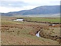
Neolithic and Bronze AgeSite Name: Whitehillocks Farm Stone CircleCountry: Scotland County: Angus Type: Stone Circle
Nearest Town: Forfar Nearest Village: Kirriemuir
Map Ref: NO370669
Latitude: 56.789369N Longitude: 3.032863W
Condition:
| 5 | Perfect |
| 4 | Almost Perfect |
| 3 | Reasonable but with some damage |
| 2 | Ruined but still recognisable as an ancient site |
| 1 | Pretty much destroyed, possibly visible as crop marks |
| 0 | No data. |
| -1 | Completely destroyed |
| 5 | Superb |
| 4 | Good |
| 3 | Ordinary |
| 2 | Not Good |
| 1 | Awful |
| 0 | No data. |
| 5 | Can be driven to, probably with disabled access |
| 4 | Short walk on a footpath |
| 3 | Requiring a bit more of a walk |
| 2 | A long walk |
| 1 | In the middle of nowhere, a nightmare to find |
| 0 | No data. |
| 5 | co-ordinates taken by GPS or official recorded co-ordinates |
| 4 | co-ordinates scaled from a detailed map |
| 3 | co-ordinates scaled from a bad map |
| 2 | co-ordinates of the nearest village |
| 1 | co-ordinates of the nearest town |
| 0 | no data |
Internal Links:
External Links:
I have visited· I would like to visit
hamish has visited here
")
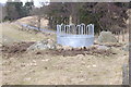
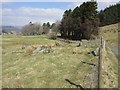
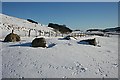
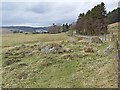
It is on a platform and the ambience gives the impression of it being "genuine". Anyway look at the pictures and make up your own mind.
You may be viewing yesterday's version of this page. To see the most up to date information please register for a free account.
")
Do not use the above information on other web sites or publications without permission of the contributor.
coldrum has found this location on Google Street View:
Nearby Images from Geograph Britain and Ireland:
©2006(licence)
©2018(licence)
©2010(licence)
©2012(licence)
©2012(licence)
The above images may not be of the site on this page, they are loaded from Geograph.
Please Submit an Image of this site or go out and take one for us!
Click here to see more info for this site
Nearby sites
Key: Red: member's photo, Blue: 3rd party photo, Yellow: other image, Green: no photo - please go there and take one, Grey: site destroyed
Download sites to:
KML (Google Earth)
GPX (GPS waypoints)
CSV (Garmin/Navman)
CSV (Excel)
To unlock full downloads you need to sign up as a Contributory Member. Otherwise downloads are limited to 50 sites.
Turn off the page maps and other distractions
Nearby sites listing. In the following links * = Image available
260m N 1° Whitehillock* Rock Art (NO37016716)
7.0km SSW 197° Corogle Burn* Standing Stones (NO349602)
7.0km SSW 197° Corogle Burn Stone Circle (NO34886017)
8.0km SSE 166° Cortachy* Standing Stone (Menhir) (NO38795911)
9.5km SE 133° Easter Memus Standing Stone (Menhir) (NO439603)
10.7km S 171° Caddam* Standing Stone (Menhir) (NO385563)
10.7km S 171° Caddam (Kirriemuir) Standing Stone (Menhir) (NO38485625)
10.8km S 188° Culhawk Hill Stone Circle (NO353562)
11.2km SW 219° Auldallan* Standing Stones (NO298583)
12.0km S 174° Rocking Stones (Kirriemuir) Natural Stone / Erratic / Other Natural Feature (NO38135496)
12.4km ESE 114° Ghaist Stone (Fern) Standing Stone (Menhir) (NO48326173)
12.4km S 169° Kirriemuir Stone Circle* Stone Circle (NO39175463)
13.0km SSW 212° Brankam Hill SE Stone Circle (NO300559)
13.0km SSW 212° Brankam Hill NW Stone Circle (NO300559)
13.1km SW 218° Strone Hill Stone Circle (NO288567)
13.7km SSW 201° Meikle Kenny C* Stone Circle (NO31825418)
13.7km SSW 201° Meikle Kenny B* Stone Circle (NO31805417)
13.8km SSW 201° Meikle Kenny A* Stone Circle (NO31765415)
14.1km SW 222° Pitmudie* Stone Row / Alignment (NO2744956473)
14.7km SSE 167° Fletcherfield Standing Stones (NO401525)
15.2km E 97° Hill of Menmuir* Rock Art (NO52096489)
15.4km SSE 162° Balinshoe Standing Stone (Menhir) (NO41645219)
15.6km S 184° Airlie Cursus Cursus (NO35605130)
15.8km S 184° Airlie Cursus Cursus (NO35645113)
16.0km SE 144° Carse Gray* Stone Circle (NO462538)
View more nearby sites and additional images


 We would like to know more about this location. Please feel free to add a brief description and any relevant information in your own language.
 Wir möchten mehr über diese Stätte erfahren. Bitte zögern Sie nicht, eine kurze Beschreibung und relevante Informationen in Deutsch hinzuzufügen.
 Nous aimerions en savoir encore un peu sur les lieux. S'il vous plaît n'hesitez pas à ajouter une courte description et tous les renseignements pertinents dans votre propre langue.
 Quisieramos informarnos un poco más de las lugares. No dude en añadir una breve descripción y otros datos relevantes en su propio idioma.