

<< Our Photo Pages >> Caddam - Standing Stone (Menhir) in Scotland in Angus
Submitted by vicky on Sunday, 09 March 2003 Page Views: 10126
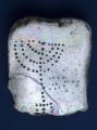
Neolithic and Bronze AgeSite Name: CaddamCountry: Scotland County: Angus Type: Standing Stone (Menhir)
Map Ref: NO385563 Landranger Map Number: 54
Latitude: 56.694358N Longitude: 3.005767W
Condition:
| 5 | Perfect |
| 4 | Almost Perfect |
| 3 | Reasonable but with some damage |
| 2 | Ruined but still recognisable as an ancient site |
| 1 | Pretty much destroyed, possibly visible as crop marks |
| 0 | No data. |
| -1 | Completely destroyed |
| 5 | Superb |
| 4 | Good |
| 3 | Ordinary |
| 2 | Not Good |
| 1 | Awful |
| 0 | No data. |
| 5 | Can be driven to, probably with disabled access |
| 4 | Short walk on a footpath |
| 3 | Requiring a bit more of a walk |
| 2 | A long walk |
| 1 | In the middle of nowhere, a nightmare to find |
| 0 | No data. |
| 5 | co-ordinates taken by GPS or official recorded co-ordinates |
| 4 | co-ordinates scaled from a detailed map |
| 3 | co-ordinates scaled from a bad map |
| 2 | co-ordinates of the nearest village |
| 1 | co-ordinates of the nearest town |
| 0 | no data |
Internal Links:
External Links:
I have visited· I would like to visit
hamish has visited here
")
Have you visited this site? Please add a comment below.
You may be viewing yesterday's version of this page. To see the most up to date information please register for a free account.
")
")
")
")
")
Do not use the above information on other web sites or publications without permission of the contributor.
Click here to see more info for this site
Nearby sites
Key: Red: member's photo, Blue: 3rd party photo, Yellow: other image, Green: no photo - please go there and take one, Grey: site destroyed
Download sites to:
KML (Google Earth)
GPX (GPS waypoints)
CSV (Garmin/Navman)
CSV (Excel)
To unlock full downloads you need to sign up as a Contributory Member. Otherwise downloads are limited to 50 sites.
Turn off the page maps and other distractions
Nearby sites listing. In the following links * = Image available
54m SSW 201° Caddam (Kirriemuir) Standing Stone (Menhir) (NO38485625)
1.4km SSW 195° Rocking Stones (Kirriemuir) Natural Stone / Erratic / Other Natural Feature (NO38135496)
1.8km SSE 157° Kirriemuir Stone Circle* Stone Circle (NO39175463)
2.8km N 5° Cortachy* Standing Stone (Menhir) (NO38795911)
3.2km W 267° Culhawk Hill Stone Circle (NO353562)
4.1km SSE 156° Fletcherfield Standing Stones (NO401525)
5.2km SE 142° Balinshoe Standing Stone (Menhir) (NO41645219)
5.3km NW 316° Corogle Burn Stone Circle (NO34886017)
5.3km NW 317° Corogle Burn* Standing Stones (NO349602)
5.8km SSW 209° Airlie Cursus Cursus (NO35605130)
5.9km SSW 208° Airlie Cursus Cursus (NO35645113)
6.5km SSE 165° Cossans* Class II Pictish Symbol Stone (NO4008350019)
6.7km NE 53° Easter Memus Standing Stone (Menhir) (NO439603)
6.8km SSW 210° Lendrick Lodge* Standing Stone (Menhir) (NO350504)
7.0km WSW 252° Meikle Kenny C* Stone Circle (NO31825418)
7.0km WSW 251° Meikle Kenny B* Stone Circle (NO31805417)
7.1km WSW 251° Meikle Kenny A* Stone Circle (NO31765415)
8.0km SW 223° Carlin Well (Craigton of Airlie) Holy Well or Sacred Spring (NO3289850521)
8.1km ESE 107° Carse Gray* Stone Circle (NO462538)
8.5km W 266° Brankam Hill SE Stone Circle (NO300559)
8.5km W 266° Brankam Hill NW Stone Circle (NO300559)
8.8km ESE 106° Baggerton Class I Pictish Symbol Stone (NO469537)
8.8km SW 226° Airlie* Standing Stone (Menhir) (NO3208450249)
8.9km WNW 282° Auldallan* Standing Stones (NO298583)
9.0km SE 128° Meffan Institute* Museum (NO45525062)
View more nearby sites and additional images


 We would like to know more about this location. Please feel free to add a brief description and any relevant information in your own language.
 Wir möchten mehr über diese Stätte erfahren. Bitte zögern Sie nicht, eine kurze Beschreibung und relevante Informationen in Deutsch hinzuzufügen.
 Nous aimerions en savoir encore un peu sur les lieux. S'il vous plaît n'hesitez pas à ajouter une courte description et tous les renseignements pertinents dans votre propre langue.
 Quisieramos informarnos un poco más de las lugares. No dude en añadir una breve descripción y otros datos relevantes en su propio idioma.