
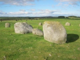

<< Our Photo Pages >> Fournou Koryfi - Ancient Village or Settlement in Greece in Crete
Submitted by Klingon on Wednesday, 17 August 2022 Page Views: 4101
Neolithic and Bronze AgeSite Name: Fournou Koryfi Alternative Name: Φούρνου ΚορυφήCountry: Greece Region: Crete Type: Ancient Village or Settlement
Nearest Town: Ierapetra Nearest Village: Mirtos
Latitude: 35.006680N Longitude: 25.609240E
Condition:
| 5 | Perfect |
| 4 | Almost Perfect |
| 3 | Reasonable but with some damage |
| 2 | Ruined but still recognisable as an ancient site |
| 1 | Pretty much destroyed, possibly visible as crop marks |
| 0 | No data. |
| -1 | Completely destroyed |
| 5 | Superb |
| 4 | Good |
| 3 | Ordinary |
| 2 | Not Good |
| 1 | Awful |
| 0 | No data. |
| 5 | Can be driven to, probably with disabled access |
| 4 | Short walk on a footpath |
| 3 | Requiring a bit more of a walk |
| 2 | A long walk |
| 1 | In the middle of nowhere, a nightmare to find |
| 0 | No data. |
| 5 | co-ordinates taken by GPS or official recorded co-ordinates |
| 4 | co-ordinates scaled from a detailed map |
| 3 | co-ordinates scaled from a bad map |
| 2 | co-ordinates of the nearest village |
| 1 | co-ordinates of the nearest town |
| 0 | no data |
Internal Links:
External Links:
I have visited· I would like to visit
Klingon visited on 4th Aug 2022 - their rating: Cond: 2 Amb: 5 Access: 3
")
You may be viewing yesterday's version of this page. To see the most up to date information please register for a free account.
")
")
")
Do not use the above information on other web sites or publications without permission of the contributor.
Nearby Images from Flickr
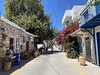
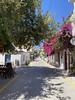
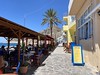
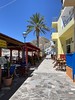
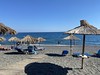
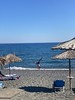
The above images may not be of the site on this page, but were taken nearby. They are loaded from Flickr so please click on them for image credits.
Click here to see more info for this site
Nearby sites
Click here to view sites on an interactive map of the areaKey: Red: member's photo, Blue: 3rd party photo, Yellow: other image, Green: no photo - please go there and take one, Grey: site destroyed
Download sites to:
KML (Google Earth)
GPX (GPS waypoints)
CSV (Garmin/Navman)
CSV (Excel)
To unlock full downloads you need to sign up as a Contributory Member. Otherwise downloads are limited to 50 sites.
Turn off the page maps and other distractions
Nearby sites listing. In the following links * = Image available
1.7km W 271° Pyrgos Myrtos* Ancient Village or Settlement
11.4km WNW 299° Kato Symi* Ancient Temple
17.5km NE 39° Priniatikos Pyrgos Ancient Village or Settlement
17.6km NE 44° Vrokastro Ancient Village or Settlement
19.6km NNE 12° Lato (Crete)* Hillfort
20.2km ENE 65° Vasiliki* Ancient Village or Settlement
20.2km NE 56° Gournia* Ancient Village or Settlement
21.2km E 89° Koutsounari fish tank* Ancient Mine, Quarry or other Industry
21.4km W 278° Kephala Ancient Village or Settlement
22.0km ENE 67° Chalasmenos* Ancient Village or Settlement
22.3km ENE 67° Katalymata* Ancient Village or Settlement
22.7km NNE 26° Kamara* Ancient Village or Settlement
22.9km NW 319° Andros Cave* Cave or Rock Shelter
22.9km NNE 25° Archaeological Museum of Agios Nikolaos* Museum
25.2km NE 56° Chrysokamino Ancient Village or Settlement
25.4km ENE 63° Vronda* Ancient Village or Settlement
26.3km ENE 64° Kastro (Crete) Ancient Village or Settlement
26.5km ENE 62° Azoria* Ancient Village or Settlement
26.6km NNW 332° Karfi* Ancient Village or Settlement
26.8km NNE 22° Temple of Venus Lenika Ancient Temple
27.7km NNE 19° Naxos (Crete) Ancient Village or Settlement
27.9km N 3° Dreros* Ancient Village or Settlement
29.9km NNE 22° Olous* Ancient Village or Settlement
30.1km N 354° Anavlochos Cairn
32.8km E 84° Makry Gialos Minoan Villa* Ancient Village or Settlement
View more nearby sites and additional images


 We would like to know more about this location. Please feel free to add a brief description and any relevant information in your own language.
 Wir möchten mehr über diese Stätte erfahren. Bitte zögern Sie nicht, eine kurze Beschreibung und relevante Informationen in Deutsch hinzuzufügen.
 Nous aimerions en savoir encore un peu sur les lieux. S'il vous plaît n'hesitez pas à ajouter une courte description et tous les renseignements pertinents dans votre propre langue.
 Quisieramos informarnos un poco más de las lugares. No dude en añadir una breve descripción y otros datos relevantes en su propio idioma.